Topton, North Carolina
Looking for the best hiking in Topton? We've got you covered with the top trails, trips, hiking, backpacking, camping and more around Topton. The detailed guides, photos, and reviews are all submitted by the Outbound community.
Top Hiking Spots in and near Topton
-
Otto, North Carolina
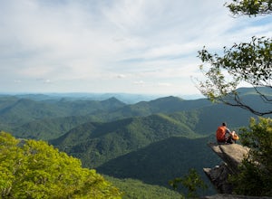
Hike to and Climb Pickens Nose
4.81.5 mi / 200 ft gainFrom the parking area (fits about 6 cars) follow the trail on the same side of the road up the ridge through dense rhododendron. Several spur trails branch off of the main trail and lead to rock outcroppings with excellent views. Getting to the parking area is slow. The narrow gravel road winds...Read more -
Fontana Dam, North Carolina
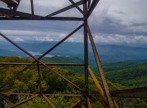
Shuckstack Fire Tower
5.08.84 mi / 2605 ft gainYour Shuckstack adventure starts at the Fontana Dam outside of Bryson City, NC. As the highest dam East of the Rocky Mountains, it's a sight on its own. This will be your last chance to fill up water bottles and use the restroom so take advantage. You can leave on foot from the dam and continue ...Read more -
Robbinsville, North Carolina
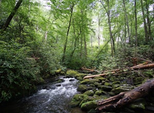
Hike Joyce Kilmer Memorial Forest Loop
5.02 miThe beauty of this trail starts at the parking lot. Before you start the trail, you will find a picnic table near the parking lot and go down to the edge of the rolling stream. Its a great spot to hear the stream and take some pictures. If you are feeling adventurous you can try to hop from rock ...Read more -
Highlands, North Carolina
Explore Cullasaja Falls
5.00.3 mi / 200 ft gainThis is an awesome waterfall that offers views from several different spots along the road as well as a quick hike down to the base! The small pull-off area is located towards the top of the falls. There isn't much space (3 maybe 4 cars at a time), but there are additional pull-off areas further ...Read more -
35.556724,-83.495827
Forney Creek Loop
4.519.04 mi / 3500 ft gainThis is an overnight loop hike that is built around one night in the back country. It can be done as an ambitious day hike. Be advised that permits are required by the NPS for all overnight stays in Great Smoky Mountain National Park. The hike begins at the Clingman's Dome parking lot at the For...Read more -
Bryson City, North Carolina
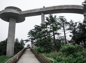
Clingmans Dome
4.41.23 miThe drive to Clingmans Dome is miles of scenic overlooks that provide endless views of ridges and valleys. Clingmans Dome Road comes to a parking lot from which you follow a .5 mile paved trail to the summit. There are also several trails that start on Clingmans Dome Road. Most notably The Appal...Read more -
Bryson City, North Carolina
Andrews Bald
5.03.55 mi / 1200 ft gainThe trail begins at the Clingmans Dome parking lot, just to the left of the paved walkway up to Clingmans Dome. You will start the hike at an elevation of 6130 feet which is only 334 feet less than Clingmans Dome which is the highest point in The Great Smoky Mountain National Park, and the second...Read more -
Bryson City, North Carolina
Clingmans Dome Loop
25.75 mi / 4000 ft gainThe first day of the hike is either 12.3 miles or 10.5 miles (depending on the campsite) almost all downhill, and the second half of the loop is 13.3 miles or 11.5 miles, again depending on the campsite, almost exclusively uphill. Just as a reference the first day took us about 6 and a half hours...Read more -
Robbinsville, North Carolina
Gregory Bald via Twentymile
4.015.42 mi / 3694 ft gainGregory Bald via Twentymile is a loop trail where you may see beautiful wildflowers located near Robbinsville, North Carolina.Read more -
Clayton, Georgia
Camp at Tallulah River Campground
Tallulah River Campground is located in the Chattahoochee-Oconee national forest. It is just outside of Clayton, Georgia. The campground has about 15 spots that are big enough for a small to medium sized RV. Each camping spot also has a nice tent pad for a big tent. Most spots are also on the riv...Read more -
Lake Santeetlah, North Carolina
Huckleberry Knob
4.81.77 mi / 295 ft gainHuckleberry Knob is the highest point in the Cheoah Ranger District at 5,560 feet, and it offers expansive views of the surrounding Cherokee and Natahala National Forest. The hike is 2.4 miles roundtrip and begins at the parking lot between mile 8 and 9 up an old dirt road. You will go up the di...Read more -
Joyce Kilmer-Slickrock Wilderness, North Carolina
Backpack Slickrock Creek Trail #42
30 mi / 3700 ft gain8:30 a.m. and we’re winding our way down Highway 129 near Robbinsville, NC. The fog is still thick over the Little Tennessee River as we slow down crossing the bridge into Graham County. “I think we missed it,” I say as we continue onward. Within minutes the Tapoco Lodge comes into view. My pre-h...Read more -
Robbinsville, North Carolina
Hike Hooper Bald
1 mi / 250 ft gainHooper bald is one of the highest points in Graham County so the views from the top can be spectacular year round. The trail-head starts at mile marker 8 on the Cherohala Skyway. From the trail-head you start your accent on a semi-paved trail and walk about a half-mile before reaching the edge o...Read more -
Cullowhee, North Carolina
Hike to Yellow Mountain Fire Tower via Cloud Catcher Lane
5.01.5 mi / 700 ft gainYellow Mountain Fire Tower features some of the best views, looking out over both the Northern Georgia mountains as well as seeing the flat-lands of South Carolina past the mountain ranges. This hike is pretty well known for its 12-mile round trip trek, starting in Cashiers, NC, however, there's ...Read more -
Highlands, North Carolina
Explore Dry Falls, North Carolina
4.60.42 mi / 95 ft gainDry Falls is located off of Hwy. 64, which has been designated as the Mountain Waters Scenic Byway, and the road does not disappoint. Hwy. 64 is a two lane road which hugs the northern side of Cullasaja Gorge, which has been carved by the Cullasaja River. Besides Dry Falls, Hwy. 64 leads you past...Read more -
Robbinsville, North Carolina
Hike the Big Fat Gap Trail
12 mi / 3000 ft gainThere are many trailheads leading into the wilderness on either the Tennessee or North Carolina side. My favorite is the Big Fat Gap trail on the North Carolina side at an elevation of 3,060'. To see the best of what this area has to offer take the Hangover Lead South Trail to the 5,180' Hangover...Read more

