Staatsburg, New York
Top Spots in and near Staatsburg
-
Ridgefield, Connecticut
Hike the Hemlock Hills & Pine Mountain Loop
7.5 mi / 1174 ft gainThere are several trailheads for Hemlock Hills But the least crowded is at the intersection of Ned's Mountain road and Bogus Road. I took my 3 year old black lab. There are ton's of little ponds for your dog to jump in and do dog things. For the most part the hike is flat but at some parts it c...Read more -
Danbury, Connecticut
Hike Middle Mountain To Thomas Mountain Loop
3.7 mi / 856 ft gainMiddle Mountain to Thomas Mountain Loop is a 3.7 mile loop hike that takes you past great forest setting located near Danbury, Connecticut.Read more -
Great Barrington, Massachusetts
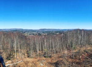
Hike Monument Mountain
4.02 mi / 720 ft gainAt 1642 feet (with a total elevation gain of 720 feet), Squaw Peak is a great spot to see both Mt Greylock along the Vermont border, and the Catskills in New York. There are several trail options here to get to the summit, but no matter which combination you choose, you can keep your trip under ...Read more -
Great Barrington, Massachusetts
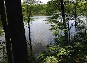
Mt. Wilcox and Beartown Mountain Trail Loop
5.09.29 mi / 981 ft gainMt. Wilcox and Beartown Mountain Trail Loop is a loop trail that takes you by the lake located near Great Barrington, Massachusetts.Read more -
Litchfield, Connecticut
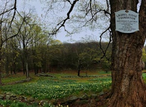
Photograph Daffodils at Laurel Ridge
Laurel Ridge is a private owned Farm , the owners are generous enough to let people visit these flowers so please be respectful of there rules. You may see the Daffodils from Sunrise-Sunset and usually fully bloomed Early April-May. Laurel Ridge is the perfect way to start Spring, the smell and ...Read more -
Stockbridge, Massachusetts
Laura's Tower and Ice Glen
5.02.4 mi / 676 ft gainYou will park at the end of Park Street in Stockbridge, Massachusetts. From the parking are you will cross a beautiful bridge over the Housatonic River. The trail crosses railroad tracks and immediately begins to climb into the woods. You will reach a split in the trail, a left will take you...Read more -
Pound Ridge, New York
Leatherman's Loop
1.25 mi / 1183 ft gainThis loop trail is moderately rated and reaches a total elevation gain of approximately 1,183 feet. It’s located in the Ward Pound Ridge Reservation, which spans roughly 4,315 acres. It is Westchester County’s largest park and includes roughly 35 plus miles of hiking trails to explore. The Ward...Read more -
Tuxedo Park, New York
Backpack Harriman State Park
4.518 mi / 1200 ft gainWhile the first day is a bit longer and less exciting in terms of frequent landmarks, its a relaxing hike through rocky, wooded, forest among bountiful blueberry bushes and the occasional raspberry bush. Enjoy the isolation on this leg. The second day is packed with frequent and beautiful landmar...Read more -
Tuxedo Park, New York
Hike to the Sterling Ridge Fire Tower
5.08.5 miStart out by turning right when you walk out of the visitor center onto Sterling Lake Loop (Blue Blazes). The visitor center is worth going in as they have a full diorama of the park with LED light to show trail routes. About .3 miles into the hike you will cross over a small bridge with a waterf...Read more -
Warwick, New York
Enjoy a Film at the Historic Warwick Drive-In
Take a trip back in time at the Warwick Drive-In and watch a feature film on the big screen. The Drive-In shows movies just in theaters and older films with three different screens / options to chose from. The theater sells tickets for both one movie and for double features, i.e. watch two movies...Read more -
Briarcliff Manor, New York
Hike Kate Kennard Trail
1.8 mi / 140 ft gainIf you’re in the town of Briarcliff and looking for an easy local trail to try out, Kate Kennard Trail is good for getting in a quick run or walk. It’s a straight line path the whole way. You’ll know you’ve reached the end of the path when you see a sign that marks the beginning of a road leading...Read more

