Staatsburg, New York
Top Spots in and near Staatsburg
-
Cragsmoor, New York
Sam's Point, Ice Cave Trail, Verkeerderkill Falls
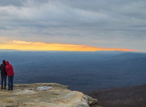
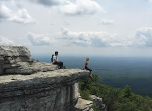
4.96.99 mi / 1063 ft gainLocated in Sam's Point Preserve, this hike has three major attractions – panoramic views from Sam's Point, mysterious and chilly Ice Caves, and a knee-weakening perch atop Verkeerderkill Falls. Pay attention to seasonal conditions before making this trip. Spring and early summer are best for see...Read more -
Cragsmoor, New York
Sam's Point Overlook to Ice Cave Trail
3.47 mi / 584 ft gainSam's Point Overlook to Ice Cave Trail is an out-and-back trail with scenic views near Lake Maratanza located near Ellenville, New York. This trail is dog friendly on-leash.Read more -
Grahamsville, New York
Swim at Peekamoose Blue Hole
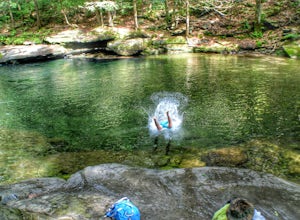
3.8To get there: From Sundown, NY, head 10 miles on Route 42 until you see a large parking area on the right with a sign for the Peekamoose Mountain area. Follow the signs from the parking area to the creek. Swimming Hole Coordinates: (41.9182, -74.4215) You can cool off from NY's warm weather and d...Read more -
Phoenicia, New York
Hike Mt. Wittenberg
4.3Looking for a great day hike in the Catskill region of NY? Then you should definitely look into and consider tackling Mt. Wittenberg then. A challenging climb up but a very rewarding summit view.Starting at Woodland Valley Campgrounds visitor registration house (where you can pay for parking for ...Read more -
Phoenicia, New York
Camp at Woodland Valley
3.0If you are looking for a great campground up in the Catskill Mountains of New York then you definitely have to check out Woodland Valley Campgrounds. Located about 2 hours north of New York City, it is the perfect place to go to get off the grid. No service for about 30 minutes in any direction.T...Read more -
Salisbury, Connecticut
Explore Riga Falls
The best part of the adventure is finding this hidden gem also known as Riga Falls. Riga Falls is actually one of Connecticut's lesser known waterfalls, but arguably the most scenic. A helpful hint is that the waterfall lies beside dirt road, keep your ears open! I've already said too much, happy...Read more -
Kent, Connecticut
Explore Kent Falls
5.00.75 mi / 250 ft gainEvery now and then you need a day to rest those sore muscle from all your recent adventures. The only issue is, you don't want to sit around inside, you want to be outside. Insert a trip to Kent Fall State Park. The perfect rest adventure day.Located 1 hour and 45 minutes north of New York City i...Read more -
Big Indian, New York
Camp on Giant Ledge
4.51.5 mi / 975 ft gainGiant Ledge is a great hike in the Catskills if you are looking for something short, with incredible views, and camping options. There are not many hikes with better views then this in the Catskills, so why not spend as much time as possible up there? There are a few camping spots you can grab w...Read more -
Big Indian, New York
Hike Giant Ledge
4.53.74 miThe trail starts across the street from the parking area you will see a sign. After a short walk in you will cross a foot bridge. At approximately 0.75 mile you will reach a junction. You will turn left toward Giant Ledge. The next half mile is fairly flat. At 1.5 miles you will reach a spur ...Read more -
Mount Washington, Massachusetts
Mount Frissell and Brace Mountain Loop Trail
5.08 mi / 807 ft gainMount Frissell and Brace Mountain Loop Trail is a loop trail where you may see beautiful wildflowers located near South Egremont, Massachusetts.Read more -
Hopewell Junction, New York
Beaver Pond via Appalachian Trail
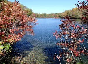
5.03 mi / 400 ft gainBeaver Pond is a small body of water created by a dam that was constructed during the days of iron ore mining in the area. The pond is crystal clear and has a wonderful tree line right on the water. The best time to visit here is early morning in the fall. With the leaves changing color they m...Read more -
Hopewell Junction, New York
Lake Canopus Viewpoint
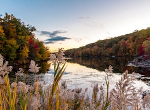
4.02.07 mi / 148 ft gainIts a great place to explore as it has a beautiful calm lake especially in the fall, the reflection of the water and the awesome colors are unbelievable. Its a short hike but you certainly could go further up. Parking is free by the road, hike towards the lake about a mile or so. The sound of bi...Read more -
Beacon, New York
Sugarloaf Mountain via Wilkinson Memorial Trail
5.02.15 mi / 820 ft gainTrail is currently closed. Get updates at parks.ny.gov. Sugarloaf Mountain is part of the Hudson Highlands State Park, along with Breakneck Ridge, Bull Hill, and Mt Beacon. Though the views are just as impressive as its sister trails, it is never as crowded and it's one of my favorite spots in ...Read more -
Beacon, New York
Sunset Point - South Beacon Mountain Loop
4.08.92 mi / 2470 ft gainThis loop hike form the Notch Trail northern trailhead on Route 9D. There is enough parking at this trailhead for about 5-6 cars. The Notch Trail is identified with blue trail markers. It is well maintained and plenty of markers to guide your way. This is important because there are m...Read more -
Sharon, Connecticut
Hike the Pine Knob Loop, Housatonic Meadows SP
5.02.5 mi / 770 ft gainThe Pine Knob loop is a 2.5 mile loop trail that takes you through beautiful thick woods filled with vistas, wild flowers and tons of wild life. You will start your adventure at the Pine Knob Trail head where you will be able to a Connecticut Appalachian trail guide. Pine Knob is a blue blaze ...Read more -
Cold Spring, New York
Sugarloaf Mountain and Breakneck Ridge Loop
4.74.33 mi / 1562 ft gainThe Breakneck Ridge to Sugar Loaf Loop gives rise to various bypasses that offer hikers moderate to advanced terrain and multiple rock scrambles. The loop entails a total elevation gain of 1,670 feet and a total distance of 5.5 miles. The start of the trail begins at the (white blazes) at the no...Read more

