Montana
Looking for the best camping in Montana? We've got you covered with the top trails, trips, hiking, backpacking, camping and more around Montana. The detailed guides, photos, and reviews are all submitted by the Outbound community.
Top Camping Spots in and near Montana
-
West Yellowstone, Montana
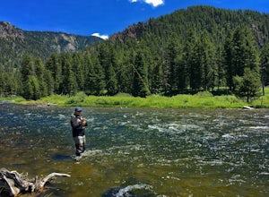
Fly Fish the Madison River (Hebgen Lake to Earthquake Lake)
The Madison River runs for 183 miles through Wyoming and Montana; however, this section of the Madison is between Hebgen Lake and Earthquake Lake. You get there by driving along Hebgen Lake Road to the Campfire Lodge Resort. Turn into here and head down the dirt road to your right (Ghost Village ...Read more -
Flathead County, Montana
Backpack to Link Lake
1.3 mi / 600 ft gainTo reach the trailhead, travel west on US Hwy 93 for 17.9 mi. and then turn right onto Olney Crossover Rd. This road will continue for 8.8 mi. and then keep left onto NF-115 for 9.7 mi. and the destination will be on the right hand side. There is a parking area where the trailhead begins. From th...Read more -
Browning, Montana
Backpack to Cosley Lake
27.2 mi / 475 ft gainThe hike goes through different wooded areas, open fields, and passes by the ranger's ranch. In no time, you will be able to see the aqua blue colors of Cosley Lake, as you approach the campground for the night.The campground has pit toilets and a bear bag hanging station, along with a cooking ar...Read more -
Kalispell, Montana
Backpack to Clayton Lake
9 mi / 1500 ft gainFrom the Camp Misery Trailhead (elev. 5,717 ft) take the left Trail 8 for .6 miles. At the junction continue left for a 1.3 mile gently ascent into Jewel Basin. Nearing Twin Lakes continue left on Trail 7 for .6 miles until you reach Trail 55. Continue right, and make sure that after a short .3 m...Read more -
Livingston, Montana
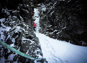
Climbing Alpine Ice at Emerald Lake
From the East Fork parking lot in Hyalite Canyon hike 4 miles gaining an easy 1,500 feet to Emerald Lake. Surrounded by mountains, Emerald Lake is a beautiful destination in itself. If you are looking for climbing, pick one of the many lines around.My partner and I decided to pick off one of the ...Read more -
Martin City, Montana
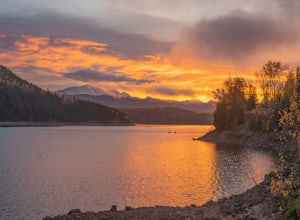
Drive around Hungry Horse Reservoir
About 100 miles of mostly gravel roads (14 miles of pavement) will take you around this beautiful reservoir. With that many miles of road and the shoreline to go with it, it is obvious that there is plenty to see and do in the Hungry Horse area. Check out some of my other adventures for ideas of...Read more -
Flathead County, Montana
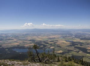
Hike to Blaine Mountain
7.3 mi / 2350 ft gainTo reach the trailhead for this hike, it is about an hour's drive from nearby Kalispell. You will drive around Hungry Horse Reservoir on the West Side Road, and turn off onto Doris Creek Road. Be sure NOT to get this mistaken with the nearby Doris Ridge Road. Once turning onto Doris Creek Road, i...Read more -
Square Butte, Montana
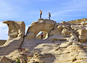
Hole in the Wall
Hole in the Wall is a natural geologic formation in the White Cliffs along the Missouri River. Located in the Upper Missouri Breaks National Monument. This stretch of the Wild and Scenic Missouri River has changed little since Lewis & Clark first explored it in 1805. You'll experience the sam...Read more -
Lewistown, Montana
Conquer the Montana Island Challenge
7.16 mi / 1024 ft gainThe Montana Island Challenge is held every year in August at the Half Moon Ranch located about an hour from Lewistown. The ranch has camping spots and a few bunkhouses available if you'd rather head up the day before instead of getting up at the crack of dawn the day of the race.The challenge con...Read more -
Flathead County, Montana
Kintla Lake Campground
* The road to this trailhead/lake is closed during the winter. Kintla Lake is one of the lesser explored lakes in Glacier National Park. Located on the west side of the park, it is accessible via an unpaved road from the Polebridge Ranger Station. From the Ranger Station, take a LEFT and contin...Read more -
Bigfork, Montana
Explore Graves Creek Falls
Graves Creek Falls are a series of pleasant waterfalls viewable without much effort. To get here From Hungry Horse drive south on the West Side Road (Forest Road 895) 33.6 miles to the Graves Creek Campground. From here turn right into the campground, park and take a short walk of a couple hundre...Read more -
Belt, Montana
Sluice Boxes State Park
5.07.71 mi / 643 ft gainThe soaring limestone cliffs and ledges mark the Belt Creek Canyon. Back in the day, this area in the Little Belt Mountains was a haven for mining. Now, the old railroad bed serves as the main access route of Sluice Boxes State Park. Sluice Boxes State Park was established in 1970 and consists o...Read more -
Choteau, Montana
Hike Jones Creek
5.04 mi / 300 ft gainThe trail head to Jones Creeks is just off of Teton River Road (the road that takes you up to Teton Pass Ski Area) and is marked with a sign, however it's only visible when you're coming down from Teton Pass. If you miss the sign, keep in mind it's about two miles past the Cave Mountain Forest Se...Read more -
White Sulphur Springs, Montana
Hike Yogo Peak and Enjoy Views of Lake Elva
A short 2-hour drive from Great Falls leads you to Yogo Peak and Lake Elva, an area of beauty, tranquility, and solitude. Yogo Peak is located in the Little Belt Mountains which are part of the Lewis & Clark National Forest. Yogo Peak doesn't have a designated trail, but it is located to the...Read more -
Condon, Montana
Holland Lake and Falls
5.03.05 mi / 561 ft gainHolland Lake and Falls is an out-and-back trail that takes you by a lake located near Condon, Montana.Read more -
Helena, Montana
Continental Divide Trail: MacDonald Pass to Priest Pass
5.010.8 mi / 2500 ft gainThe CDT trail is a popular trail with thru-hikers, and is considered one of the three Crown Jewels. The Appalachian Trail and the Pacific Crest Trail being the other two. This section of the Continental Divide Trail starts 25-minutes to the West of Helena just off Highway 12 at the CDNST Trailhe...Read more

