Montana
Looking for the best fitness in Montana? We've got you covered with the top trails, trips, hiking, backpacking, camping and more around Montana. The detailed guides, photos, and reviews are all submitted by the Outbound community.
Top Fitness Spots in and near Montana
-
Gallatin Gateway, Montana
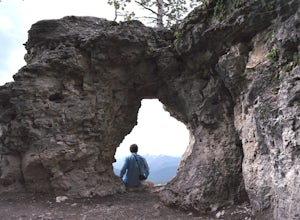
Summit Storm Castle Peak
4.85 mi / 1900 ft gainStorm Castle (or Castle Mountain) is a rocky peak that rises to an elevation of 7,280 ft on the east side of the Gallatin Canyon overlooking Beckman Flats. The hike is a gorgeous 5 mile out and back trail located just 30 minutes south of Bozeman, Montana in the Gallatin Canyon. This trail offers ...Read more -
Gallatin Gateway, Montana
Hike to Golden Trout Lakes
4.05 mi / 1300 ft gainThe Golden Trout lakes offer a scenic getaway just out of the Gallatin Valley Canyon. To access the trail head, turn east onto Portal Creek Road #984 and continue southeast for 6.8 miles. The road is in rough condition and is better suited for vehicles with a higher clearance. The trail head is e...Read more -
Bozeman, Montana
Hike Sypes Canyon
3.04 miSypes Canyon Trail is a gorgeous hike to a scenic lookout over Bozeman, MT. The trail only lies 20 minutes north of Bozeman and offers the perfect after work exercise. The trail is heavily populated with people and trail conditions fluctuate throughout the year. The trail follows a small creek th...Read more -
Glacier County, Montana
Hike to Scenic Point in Glacier National Park
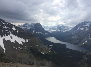
5.07.74 mi / 2205 ft gainPark at the trailhead and begin the hike. The trail starts out relatively flat until you reach a small waterfall. Then, hike up the switchbacks for about 4 miles while gaining around 2300 feet. From the top, you can see both Upper Two Medicine Lake and Two Medicine Lake. The views are stunning. ...Read more -
Wilsall, Montana
Summit Hardscrabble Peak
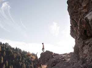
5.04 mi / 1900 ft gainLocated in the Bridger Mountain Range, Hardscrabble Peak offers a scenic hike just outside of Bozeman, MT. The Peak sits just north of the more popular Sacagawea Peak and from atop grants views over the Gallatin Valley as well as surrounding mountain ranges such as the Big Belts, Crazies, Tabacco...Read more -
Browning, Montana
Swiftcurrent Lookout
16.68 mi / 4491 ft gainTake this beautiful hike up Swiftcurrent Mountain to the Fire Lookout (8436 ft). The hike is 7.1 miles one-way from from the Swiftcurrent Inn parking lot trailhead. The elevation gain is 2,307 feet. The First 3 miles or so are a flat hike where you'll pass by several famous lakes and gain only ...Read more -
West Glacier, Montana
Waterton Lake via Bowman Lake
49.5 mi / 6365 ft gainOur trip started on Thursday evening, spending the night at the Bowman Lake campground. You can park your car here and it's where the hike will start and end. I recommend staying here the night before because day 1 is a doozy, so you'll want an early start. Day 1 is the hardest day of the hike, ...Read more -
Florence, Montana
Backpack the Sweeney Creek Trail
14 mi / 2600 ft gainThe hike into Duffy Lake was approximately 7 miles with ~2600' gain. The first mile or two is fairly steep, then it will wiggle up and down the mountain until it drops down into the drainage to the lake. You can hike to Holloway Lake too if the trail isn't completely covered in snow. Late spring ...Read more -
Sun River, Montana
Hike the First Peoples Buffalo Jump Loop
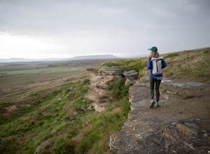
5.03 mi / 400 ft gainWhile the trail doesn't offer the typical scenery of a Montana hike, the views are spectacular. At the top of the jump, you're at one of the highest points of the basin, allowing you to take in the full magnitude of the surrounding mountains, which include the Big Belt, Little Belt and Highwood R...Read more -
Augusta, Montana
Hike to Willow Creek Falls
5.04.5 mi / 1000 ft gainThe hike up Willow Creek Gorge is one of my favorites so far. Unfortunately, because of the terrain and elevation gain, I wouldn't recommend taking young kids but if you do, make sure they're attached to you in some way. There are no services at the trail head, so make sure to bring everything yo...Read more -
Great Falls, Montana
Hike Sulphur Springs Trail
3.32 mi / 278 ft gainYou can find the Sulphur Springs trailhead near the Morony Dam and Reservoir. There's a graveled parking lot, an outhouse and an informative story board to quell your curiosity. For your convenience, I'll give you a Reader's Digest version of the history of this specific area. As we all know, Lew...Read more -
Kalispell, Montana
Backpack to Clayton Lake
9 mi / 1500 ft gainFrom the Camp Misery Trailhead (elev. 5,717 ft) take the left Trail 8 for .6 miles. At the junction continue left for a 1.3 mile gently ascent into Jewel Basin. Nearing Twin Lakes continue left on Trail 7 for .6 miles until you reach Trail 55. Continue right, and make sure that after a short .3 m...Read more -
Lincoln, Montana
Hike the Continental Divide Trail via Roger Pass
2.33 mi / 665 ft gainAfter driving over Rogers Pass more times than I can count, we finally made it a point to stop and check out the Continental Divide Trail No. 440 -- glad we did. If you've driven the pass, you've seen the trail head about 66 miles west of Great Falls -- the wooden stairs off the right side of th...Read more -
Lewistown, Montana
Conquer the Montana Island Challenge
7.16 mi / 1024 ft gainThe Montana Island Challenge is held every year in August at the Half Moon Ranch located about an hour from Lewistown. The ranch has camping spots and a few bunkhouses available if you'd rather head up the day before instead of getting up at the crack of dawn the day of the race.The challenge con...Read more -
Choteau, Montana
Hike Jones Creek
5.04 mi / 300 ft gainThe trail head to Jones Creeks is just off of Teton River Road (the road that takes you up to Teton Pass Ski Area) and is marked with a sign, however it's only visible when you're coming down from Teton Pass. If you miss the sign, keep in mind it's about two miles past the Cave Mountain Forest Se...Read more

