Montana
Looking for the best camping in Montana? We've got you covered with the top trails, trips, hiking, backpacking, camping and more around Montana. The detailed guides, photos, and reviews are all submitted by the Outbound community.
Top Camping Spots in and near Montana
-
Kalispell, Montana
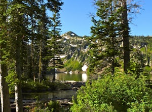
Backpack to Black Lake
7 mi / 1500 ft gainBegin at Camp Misery (elev. 5,717 ft). This is a total misname by the way! It should be titled Camp On The Way To Awesomeness! Anyway, head .6 miles on Trail 8 to the intersection of trail. From here turn right on Trail 68 and hike .7 miles until the intersection where you turn right on Trail 7 f...Read more -
Madison County, Montana
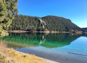
Camp at Wade Lake
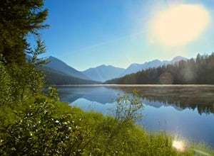
Wade Lake Campground is a gorgeous campground, situated right on the crystal clear blue waters of Wade Lake. It has a handful of maintained sites, as well as a vault toilet. You can easily car camp here, though you may want to be careful on the road in if you're hauling a camper. The beauty of t...Read more -
Flathead County, Montana
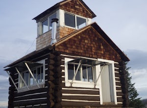
Camp Out at the Hornet Lookout
1 mi / 800 ft gainReservations for Hornet Lookout are obtained via Recreation.gov, and can be made up to six months in advance. Consider a four-wheel or all-wheel drive vehicle with some clearance if available, as the forest service roads aren't always well maintained. Although the hike is short, it is all switc...Read more -
Gallatin Gateway, Montana
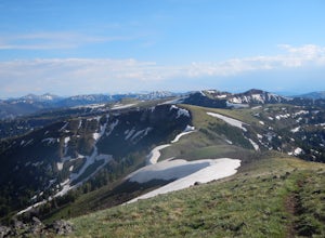
Backpack the Gallatin Crest Trail
42 mi / 6000 ft gainThere are some different options for starting and ending this hike, but the route I did started at Buffalo Horn Trailhead and ends at the Hyalite Creek Trailhead, and is approximately 42 miles total. I did the trail over the course of three and a half days, spending three nights in the backcountr...Read more -
Augusta, Montana
Hike to Willow Creek Falls
5.04.5 mi / 1000 ft gainThe hike up Willow Creek Gorge is one of my favorites so far. Unfortunately, because of the terrain and elevation gain, I wouldn't recommend taking young kids but if you do, make sure they're attached to you in some way. There are no services at the trail head, so make sure to bring everything yo...Read more -
Roscoe, Montana
Backpack to the Beartooths
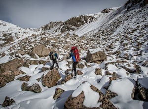
5.014 mi / 7620 ft gainWe stood there, against the wind, looking at 3-4 pitches. The line appeared too good to be true. It was a bit of an ice pitch, followed by a snow coliour, finishing with a pitch of mixed climbing that would take us to the top.I'd heard things about The Beartooths. But, they weren’t validated unti...Read more -
Darby, Montana
Backpack and Summit Trapper Peak
4.08.75 mi / 3327 ft gainFrom Darby, MT, follow MT 473 south for 4 miles to West Fork Bitterroot River Rd. A mile past the Job Corps, at milepost 7, turn right on FS 5634 (Baker Point Rd.). Follow this road 10 miles to the trailhead at about 7000 ft. The trail begins on a FS trail to Baker Lake. There are fish in Baker L...Read more -
West Yellowstone, Montana
Camp at Cherry Creek Campground at Hebgen Lake
In early November we drove from Big Sky to this free campsite located on the southern part of the lake. The road is dirt but mellow. We saw no other campers the entire 2 days we were there. We got out on our inflatable kayak the first day and paddled out on the glassy water near some enormous fl...Read more -
West Glacier, Montana
Backpack to Logging Lake
8.8 miBackcountry camping is the best plan if you’d like to visit Logging Lake, and the primitive campsites lay at the end of a four and a half mile hike through some of the most unspoiled sections of the park. The trail follows logging creek most of the way to the lake traversing through a variety of ...Read more -
Park County, Montana
Backpack the Aero Lakes to Granite Peak
26 mi / 6200 ft gainGranite Peak is considered one of the most difficult state high-points, for its remoteness and its climbing challenge. Unfortunately, the access to this route is very remote. Fortunately, this route to the summer is the easiest way up in terms of the technical climbing challenge. This route, k...Read more -
Browning, Montana
Backpack to the Foot of Glenns Lake
20.6 mi / 950 ft gainStarting from the Chief Mountain Parking Area, take the trail to the left of the bathrooms at the end of the parking lot (left of the bathrooms if you are facing the bathrooms and the main road is to your right). You will quickly hike to a wooden kiosk. Read this kiosk for any pertinent informati...Read more -
Bigfork, Montana
Summit Swan Peak
18.49 mi / 6180 ft gainThis hike is about an hour drive south from Kalispell. Follow MT-83 S for about 47 mi. towards and past Swan Lake. Take a left on NF-554 and follow the road for 1.6 mi. and take a right on Squeezer Creek Rd. and follow the road for 4 mi. to a gated road and park near the gate. Follow the gated ro...Read more -
Condon, Montana
Climb Holland Peak
11 mi / 5200 ft gainAbout 2 mi. south of Condon, MT, take Rumble Creek Road east to Cooney Lookout and park at the trailhead at 4550 ft. Follow the trail for about 1 mi. and after about 100 yards after the third bridge, look for a well worn trail heading up the hill side. Take this steep, hard-packed trail and follo...Read more -
Kalispell, Montana
Summit Lake Mountain and Nasukoin Mountain
5.012 mi / 3500 ft gainTo reach the trailhead, travel west on US Hwy 93 for 17.9 mi. and then turn right onto Olney Crossover Rd. This road will continue for 8.8 mi. and then keep left onto NF-115 for 9.7 mi. and the destination will be on the right hand side. There is a parking area where the trailhead begins. From th...Read more -
Augusta, Montana
Hike Crown Mountain, Augusta
8 mi / 4200 ft gainLocated an hour and forty minutes east of Great Falls Montana, Crown Mountain is a fun day hike, and you'll see few if any other people. The nearest town is Augusta and a great place to stop for a burger and beer at Buckhorn Bar afterward. From Augusta, head West on Benchmark Road for 20 miles. ...Read more -
Deer Lodge, Montana
Summit Mount Powell
11.6 mi / 4730 ft gainFrom Interstate 90, exit at Racetrack #195. Continue west for one mile and turn north at a T intersection. Follow the road for about 0.75 mi. to Quinlan Rd. and continue west with a dogleg south for 3.5 mi. Take a sharp right to the north east to a Y and take the left fork. After about 0.07 mi., ...Read more

