Flowery Branch, Georgia
Looking for the best hiking in Flowery Branch? We've got you covered with the top trails, trips, hiking, backpacking, camping and more around Flowery Branch. The detailed guides, photos, and reviews are all submitted by the Outbound community.
Top Hiking Spots in and near Flowery Branch
-
Suwanee, Georgia
Sims Lake Park Trail
5.01.17 mi / 135 ft gainSims Lake Park Trail is a loop trail that takes you by a lake located near Suwanee, Georgia.Read more -
Cumming, Georgia
Hike the Indian Seats Trail
4.33.24 mi / 453 ft gainThe Sawnee Mountain Preserve is easy to get to with a GPS and offers plenty of parking. To get to the Indian Seats Trail you will start down a short (.17 mile) trail that will take you to the trailhead. The Indian Seats Trail is a loop so once you reach the marked trail you can go either left or ...Read more -
Cumming, Georgia
Mountainside Loop Trail
4.05.35 mi / 823 ft gainMountainside Loop Trail is a loop trail where you may see beautiful wildflowers located near Cumming, Georgia.Read more -
Duluth, Georgia
Bunten Road Park Loop
1.66 mi / 121 ft gainBunten Road Park Loop is a loop trail that takes you through a nice forest located near Duluth, Georgia.Read more -
Dahlonega, Georgia
Lake Zwerner (aka Yahoola Creek Reservoir)
5.03.24 mi / 367 ft gainLake Zwerner (aka Yahoola Creek Reservoir) is a loop trail that takes you by a river located near Dahlonega, Georgia.Read more -
Roswell, Georgia
Hike to the Roswell Mill Ruins via Vickery Creek Trail
4.43.46 mi / 374 ft gainFrom Riverside Road, the Vickery Creek Trail takes you alongside the creek, then to an intersection where you will turn right. Switch onto Outer Loop Trail at the next intersection, and keep an eye out for marked junctions going forward. The trail will take you to the Roswell Mill waterfall, the...Read more -
Stone Mountain, Georgia
Stone Mountain
4.22.23 mi / 650 ft gainStone Mountain sits on the outskirts of downtown Atlanta. Located in the center of Stone Mountain Park, this 1,686 ft. granite mound provides visitors with a challenging cardio workout and excellent panoramic views of the Atlanta metropolitan area. Those who want to climb Stone Mountain should...Read more -
Sandy Springs, Georgia
Hike through Big Trees Forest Preserve
4.02 mi / 120 ft gainBig Trees is truly a backyard beauty. The entrance connector brings you through to the beginning of the trails. If you are low on time, try out the Big Trees Loop (1/2 mile) which appears slightly before the major Backcountry trail system. Without going too deep into the preserve, you can still e...Read more -
Jasper, Georgia
Mount Oglethorpe
0.69 mi / 49 ft gainMount Oglethorpe, located in Jasper, Georgia, offers a challenging hiking trail that spans approximately 0.69 miles. The trail is marked by a steady incline, making it suitable for intermediate to advanced hikers. The path is well-maintained and clearly marked, ensuring a safe journey for all hik...Read more -
Dawsonville, Georgia
Amicalola Falls
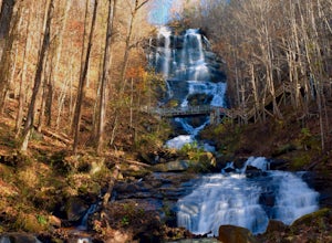
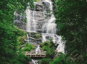
4.30.73 mi / 292 ft gainAdventurers access the falls through the state park entrance. From the parking lot, hikers follow the clearly marked signs to the base of the falls. The incline begins by the pond at the base of the falls. From the pond, follow the incline along the cascading portion of the falls to the stairs. A...Read more -
Dawsonville, Georgia
Hike to Springer Mountain
3.519 mi / 4346 ft gainBegin your journey from Amicalola Falls State Park. Despite the steep climb, you should park at the base of the falls and climb the steps for a great view of one of the grandest falls in the South. (For more on that hike, see: "Climb the Stairs to Amicalola Falls"). From the top of the falls, fol...Read more -
Dawsonville, Georgia
Amicalola Falls Loop via Upper Observation Platform
5.01.93 mi / 666 ft gainTo get there you can use Google Maps or Waze to “Upper Observation Platform” – W Ridge Staircase, Dawsonville, GA 30534. The other option is to start at the visitor center. If you start at the visitor center, it will add about a mile to your hike so parking in the upper parking lot like us will s...Read more -
Cleveland, Georgia
Hike and Climb to Yonah Mountain
4.94.53 mi / 1417 ft gainThe trail starts at "Mt. Yonah Trailhead" and is 4.4 mile round-trip with elevation of 1,500' to 3,166'. The trail stays below moderate tree coverage until around the halfway point where you will come upon a clearing known as the first LZ (landing zone). The mountain is shared with hikers by Army...Read more -
Cleveland, Georgia
Mount Yonah Trail
4.17 mi / 1430 ft gainMount Yonah Trail is an out-and-back trail where you may see beautiful wildflowers located near Cleveland, Georgia.Read more -
Atlanta, Georgia
Take a Stroll through Blue Heron Nature Preserve
0.7 miBlue Heron Nature Preserve is located directly off of the heavily trafficked Roswell Road in Buckhead. The preserve boasts seven acres of greenery, wetlands, meadows, wildlife, and wildflowers. There is even an educational facility located on the grounds for those extra curious explorers. This...Read more -
Marietta, United States
Hike Along Sope Creek
4.31.97 mi / 226 ft gainSope Creek is a little slice of wild heaven squeezed into the hustle and bustle of Atlanta's metro madness. Bordering the Chattahoochee River, Interstate 285, and Suburbia sprawl, Sope Creek offers the city dweller an environmental escape that seems too good to be true. From the parking lot off...Read more


