Flowery Branch, Georgia
Top Spots in and near Flowery Branch
-
Gainesville, Georgia
Mountain Bike Chicopee Woods' Flying Squirrel Trail
4.7 mi / 200 ft gainThere is a designated parking lot for the Chicopee Woods mountain bike trails with plenty of parking, but it can fill up on weekends.To access the trailhead for Flying Squirrel, you have to take a few other trails (a good warm-up!) to get back to a junction known as ‘Confusion Corner’, which is w...Read more -
Suwanee, Georgia
Sims Lake Park Trail
5.01.17 mi / 135 ft gainSims Lake Park Trail is a loop trail that takes you by a lake located near Suwanee, Georgia.Read more -
Gainesville, Georgia
Swim in Lake Sidney Lanier at Dogwood Park
3.0Lake Sidney Lanier is pretty big, but you don't need to be overwhelmed when you visit the lake via Dogwood Park. The park has a large pavilion and a few other picnic tables, lots of shade trees, and a couple of ways to access the lake. On the left side, there's an abandoned marina (dangerous—it's...Read more -
Cumming, Georgia
Hike the Indian Seats Trail
4.33.24 mi / 453 ft gainThe Sawnee Mountain Preserve is easy to get to with a GPS and offers plenty of parking. To get to the Indian Seats Trail you will start down a short (.17 mile) trail that will take you to the trailhead. The Indian Seats Trail is a loop so once you reach the marked trail you can go either left or ...Read more -
Cumming, Georgia
Mountainside Loop Trail
4.05.35 mi / 823 ft gainMountainside Loop Trail is a loop trail where you may see beautiful wildflowers located near Cumming, Georgia.Read more -
Lawrenceville, Georgia
Rhodes Jordan Park Trail
1.48 mi / 138 ft gainRhodes Jordan Park Trail is a loop trail that takes you by a lake located near Lawrenceville, Georgia.Read more -
Duluth, Georgia
Bunten Road Park Loop
1.66 mi / 121 ft gainBunten Road Park Loop is a loop trail that takes you through a nice forest located near Duluth, Georgia.Read more -
Duluth, Georgia
Shorty Howell Park Loop
1.33 mi / 121 ft gainShorty Howell Park Loop is a loop trail that is good for all skill levels located near Duluth, Georgia.Read more -
Alpharetta, Georgia
Bike or Run the Big Creek Greenway
3.516 mi / 200 ft gainThe Big Creek Greenway is a roughly 8-mile stretch of paved trail that runs from its northern Marconi Drive entrance in Alpharetta down to Old Alabama Road in Roswell. There is also an extended bit of the Greenway a little further north in Forsyth County, though these two trails do not connect. T...Read more -
Dahlonega, Georgia
Kayak the Chestatee River South of Dahlonega
4.0This six mile section of the Chestatee River is a safe, enjoyable float mostly away from civilization. There are several small rapids and bumpy areas (class 1) throughout, with two larger rapids (class 1-2) towards the end of the section. It does get pretty shallow in some sections, so keep watch...Read more -
Roswell, Georgia
Big Creek Freeride
3.5The Big Creek Freeride area is part of the Big Creek recreation area which provides a paved greenway, singletrack mountain biking trails, and two pump tracks.The Freeride area contains a number of downhill mountain biking lines that bottom out at the Greenway toward the back end of the trail syst...Read more -
Dahlonega, Georgia
Lake Zwerner (aka Yahoola Creek Reservoir)
5.03.24 mi / 367 ft gainLake Zwerner (aka Yahoola Creek Reservoir) is a loop trail that takes you by a river located near Dahlonega, Georgia.Read more -
Dahlonega, Georgia
Explore Cane Creek Falls
From the parking lot, walk about 500 feet to the check-in office to let the receptionist know that you would like to visit the falls. This campground operates as a retreat select times throughout the year and is closed to the public during those times so prior to visiting, be sure to call and fi...Read more -
Roswell, Georgia
Hike to the Roswell Mill Ruins via Vickery Creek Trail
4.43.46 mi / 374 ft gainFrom Riverside Road, the Vickery Creek Trail takes you alongside the creek, then to an intersection where you will turn right. Switch onto Outer Loop Trail at the next intersection, and keep an eye out for marked junctions going forward. The trail will take you to the Roswell Mill waterfall, the...Read more -
Roswell, Georgia
Climb and Chill at Allenbrook
4.0You’re going to be really surprised you’re still in Roswell, or in the Atlanta area at all. When you get out of your car and start walking down the wooden stairs at the start of the trail, the busy sounds of the rushing cars on Atlanta Street fade away into the wind flowing through the Tulip Popl...Read more -
Stone Mountain, Georgia
Stone Mountain
4.22.23 mi / 650 ft gainStone Mountain sits on the outskirts of downtown Atlanta. Located in the center of Stone Mountain Park, this 1,686 ft. granite mound provides visitors with a challenging cardio workout and excellent panoramic views of the Atlanta metropolitan area. Those who want to climb Stone Mountain should...Read more
Camping and Lodging in Flowery Branch
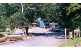
Flowery Branch, Georgia
Old Federal
Overview
Old Federal Campground lies on the eastern banks of Lake Sidney Lanier in Northern Georgia.
Popular for its aqua-blue waters an...
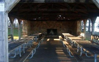
Flowery Branch, Georgia
Van Pugh North Park Shelter (Ga)
Overview
Van Pugh North Park lies approximately 15 miles north of Buford Dam on Lake Sidney Lanier. The site features beautiful views o...
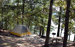
Flowery Branch, Georgia
Van Pugh South Campground
Overview
Van Pugh South Campground lies on the banks of Lake Sidney Lanier in the foothills of the Blue Ridge Mountains of Northern Georg...
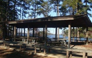
Buford, Georgia
Lanier Park Shelter (Ga)
Overview
Lanier Park lies just north of Buford Dam on Lake Sidney Lanier. The site features beautiful views of the lake as well as exce...
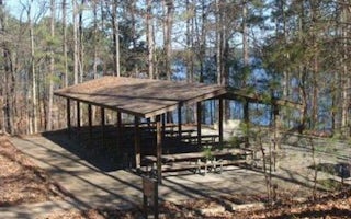
34.1524861,-84.0615167, Georgia
Buford Dam Park Shelters (Ga)
Overview
Buford Dam Park lies just north of Buford Dam on Lake Sidney Lanier. The site features beautiful views of the lake as well as ...
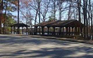
Cumming, Georgia
West Bank Park Shelters (Ga)
Overview
West Bank Park lies just north of Buford Dam on Lake Sidney Lanier. The site features beautiful views of the lake as well as e...


