Euharlee, Georgia
Looking for the best hiking in Euharlee? We've got you covered with the top trails, trips, hiking, backpacking, camping and more around Euharlee. The detailed guides, photos, and reviews are all submitted by the Outbound community.
Top Hiking Spots in and near Euharlee
-
Cartersville, Georgia
Etowah Indian Mounds Interpretive and River Walk Trails
4.01.08 mi / 105 ft gainEtowah Indian Mounds Interpretive and River Walk Trails is a loop trail that takes you by a river located near Cartersville, Georgia.Read more -
Cartersville, Georgia
Pine Mountain Loop
4.62.11 mi / 597 ft gainThe Pine Mountain Trail winds and climbs its way to awesome summit views, along massive granite outcrops and serene forest. Hike over wooden bridges, across sparkling streams, past misty waterfalls & rock outcroppings, varied forest, scenic overlooks, & leaping deer. This local gem is tuc...Read more -
Cartersville, Georgia
Camp at Red Top Mountain State Park
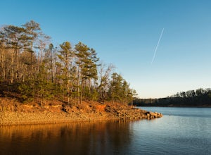
4.5Red Top Mountain State Park finds itself just 30 minutes up I-75 from the urban sprawl of Atlanta, and it is surprising how quickly you can forget exactly how close you are to the city with just one night of camping here. The State Park has a range of activities to offer, so there is bound to be...Read more -
Acworth, Georgia
Hike and Swim at Red Top Mountain
4.54.74 mi / 472 ft gainThe Georgia summer is no joke. Fortunately, Red Top Mountain's Homestead Trail hosts enough shade and swimming for all adventurers. The 5.5 mile loop is located on a large peninsula stretching out into Lake Allatoona. Hikers enter a lush forest of wildlife and will encounter moderate elevation...Read more -
Marietta, Georgia
Hike to Noses Creek
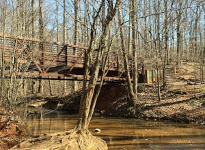
3.52 miStarting at the Burnt Hickory Parking lot on Kennesaw National Battlefield, you head south on a pretty flat trail. After a mile and a half you will come across a bridge that goes over Noses Creek. If you're looking to cover more ground, the trails around the creek expand for miles in any directio...Read more -
Marietta, Georgia
Hike the Battlefield and Mountain Loop
5.010.24 mi / 1355 ft gainFrom the visitor center, start on the Kenneshaw Mountain Trail, which takes you up a series of switchbacks to the summit of Kennesaw Mountain (600' elevation gain). Take in the views of Atlanta from the top, then continue on the trail as it descends, then starts up Little Kennesaw Mountain. At 2...Read more -
Woodstock, Georgia
Rope Mill Loop
4.36 mi / 522 ft gainRope Mill Loop is a loop trail that takes you through a nice forest located near Woodstock, Georgia.Read more -
Summerville, Georgia
Hike the Marble Mine Trail
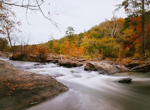
4.31.7 mi / 200 ft gainThis 1.7 mile loop is almost entirely on a wide pebbled road making this hike perfect for getting families and friends outdoors. Though there is some elevation gain, the Marble Mine Loop is quite an easy walk. Go during the Fall and the trees are boasting all the reds, oranges, and yellows of the...Read more -
Marietta, United States
Hike Along Sope Creek
4.31.97 mi / 226 ft gainSope Creek is a little slice of wild heaven squeezed into the hustle and bustle of Atlanta's metro madness. Bordering the Chattahoochee River, Interstate 285, and Suburbia sprawl, Sope Creek offers the city dweller an environmental escape that seems too good to be true. From the parking lot off...Read more -
Lithia Springs, Georgia
Sweetwater Creek White Loop
4.54.87 mi / 371 ft gainSweetwater Creek State Park offers a breath of fresh air and beautiful sights only 15 miles from Atlanta. The park has 9 miles of trails to choose from. The shortest of the three trails is the Red Trail (1 mile, one-way). After a half mile you will arrive at the impressive 5 story New Manchester ...Read more -
Lithia Springs, Georgia
Sweetwater Creek Red Trail
4.81.48 mi / 46 ft gainSweetwater Creek State Park lies just about 20 minutes West of Downtown Atlanta. An easy drive along I-20 from the large city makes this park a very popular destination, especially on the weekends. Out of the parks three main trails, the Red Trail is by far my favorite. Scenic river views and ...Read more -
LaFayette, Georgia
Hike to Keown Falls
1.8 mi / 450 ft gainKeown Falls Trail is a moderate loop perfect for a Spring day (especially after those April showers). The trailhead is located in the Keown Falls picnic area which is very spacious spotted with several picnic tables. This would be a great place for a family gathering and is spacious enough that ...Read more -
Atlanta, United States
Hike along the East Palisades Trail
4.54.3 mi / 488 ft gainThe East Palisades trail is one of the only real hiking trails within Atlanta's perimeter. Although it boasts surprising beauty and great trails, relatively few people in the city are aware this trail even exists. As part of the Chattahoochee National Recreation Area, this section of forest is ...Read more -
Roswell, Georgia
Hike to the Roswell Mill Ruins via Vickery Creek Trail
4.43.46 mi / 374 ft gainFrom Riverside Road, the Vickery Creek Trail takes you alongside the creek, then to an intersection where you will turn right. Switch onto Outer Loop Trail at the next intersection, and keep an eye out for marked junctions going forward. The trail will take you to the Roswell Mill waterfall, the...Read more -
Sandy Springs, Georgia
Hike through Big Trees Forest Preserve
4.02 mi / 120 ft gainBig Trees is truly a backyard beauty. The entrance connector brings you through to the beginning of the trails. If you are low on time, try out the Big Trees Loop (1/2 mile) which appears slightly before the major Backcountry trail system. Without going too deep into the preserve, you can still e...Read more -
Atlanta, Georgia
Take a Stroll through Blue Heron Nature Preserve
0.7 miBlue Heron Nature Preserve is located directly off of the heavily trafficked Roswell Road in Buckhead. The preserve boasts seven acres of greenery, wetlands, meadows, wildlife, and wildflowers. There is even an educational facility located on the grounds for those extra curious explorers. This...Read more

