Livermore, Colorado
Top Spots in and near Livermore
-
Laporte, Colorado
Hike the 3 Bar and Oh Tee Loops at Eagle's Nest Open Space
5 mi / 150 ft gainTo get to Eagle's Nest Open Space drive on Highway 287 between Laramie, Wyo. and Fort Collins, Colo. As you continue down 287, look for the Forks restaurant and rest stop in Livermore, Colo. Turn here onto Red Feather Lakes Road. After a few hundred feet on Red Feather Lakes Road, look for the E...Read more -
Bellvue, Colorado
Hike the Black Powder Trail
1.5 mi / 450 ft gainThe Gateway Natural Area, part of the City of Fort Collins public lands system, is a wonderful (and close to the city) place to begin exploring the many outdoor assets and activities found in the greater Fort Collins area. The Black Powder Trail is a relatively easy, well-marked 1.5 mile out and ...Read more -
Bellvue, Colorado
Climb Greyrock Mountain
5.07.1 mi / 3000 ft gainThe main trail begins at the Cache La Poudre river on the Poudre Canyon Highway about 30 minutes from Fort Collins. After about .75 miles the trail splits. To go left on Greyrock Meadows trail adds 2 miles to your trip and provides excellent views of Greyrock Mountain and Meadows from the south, ...Read more -
Bellvue, Colorado
Trail Run the Hewlett Gulch Trail
5.08.5 mi / 800 ft gainHewlett Gulch Trailhead is located about 20 minutes from Fort Collins and offers easy hiking in the Poudre Canyon.From Fort Collins, take 287 to Ted's Place. Take a left onto CO 14 and follow 14 through the canyon just past Poudre Park where you see the trailhead sign. Turn left onto the road tha...Read more -
Wellington, Colorado
Climb Table Mountain in the Red Mountain Open Space
4.05 mi / 1200 ft gainTable Mountain sits smack dab in the middle of Red Mountain Open Space, an area known to geologists (and settlers) as "The Big Hole", a singular and unique landform that peaks into the "basement" rocks that underly northern Colorado and Southeastern Wyoming. Soapstone cliffs and bright red Dakota...Read more -
Laporte, Colorado
Hike the Bellvue Dome
2.81.75 mi / 600 ft gainThe Bellvue Dome, known locally as "Goat Hill", was created by the same geological forces that made the Rocky Mountains, but what makes this structure unique is its shape, the steep cliff on its western edge carved by the Cache la Poudre River at the base, and its prominent location dominating th...Read more -
Wellington, Colorado
Hike the Bent Rock Trail at Red Mountain Open Space
2.6 mi / 200 ft gainTo get to Red Mountain Open Space from Fort Collins, take Highway 287 to Highway 1. Follow Highway 1 until you see County Road 15, get off there. This is where it gets confusing, so hang on. You will follow CR15 for a few miles until CR78, take a left onto CR78. Then take a right on CR17, then a ...Read more -
Wellington, Colorado
Hike the K-Lynn Cameron Trail in the Red Mountain Open Space
5.4 mi / 800 ft gainThe K-Lynn Trail is a 2.4 mile loop trail that goes west off of the Ruby Wash Trail on the western side of the Red Mountain Open Space. To get there, take the Bent Rock Trail from the Red Mountain Open Space parking lot where the Red Canyon / Antelope Valley road dead-ends.Once on the Bent Rock T...Read more -
Fort Collins, Colorado
Catch a Sunset at Bingham Hill Park
Bingham Hill Park sits on the northern terminus of the main hogsback/ridgeline that makes up the eastern wall of the Horsetooth Reservoir, just off the eponymously named Bingham Hill Road and minutes from downtown Fort Collins.From the top you look out over the Front Range, The Poudre River, Arth...Read more -
Fort Collins, Colorado
Hike the North Loop via Foothills Trail
5.06.5 mi / 700 ft gainDespite its singular name, the Foothills Trail in Fort Collins is an interconnected series of trails that follows the ridges and hogsbacks which comprise the majority of the eastern side of the Horsetooth Reservoir. The trail can be accessed at several points along its length (by trails also call...Read more -
Fort Collins, Colorado
Fat Tire Bike the Foothills Trail
5.08.5 mi / 1000 ft gainThe Reservoir Ridge and Foothills trail system around Horsetooth Reservoir and Fort Collins is excellent for mountain biking, trail running, and hiking. During the winter it is particularly great for fat tire mountain biking, and the Foothills Trail is one of the best. The trail itself is roughly...Read more -
Fort Collins, Colorado
Mountain Bike Reservoir Ridge
2.3 mi / 216 ft gainSummary One of my favorite post-work rides in Fort Collins, Colorado is a short but challenging loop along Reservoir Ridge. The scenery is incredible and includes water, mountains, a great trail system, and a spattering of intermediate, rocky sections. This is a solid loop to get your heart rate ...Read more -
Wellington, Colorado
Hike the Mahogany Loop Trail at Soapstone Prairie Natural Area
7.4 mi / 330 ft gainTo get to Soapstone Prairie from Fort Collins, take Highway 287 north out of town, then turn right onto Highway 1. Continue on Highway 1 until it meets with County Road 15. Take County Road 15 north all the way to Rawhide Flats Road, which leads directly into Soapstone Prairie. As you begin to ap...Read more -
Fort Collins, Colorado
North Shield Pond Trail
3.01.54 mi / 43 ft gainNorth Shield Pond Trail is a loop trail where you may see beautiful wildflowers located near Fort Collins, Colorado.Read more -
Livermore, Colorado
Mt. McConnel Summit Trail Loop
4.26 mi / 1453 ft gainThis 4.3-mile round trip hike gains 1300 feet of elevation before reaching the Mt. McConnel summit. The primitive trail is rated as difficult and has an ascent of many switchbacks, leading up to a wild flower-covered summit. The trail winds along the ridge line around 8,000 feet, offering panoram...Read more -
Fort Collins, Colorado
Hike Arthur's Rock in Lory State Park
4.83.7 mi / 1150 ft gainThe climb to the summit of Arthur's Rock in Lory State Park provides relative isolation and solitude just 30 minutes from downtown Fort Collins along with great hiking, trail running, mountain biking, rock climbing, and horseback riding.Arthur's Rock Trail is the most direct route to the summit, ...Read more
Camping and Lodging in Livermore
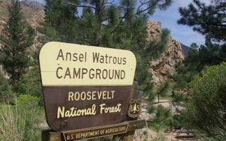
Bellvue, Colorado
Ansel Watrous
Overview
Ansel Watrous Campground is located on the Cache la Poudre River, 22 miles northwest of Fort Collins, Colo., along Highway 14. V...
Wellington, Colorado
Fort Collins North / Wellington KOA Journey
College town Fort Collins and cowpoke town Cheyenne, Wyoming, are both close enough to explore in the same day from this rural campground...
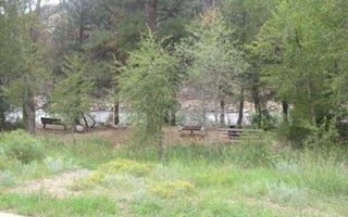
Livermore, Colorado
Narrows (Co)
Overview
Narrows Campground is located on the Cache la Poudre River, 32 miles northwest of Fort Collins, Colorado, along Highway 14. Visi...
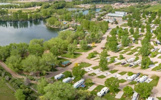
Fort Collins, Colorado
Fort Collins / Lakeside KOA Holiday
Welcome to the KOA closest to Fort Collins. You'll find plenty of amenities here to please the entire family. Enjoy the 9-acre catch-and-...
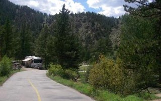
Livermore, Colorado
Mountain Park
Overview
Mountain Park Campground is located on the Cache la Poudre River, 40 miles northwest of Fort Collins, Colo., along Highway 14. V...
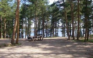
Red Feather Lakes, Colorado
Dowdy Lake
Overview
Dowdy Lake Campground is located 48 miles northwest of Fort Collins, Colo., near the village of Red Feather Lakes. Visitors enjo...


