Livermore, Colorado
Looking for the best mountain biking in Livermore? We've got you covered with the top trails, trips, hiking, backpacking, camping and more around Livermore. The detailed guides, photos, and reviews are all submitted by the Outbound community.
Top Mountain Biking Spots in and near Livermore
-
Fort Collins, Colorado
Hike the North Loop via Foothills Trail
5.06.5 mi / 700 ft gainDespite its singular name, the Foothills Trail in Fort Collins is an interconnected series of trails that follows the ridges and hogsbacks which comprise the majority of the eastern side of the Horsetooth Reservoir. The trail can be accessed at several points along its length (by trails also call...Read more -
Fort Collins, Colorado
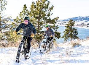
Fat Tire Bike the Foothills Trail
5.08.5 mi / 1000 ft gainThe Reservoir Ridge and Foothills trail system around Horsetooth Reservoir and Fort Collins is excellent for mountain biking, trail running, and hiking. During the winter it is particularly great for fat tire mountain biking, and the Foothills Trail is one of the best. The trail itself is roughly...Read more -
Fort Collins, Colorado
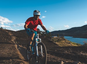
Mountain Bike Reservoir Ridge
2.3 mi / 216 ft gainSummary One of my favorite post-work rides in Fort Collins, Colorado is a short but challenging loop along Reservoir Ridge. The scenery is incredible and includes water, mountains, a great trail system, and a spattering of intermediate, rocky sections. This is a solid loop to get your heart rate ...Read more -
Fort Collins, Colorado
Hike Arthur's Rock in Lory State Park
4.83.7 mi / 1150 ft gainThe climb to the summit of Arthur's Rock in Lory State Park provides relative isolation and solitude just 30 minutes from downtown Fort Collins along with great hiking, trail running, mountain biking, rock climbing, and horseback riding.Arthur's Rock Trail is the most direct route to the summit, ...Read more -
Fort Collins, Colorado
Hike the Coyote Ridge Trail
1.03 mi / 550 ft gainThe Coyote Ridge Natural Area is one of several Larimer County "gateway" preserves and Open Lands that lead into the Front Range of the Rocky Mountains, connecting the shrublands of the Great Plains to the Rocky Mountain themselves through a network of trails, parks, and preserves. The Coyote Rid...Read more -
Cheyenne, Wyoming
Hidden Falls Loop
5.04.32 mi / 469 ft gainDirections: From Laramie, take I-80 east to exit 323 and continue on HWY 210 east for approximately 15 miles. From there the entrance to Curt Gowdy State Park will be clearly marked on the right side of the road. Then drive south for 1.4 miles until you reach a large parking area on the right sid...Read more -
Cheyenne, Wyoming
Lakeside Camping and Mountain Biking
4.0This trail system is somewhat of a hidden gem to mountain bikers south of the Wyoming border. Those who know their way around the best trail systems, though, hail Curt Gowdy as one of the best. If you've got some energy to burn, try the IMBA Epic suggested route, which loops together the 20 miles...Read more


