Fairplay, Colorado
Looking for the best photography in Fairplay? We've got you covered with the top trails, trips, hiking, backpacking, camping and more around Fairplay. The detailed guides, photos, and reviews are all submitted by the Outbound community.
Top Photography Spots in and near Fairplay
-
Red Cliff, Colorado
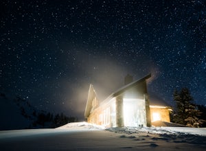
Ski to Fowler-Hilliard Hut
6.5 mi / 2500 ft gainFowler-Hilliard hut sits at 11,500 ft on a forested ridge of Resolution Mountain, with easy access to intermediate and expert backcountry skiing right out the door. This newer hut was built in 2010 after the original hut burned down from a lightning strike. The hut comes stocked with padded mattr...Read more -
Jefferson, Colorado
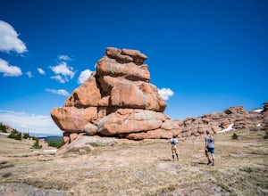
Trek through Granite Pillars on Bison Peak
12.4 mi / 4000 ft gainBison peak sits 2 hours from Denver in the mountains of the Lost Creek Wilderness. To reach the 12,431 ft. summit you'll start in low density ponderosa forest at 8,750 ft on crushed granite trail. Early starts are recommended in the summer months as the trail's high albedo can make for an extreme...Read more -
Buena Vista, Colorado
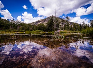
Hope Pass via Willis Gulch
5.08.75 mi / 3297 ft gainHope Pass is accessed from the Willis Gulch trailhead about 25 miles outside of Leadville, Colorado. To get to the trail head, follow Highway 24 East for about 16 miles until you arrive at the junction for Highway 82. Turn right and follow Highway 82 for about 8.3 miles. You will see a sign on th...Read more -
Frisco, Colorado
Climb Mount Royal
4.7To access the trailhead, drive 4 blocks South to the end of 2nd Avenue from Frisco's Main Street. The trailhead is located around 9,075 feet.Being a popular hike, the trail is clear in the summer months and usually populated by boot prints and snowshoe tracks in the winter. Follow the trail from ...Read more -
Chaffee County, Colorado
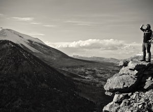
Off-Trail Hike of Limestone Ridge
4.09 mi / 1000 ft gainFinding a winter or early spring adventure that won't take you deep into dangerous mountain territory, while still providing epic vistas, is a challenge in Colorado. There are a few 10,000' tall ranges that sometimes escape deep snow, which are inviting for a first step into the alpine wonderland...Read more -
Frisco, Colorado
Hike or Snowshoe to Rainbow Lakes
5.03 mi / 250 ft gainYou can do this hike two different ways: 1- Start from the Peaks Trail Trailhead for an out and back hike, distance is a little over 2 miles roundtrip. 2- Start along the Summit County Recreational Trail (as marked on this map), also out and back hike, total distance just over 3 miles, and provid...Read more -
Swan Mountain Road, Colorado
Sapphire Point Overlook
3.30.62 mi / 49 ft gainThis short, 0.6 mile loop hike gives a beautiful view of Lake Dillon and is an easy, family-friendly hike. Dogs are allowed but must be kept on leash. The trail is clear cut and descends a few feet while looping around the side of the mountain to the overlook point. It is definitely a worthwhil...Read more -
Buena Vista, Colorado
Mt. Belford and Mt. Oxford
4.510.34 mi / 5856 ft gainYou'll being your ascent at the Missouri Gulch Trailhead, which is located a few miles up Chaffee County Road 390, at around 9,600 feet. The trail is very clear and very well maintained, but is steeper than most trails (even quite a few of the 14er trails I've done) right from the get-go. Remembe...Read more -
Buena Vista, Colorado
Hike Missouri Mountain
5.010.5 mi / 4500 ft gainGetting there: The trail begins at Missouri Gulch TH. If you are a car camper or are trying to snag a sunrise summit, there are many many drive off sites in trees and near water before and after the trailhead. The road to get to the trailhead is not paved, but is well maintained - a super high cl...Read more -
Frisco, Colorado
Frisco to Vail through Hike
5.013.55 mi / 3430 ft gainStarting at the Meadow Creek Trail head just off the turn off to Frisco this hike connects the stunning Eccles Pass and Gore Creek trails.Passing over Eccles Pass (11,917') and Red Buffalo Pass (11,742') this spectacular hike passes through dense forest, serene lakes and bubbling creeks.The Vail ...Read more -
Frisco, Colorado
Hike to Eccles Pass
10 mi / 3000 ft gainStarting at just over 9,000ft the Meadow Creek trail follows the path of the similarly named Meadow Creek. Through a canopy of aspens and pines the trail climbs at a steady, moderate rate. After a few water crossings the trees give way to an alpine meadow that offer a view of the final approach t...Read more -
Frisco, Colorado
Hike Red Buffalo Pass, Frisco to East Vail
13.2 mi / 3400 ft gainStarting at the Meadow Creek trailhead in Frisco, you'll find yourself ending up in East Vail at Gore Lake Trailhead. See all photos here. The trail in Meadow Creek starts to climb at a gradual pace for the 3-4 miles, after a mile or so, take a look back upon the views of Lake Dillion. You'll ar...Read more -
Buena Vista, Colorado
Mt. Elbert via Black Cloud Trail
4.510.69 mi / 4967 ft gainDirections: Heading south from Leadville from U.S. 24: West on CO 82 for 10.5 miles to a hidden right turn that leads to a trail head. If you make it to the Mt. Elbert Lodge, you have gone just a bit too far. The parking lot (aka: dirt access) should be relatively empty as everyone tends to hik...Read more -
Dillon, Colorado
Off-Road to Glacier Mountain
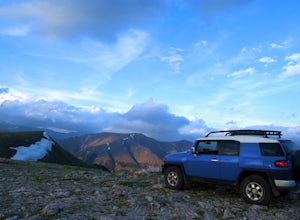
5.07.4 mi / 2100 ft gainThe trail begins just past historical Main Street Montezuma. You will see a sign on your right for St. Johns road. This road is officially marked as 275 on a map. The original road lead to St. Johns but not much of the town remains.You will cross the Snake River almost immediately after you turn ...Read more -
Frisco, Colorado
Sunset Shots at Lake Dillon
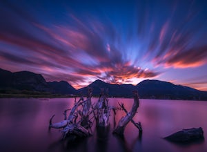
4.3To get to the southern end of the lake from Denver, head west on 70 until you reach 9. Take 9 for a few miles until you find the spot on the lake where you want to get started. On the south side of Lake Dillon, there was an abundance of old stumps lining the beach, which would occasionally drift ...Read more -
Dillon, Colorado
Sunset Views from Morgan Peak
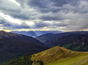
8.42 mi / 2900 ft gainHow you get to Morgan Peak and the other 13ers in the area depends on if you have a 4-wheel drive with good clearance or not. If so, drive the rough Santa Fe road from the small town of Montezuma (just outside Keystone). The road is also known as Forest Service 264 and is a left at the stop sign ...Read more

