Yosemite Village, California
Looking for the best rock climbing in Yosemite Village? We've got you covered with the top trails, trips, hiking, backpacking, camping and more around Yosemite Village. The detailed guides, photos, and reviews are all submitted by the Outbound community.
Top Rock Climbing Spots in and near Yosemite Village
-
YOSEMITE NATIONAL PARK, California
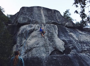
Rock Climb Penthouse Cracks, Yosemite NP
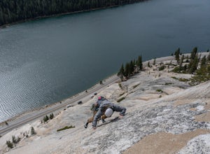
The Penthouse Cracks in Yosemite Valley are a great introduction to crack climbing, in a safe environment. With fixed protection above the routes, you are able to safely top rope these climbs. Featuring a 5.8, two 5.10 climbs, and a 5.11, everyone can find something fun to try.Park at Yosemite Lo...Read more -
Yosemite Valley, California
El Capitan Trail
5.014.68 mi / 5052 ft gainStart on the Yosemite Falls trailhead and work your way up. Yosemite Falls can be anywhere from a huge flow to a slow trickle depending on the time of year. Hiking boots are absolutely necessary and hiking poles are a huge benefit. Say hello to rock climbers at the top as they finish their El Cap...Read more -
Mariposa County, California
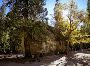
Rock Climb in Camp 4
5.0Some of the best bouldering in Yosemite Valley is on these polished granite boulders. This is an incredibly popular spot, especially during the summer months because of the tourist season. There's a small parking lot for Camp 4, but if that fills up, you'll have to park elsewhere and either walk ...Read more -
Mariposa County, California
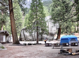
Camp at Camp 4, Yosemite NP
4.5Camp 4 is located in Yosemite Valley near Yosemite Valley Lodge. It's a popular spot for climbers as there is bouldering within the site. It's also located close to the Upper Yosemite Falls trail. Pets are not allowed. First come, first serve, $6/night. More info at https://www.nps.gov/yose/plany...Read more -
Wawona, California
Climb Hermaphrodite Flake to Boltway in Yosemite National Park
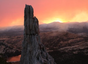
This is a great 5.7/5.8 linkup for anyone looking for an intermediate climb in Tuolumne. Always read through beta on Mountain Project and Super Topo and having the book on hand is always a good idea. To find the route, this photo is super helpful. The flake is pretty obvious, it's the one feature...Read more -
Mariposa County, California
Hike to Tuolumne Peak Plateau
11.7 mi / 1800 ft gainThe most direct route begins at Murphy Creek trailhead, on the north side of Tioga Road near Tenaya Lake. Walk north on Murphy Creek trail for 2.5 miles with minimal elevation gain. Polly Dome Lakes are a great side trip via the social trail on the right side of the trail before the first junctio...Read more -
YOSEMITE NATIONAL PARK, California
Scramble Yosemite's Cathedral Peak
3.0Start at Toulumne Meadows (8000 ft), and take the John Muir Trail, on the south side of Tioga Road. After about 1 mile, an unmarked trail will appear on your left – it is a less-traveled path, primarily taken by climbers. This trail will lead you away from Cathedral Lake to the back of Cathedral ...Read more -
Tuolumne County, California
Rock Climb Lembert Dome, Yosemite NP
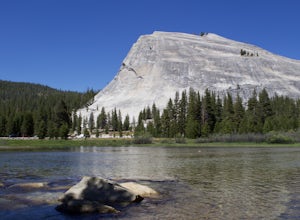
Lembert Dome stands out clearly as it is right along the road with a fairly large parking lot, about 1/4 mile past the Toulumne Store. There are multiple routes on this dome and for detail on all climbs, pick up the Tuolumne Free Climbs climbing guide. The area around this dome is gorogeous with ...Read more -
YOSEMITE NATIONAL PARK, California
Mt. Conness
5.019.03 mi / 5400 ft gainThis trip is best done as a 3 day, 2 night backpacking trip making camp at Young Lakes, however it is possible to do it in a single day long haul. Start at the Lembert Dome Parking Lot and take the trail via the Dog Lake route towards Young Lakes. It's about 7 miles to the upper of the three You...Read more -
Lee Vining, California
Climb the Third Pillar of Dana
From Highway 120 (Tioga Road) you can park at the lot just above Tioga Lake. Another mile up the road is the Yosemite entrance, so if you hit that, you've gone too far. Follow the trail around the south side of the lake and into Glacier Canyon. After about 2 miles you'll start scrambling on the N...Read more -
Lee Vining, California
Climb North Peak via the NW Ridge
DirectionsAlthough North Peak lies right on the border of Yosemite, the hike starts just outside the park at the Saddle Bag Lake trail-head. There are also some campsites here if you wish to spend the night, but I think they are usually in high demand and hard to come by. To get to Saddlebag Lak...Read more -
Bass Lake, California
Camp at Greys Mountain Campground
/ 5293 ft gainFrom Greys Mountain Campground, Sierra National Forest is your oyster! Enjoy hiking, swimming, fishing, mountain biking, boating, paddle boarding, kayaking, canoeing, and more. Each site is equipped with a picnic table and a fire ring. The campground has vault toilets and (sometimes) potable wate...Read more -
Madera County, California
Ediza Lake via Agnew Meadows
4.013.54 mi / 1804 ft gainStart at the Agnew Meadows Trailhead. You will need to arrive before 7:30AM or take the Shuttle from Mammoth Mountain. Start out by heading north on the John Muir Trail. You will pass Shadow Lake; walk around the south side of the lake for mountain views. Then, follow the trail up Shadow Creek u...Read more -
Madera County, California
Climb Mount Ritter
Mt Ritter is a long climb, but it is worth the effort. Start out by establishing camp at Ediza Lake prior to your ascent. The SE Glacier route (first ascent by John Muir) follows the path of least resistance up the SE side of Mt Ritter.The route first gains a broad bench below Ritter and Banner P...Read more -
Bass Lake, California
Climb and Camp at Shuteye Ridge
5.0The Journey to your final destination can get a little tricky once you get on the dirt roads. From the Bay Area it will take you about 3 hours to get into Oakhurst, then another hour to get to the Wilderness Area simply because of the windy and not maintained roads. On that note I would suggest t...Read more -
Bridgeport, California
Climb Matterhorn Peak via the East Couloir
10 mi / 6000 ft gainMatterhorn Peak in the northeastern Yosemite Wilderness is an SPS Emblem Peak and many regard it as the beginning of the High Sierra, as there are no peaks higher to the north in the Sierra Nevada.There are many routes to the summit, but the shortest and most direct (though not easiest) begins at...Read more

