Watsonville, California
Looking for the best hiking in Watsonville? We've got you covered with the top trails, trips, hiking, backpacking, camping and more around Watsonville. The detailed guides, photos, and reviews are all submitted by the Outbound community.
Top Hiking Spots in and near Watsonville
-
Big Sur, California
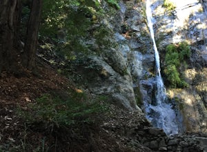
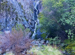
Hike to Pfeiffer Falls
4.02 miThis trail is a staff favorite at Big Sur. This family-friendly waterfall trail provides only a moderate challenge for young children and older family members. There are two starting points for this hike depending on where you stashed the car. If you’re parked near the gift shop, the head up the ...Read more -
Half Moon Bay, California
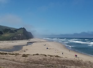
Stroll along the Southern Beaches at San Gregorio State Beach
4.02.9 mi / 413 ft gainNot a trail per se, but approximately 3 miles (down and back) of beautiful beach to walk down. Lots of interesting caves, wild animals, and rock formations to discover. This is a popular location for sea kayakers. San Gregorio State Beach was originally founded to protect the estuary at the back ...Read more -
Big Sur, California
Sykes Hot Springs via Pine Ridge Trail
4.218.96 mi / 7339 ft gainThe trek to Sykes Hot Springs is about 10-miles one way along the Pine Ridge Trail. This is a great backpacking trip, but can be done as an out-and-back hike from the campgrounds at Pfeiffer Big Sur State Park if you're really moving. The trail is moderately challenging, you'll cross the river t...Read more -
Big Sur, California
Pine Ridge, North Coast Ridge Loop
2.033.45 mi / 11388 ft gainIf you are looking to do some backpacking in the Big Sur area, you've come to the right place. This post shares a suggested 4-day backpacking loop in the Ventana Wilderness that will offer a bit of everything - challenging hiking with a healthy does of elevation, beautiful primitive camping amon...Read more -
Big Sur, California
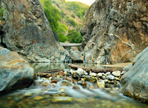
Explore the Big Sur River Gorge
4.71 miIf you are in the Big Sur area during the summer, exploring the Big Sur River Gorge is a must! The gorge is located in Pfeiffer Big Sur State Park, and your closest parking will be day use parking lot 3. The trailhead to the gorge can be found at the northeast end of Pfeiffer Big Sur State Park C...Read more -
Livermore, California
Hike to Murietta Falls
4.012 mi / 4175 ft gainGet ready for one of the toughest, lung busting hikes in the east bay with over 6-miles and 4,000ft of climbing in one direction. When you make it to the hike, it's also important to realize that without recent rain, there many not actually be a waterfall. With that said, you're still getting in ...Read more -
Big Sur, California
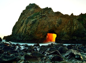
Pfeiffer Beach
4.00.81 mi / 75 ft gainPfeiffer Beach located in Big Sur may truly be one of the most awesome beaches in California...if you can find it. I lived within 40 miles of this beach for over 20 years and just discovered it recently. This beach is located on an unmarked road called Sycamore Canyon Road. On Highway 1, this roa...Read more -
Redwood City, California
Hike the Methuselah and El Corte De Madera Creek Loop
6.2 mi / 1800 ft gainThis loop hike will provide people with the opportunity to experience the tranquility of the lower canyons of the preserve, which tend to be more isolated than the heavier-trafficked trails that are closer to the main highway. Be warned that this hike is fairly strenuous because of the large amou...Read more -
Redwood City, California
Hike the Crystal Springs Trail Loop
5.6 mi / 1300 ft gainThis is a great hike for any season of the year, with rushing streams during the winter, wildflowers in the spring, and cool, shaded canyons during the summer. Starting from near the Zwierlein Picnic area, take the Crystal Springs to the left into the redwood forest. Stay straight at the next tra...Read more -
Redwood City, California
Hike the Pulgas Ridge Open Space Preserve Loop
3.75.5 mi / 1000 ft gainGetting there: exit Highway 280 at Edgewood Road, travel .75 miles east, turn left on Crestview Drive, then immediately left again on Edmonds Road.Once parked, there are several different path options through the park. All of them connect in a large loop, and return to the parking lot. The Cordil...Read more -
Livermore, California
Hike the East Shore Trail Loop
3.7 mi / 1040 ft gainThis hike is best done during the spring, fall, or winter when moderate temperatures make the hike more comfortable. Be warned that this hike has a large elevation change despite being less than 4 miles. Starting at the Arroyo Road Staging Area, take the East Shore Trail east, heading towards a s...Read more -
Redwood City, California
Hike Purisima Creek Redwoods OSP
4.67 miThere are two places to park for this specific loop- the main parking area on Highway 35 (Skyline Boulevard) and a smaller parking lot on the western end of the park. I would recommend parking at whichever is closest. Find directions to both on Openspace.org. From the main parking lot, the trail ...Read more -
Redwood City, California
Hike Whittemore Gulch at Purisima Creek Redwoods OSP
4.09.3 mi / 2109 ft gainThis trail starts out going downhill towards the ocean for the first half, which makes for a tough end to the hike as you trek back up the ridge. However, there are nice ocean and hilltop views that are worth the climb. On this trail, you'll pass 60+ banana slugs if conditions are right. They ar...Read more -
Sunol, California
Hike the Pleasanton Ridge Trail
4.36.4 mi / 1443 ft gainPleasanton Ridge Trail is a 6.4 mile loop. The loop is shared by dog walkers, trail runners, hikers, mountain bikers and horseback riders. From the ridge your viewpoints will include Mount Diablo and the San Francisco Bay. This hike from the Foothills Staging Area is an excellent introduction ...Read more -
Greenfield, California
Adventure at Arroyo Seco
4.6This off-the-beaten-trail adventure has a little bit of everything for everyone, and is as challenging as you make it. Many just make it about a mile down to the river for a leisurely day of relaxing, swimming, sunbathing, and enjoying a few cold beverages. Others embark on a 7+ mile adventure up...Read more -
Half Moon Bay, California
Purisima Creek Trail and Craig Britton Trail Loop
4.06.95 mi / 1411 ft gainThis hike is perfect for any time of year, always staying cool because it is near the coast, and there are multiple creeks that flow year-round. Even on foggy days, the fog condenses on trees to make it seem like it is "raining." Be warned that this hike has a lot of elevation change and is stre...Read more

