Watsonville, California
Looking for the best running in Watsonville? We've got you covered with the top trails, trips, hiking, backpacking, camping and more around Watsonville. The detailed guides, photos, and reviews are all submitted by the Outbound community.
Top Running Spots in and near Watsonville
-
Marina, California
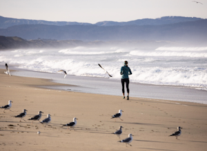
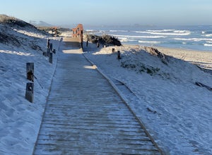
Surf, Run, or Catch a Sunset at Marina State Beach
From the moment you turn into the parking lot, you know Marina State Beach is special. Grab a parking spot in the large lot and then run down the dunes and onto the shoreline! The beach feels spacious on this section of the shore and gives plenty of room to run around or to put down a blanket to ...Read more -
Marina, California
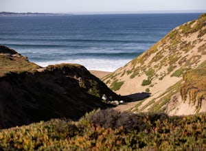
Explore Fort Ord Dunes State Park
5.0One of the best parts of Monterey is the beaches – but their popularity is also their weakness, so if you want seclusion head to the lesser-known Fort Ord Dunes for solitude and beautiful views of Monterey Bay and the Pacific Coast. Historically, this location was chosen as the location for Fort ...Read more -
Santa Cruz, California
Hike the Rincon Fire Trail
5.01 mi / 300 ft gainThe Rincon Fire Trail Starts at a small dirt parking lot next to CA-9 and traverses down the mountain to the San Lorenzo River Connecting with the Pipeline Trail. The trail can be a simple one of a mile out and back or up to 5 miles depending on your preference. The elevation will change by about...Read more -
Felton, California
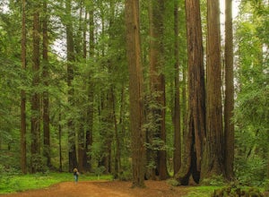
Redwood Grove Loop
4.00.93 mi / 144 ft gainHenry Cowell Redwoods State Park is located just a few miles north of the city of Santa Cruz, along Highway 9. The park is home to an array of hiking and biking trails, but the crown jewel of the park is the Redwood Grove Loop Trail, which is only a 1/4 mile in from the park's entrance. Many peo...Read more -
Salinas, California
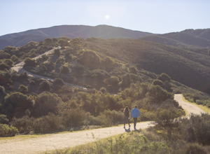
Hike or Trail Run around Toro Park
Just a short drive from downtown Monterey you will find yourself amongst the rugged yet serene hills ofToro Park. For a $2 admission fee you will have access to 20+ miles of trails that climb through canyons and run along ridgelines to peaks with views of the ocean in the distance. While the map ...Read more -
San Jose, California
Explore Santa Teresa County Park
4.58.3 mi / 2053 ft gainThe Santa Teresa County Park loop is perfect for wildlife viewing! Be ready to see deer, coyote, hawks, turkeys, pigs and cows. The trail is rated as moderate - be cautious with mud if you are visiting the park after a rain shower. Dogs are allowed in the park, but must be kept on leash. There i...Read more -
San Jose, California
Hike the Quicksilver Trail
4.35.1 mi / 915 ft gainThe trails are well maintained and offer good visibility. The trail can be muddy after it rains, and does not have much shade (so bring extra water in the summer). Dogs are allowed on this trail but must be kept on leash. Keep your eyes peeled for wildlife - this trail is frequently used for bir...Read more -
Pacific Grove, California
Spanish Bay Trail
5.02.8 mi / 78 ft gainSpanish Bay Trail is an out and back trail that takes you past scenic views located near Monterey, California.Read more -
Carmel-by-the-Sea, California
Hike along the Carmel River Beach Trail
1 mi / 100 ft gainKnown as "Ribera Beach" by locals, this stretch of land nestled between Carmel River State Beach and Monastery Beach is not to be missed! The trails are easy to get to and can be accessed by 4 locations. The first entrance is on Highway 1 at the Bay School (between Ribera Road and Monastery Beach...Read more -
Carmel-by-the-Sea, California
Hike to the Top of Inspiration Point
5.01.3 mi / 850 ft gainThis magnificent trail was recently converted into part of the Monterey Regional Parks System. Walk through pastures of cows, through coast oaks, up a steep incline with vast views of Carmel Valley, Carmel and the Pacific Ocean up to the top where a picnic table awaits you at Inspiration Point. T...Read more -
Carmel-by-the-Sea, California
Cypress Grove Trail via South Shore Trail
5.01.72 mi / 121 ft gainCypress Grove Trail via South Shore Trail is a family-friendly loop hiking trail located near Carmel-by-the-Sea, California. Along this hike in Point Lobos State Natural Reserve, you'll get a chance to see beautiful coastal views with rugged cliffs, views across Monterey Bay, and Cypress trees as...Read more -
Boulder Creek, California
Hike to Sempervirens Falls
4.02.1 mi / 100 ft gainThe hike to Sempervirens Falls is an easy 2.1 mile out-and-back hike on the Sequoia Trail. You'll travel through the redwood forest and some of the campgrounds located in Big Basin State Park. The hike is pleasant but on occasion, you'll be too close to the road to feel like you're deep in the wi...Read more -
Los Gatos, California
Lost Mine Trail Run
Communes, dairy, and gold. These words are not often associated with trail running, but out on Monte Bello Ridge and Black Mountain which rise high above Silicon Valley, you might just hear them uttered.From the parking area in Skyline Open Space we start our run by crossing Skyline Boulevard and...Read more -
San Jose, California
North Rim Trail to Eagle Rock
5.01.94 mi / 240 ft gainNorth Rim Trail to Eagle Rock is an out-and-back trail that takes you past scenic surroundings located near San Jose, California.Read more -
Redwood City, California
Hike Russian Ridge
4.54 miRussian Ridge offers a great place to jump on the trail and in the right season, see some of the best wildflowers blooming. On top of that, you get access to amazing views from the ridge. Once you hit your parking space, add a little extra warm up before jumping on the trail to make this 3.7-mil...Read more -
Los Altos, California
Hike the Monte Bello Open Space Preserve Loop
4.52.9 mi / 600 ft gainThis hike is best done in the late fall, winter, and spring so that the creek is running and the hills are green. Starting at the preserve parking lot, the first half of the hike is predominantly downhill. At the main trailhead, start in the direction of the Stevens Creek Nature Trail, as told by...Read more

