Vista, California
Looking for the best hiking in Vista? We've got you covered with the top trails, trips, hiking, backpacking, camping and more around Vista. The detailed guides, photos, and reviews are all submitted by the Outbound community.
Top Hiking Spots in and near Vista
-
Santee, California
Crystal Cave
4.00.46 mi / 59 ft gainStarting at 8100 Mesa road, you will see parking along the side of the road in a few places, take advantage where you find it. Pass over the trail gate that marks the start of the journey. This will be a quick trip, as the total distance is less than a mile out and back. Head a quarter mile or ...Read more -
San Diego, California
Hike to the Rope Swing in Tecolote Canyon
4.04.4 miTecolote Canyon offers a great opportunity to explore nature right in the heart of San Diego, whether it is a hike, run, or bike ride on the trails. But the best kept secret is perhaps a rope swing over the creek! The main trail starts off at Tecolote Canyon Natural Park & Nature Center, wh...Read more -
San Diego, California
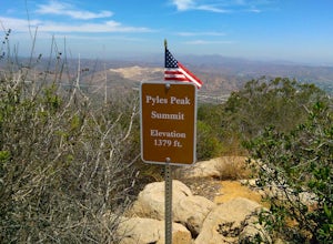
Pyles Peak
5.06.03 mi / 1706 ft gainMost people who live in San Diego have heard of, if not hiked, Cowles Mountain. At 1591 ft., Cowles is the highest peak in the city of San Diego. It's a hugely popular destination for day hikers and trail runners looking to get in a little trail time and take in the 360 degree views the summit h...Read more -
San Juan Capistrano, California
Hike the Pinhead Peak Trail at Ronald W. Caspers Wilderness Park
4.02 mi / 220 ft gainRonald W. Caspers Wilderness Park is the perfect place to getaway from the hubbub of LA. Enjoy the scenic drive north on Ortega Highway before reaching the entrance gate to the park. Parking Fees are currently $3 on Weekdays and $5 on Weekends. Camping Fees vary depending on your group size. The...Read more -
Lake Elsinore, California
Hike Bear Canyon Trail to Sitton Peak
6.4 mi / 2200 ft gainA MUST hike for any orange country resident! The hike starts of off Ortega HWY 74 at the Bear Canyon Trail head on the same side of the road as the Ortega oaks candy store. Its recommended you park in the lot across the street from the trail head (tip:there is a working water spicket in the parki...Read more -
Lake Elsinore, California
Sitton Peak
9.36 mi / 2011 ft gainIt's amazing what you can find in your own backyard if you really do you research. In Orange County there are so many awesome hiking options that are often overlooked. The Bear Canyon to Sitton Peak Trail in the San Mateo Wilderness is one of those. Sitton tops out at 3,273 feet and it's a 5 mil...Read more -
Trabuco Canyon, California
Bell Canyon Trail
3.86 mi / 102 ft gainBell Canyon Trail is an out-and-back trail where you may see wildflowers located near San Juan Capistrano, California.Read more -
San Diego, California
Old Town San Diego State Historical Park
4.51 miFrom where Father Junipero Serra established the first of 21 California Missions in 1769, this area was the first permanent European settlement in the San Diego region. Today, past and present meet in a preserved historical park located near Downtown San Diego. You can explore life as it was in ...Read more -
Ramona, California
Cedar Creek Falls
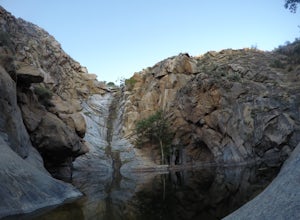
4.85.52 mi / 1024 ft gainThe trail to Cedar Falls starts out at a hill in a residential area and ends in an unexpected spot where there is a beautiful waterfall complete with a swimming hole. Surrounded by 75-foot-high cliffs, a magnificent waterfall splashes into a pool known as the Devil’s Punch Bowl. Hikers have been ...Read more -
San Diego, California
Balboa Park Loop
4.64.34 mi / 226 ft gainThe Balboa Park Trail offers the chance to see wildlife and is open year-round. The trail is shared by runners, families, hikers, and bikers. Dogs are able to use the trail but must be kept on leash. There is a dog park you will pass by.Read more -
Dana Point, California
Walk the Dana Point Preserve Trail
5.00.5 miOcean views the whole time, plenty of wildlife and different species of native plants make this short hike beautiful. With the hike being short enough to complete in the afternoon after a day at the beach you can see a beautiful view of the coastline north and south. There is plenty of parking in...Read more -
San Diego, California
Seven Bridge Walk Loop
5.05.75 mi / 217 ft gainThe Seven Bridge Walk is a 5.2 mile loop through urban San Diego with scenic views, neat bridges, and gorgeous palm trees. Dogs are allowed on the trail, and the loop is perfect for families and all skill levels. On a Sunday, you will go through the Hillcrest farmers market - a great spot for cof...Read more -
Santa Ysabel, California
Hiking in Santa Ysabel
3.0Starting at the trailhead on Hwy 79, enter through the gate and make sure to close it behind you - the preserve is open range area for herds of cows, make sure not to disturb them when hiking. From the gate you'll see the sign with a detailed map of trails that are available for hiking. The trail...Read more -
Laguna Niguel, California
Colinas Ridge Trail
2.01 mi / 131 ft gainFirst, you'll be parking in the parking lot for the dog park. It's free parking and there are roughly 40 spaces, so there is plenty of parking. I've never seen more than 20 cars here at any one time. Once parked you'll find the trail head/ start on the northwest side of the lot (opposite the dog ...Read more -
Dana Point, California
Hike the Salt Creek Trail
5.03 mi / 20 ft gainStarting from the Salt Creek Beach parking lot (a paid lot that takes cash, debit, and credit cards and charges by the hour. There are pay stations at a few points in the parking lots), you head west towards the ocean...through a tunnel and down the hill towards the beach. Once you get to the bas...Read more -
Warner Springs, California
Eagle Rock via the Pacific Crest Trail
5.06.2 mi / 807 ft gainWith doing more hikes in the SoCal area, I've realized half the battle is just trying to find the damn trailhead.Technically you have 2 ways to enter this trail ... Start from 79 and add a very enjoyable extra 3ish miles, or start from the Warner Springs Fire Station, for a total 7 mile hike.We c...Read more

