Ventura County, California
Looking for the best photography in Ventura County? We've got you covered with the top trails, trips, hiking, backpacking, camping and more around Ventura County. The detailed guides, photos, and reviews are all submitted by the Outbound community.
Top Photography Spots in and near Ventura County
-
Los Angeles, California
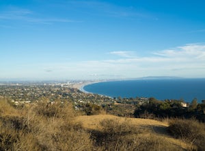
Parker Mesa Overlook via Paseo Miramar
4.25.32 mi / 1099 ft gainThis 5.4-mile out-and back trail takes off from the end of the residential area of Paseo Miramar. Once you hike a little less than a quarter mile in, you'll connect with Los Liones Canyon Trail. Continue on Paseo Miramar Trail, which in another 2.5 miles, will connect you with the Parker Mesa Ove...Read more -
Los Angeles, California
Temescal Canyon Loop
3.93.76 mi / 810 ft gainThere are a couple of different ways that you can hike in Temescal Canyon. For this one, the loop begins from Temescal Canyon Trail at Sunset Boulevard and is approximately 3.76 miles. This loop is not dog friendly. Additional Options for Hiking Temescal Canyon: The basic loop – 2.6 milesTh...Read more -
Los Angeles, California
Inspiration Point Loop Trail
2.36 mi / 486 ft gainThe Inspiration Point 2.3 mile loop hike in Will Rogers State Park is a family-friendly hike or after-work run near Los Angeles, California. It’s a great dirt trail for all skill levels and features scenic views and beautifully budding wildflowers. You’ll get to escape the city and take in the br...Read more -
1501 Will Rogers State Park Road, California
Backbone Trail via Will Rogers State Park
5.03.02 mi / 656 ft gainYou'll make your way up Will Rogers State Park Road, located just minutes from Santa Monica, Brentwood, Westwood, Malibu, Palisades, and much of west Los Angeles. Once on the road, head all the way to the top and you'll dead end into the parking lot. Always worth supporting State Parks with the p...Read more -
Ventura, California
East Anacapa Island Loop
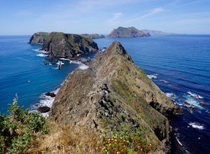
2.31 mi / 269 ft gainLeaving from either Ventura or Oxnard via Island Packers, this full-day hike is in the middle of the Santa Barbara Channel on a small island, about one hour from Los Angeles by car and one additional hour by boat. Without a beach on which to anchor, your boat will pull into Landing Cove and idle ...Read more -
Agua Dulce, California
Vasquez Rocks
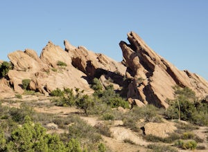
5.02.42 mi / 367 ft gainThis is a Natural Park Area located in Santa Clarita, within the Sierra Pelona Mountains. It features amazing diagonal rock formations, created because of the force between two tectonic plates pushing against each other. This place is a photographer's paradise, and every spot in this 900+ acre l...Read more -
Los Angeles, California
Verdugo Mountain Traverse
5.012.13 mi / 0 ft gainThe Verdugo Mountain Range is a small, rugged range spanning across the northeast end of the San Fernando Valley from Sun Valley to Glendale. With close to 50 miles of graded and well-maintained trails, the Verdugos are surprisingly underutilized and make a great place for someone looking to esca...Read more -
Los Angeles, California
Verdugo's North Ridge Trail
12.7 mi / 2684 ft gainThe Verdugo Mountain Range is a small, rugged range spanning across the northeast end of the San Fernando Valley from Sun Valley to Glendale. With close to 50 miles of graded and well-maintained trails, the Verdugos are surprisingly underutilized and make a great place for someone looking to esca...Read more -
Santa Monica, California
Spend a Day at the Santa Monica Pier
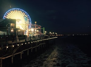
4.2*Unlimited photography options with the ferris wheel, beach, ocean, and sunsets *Abundant people watching opportunities *Plenty of ways to get a workout in including swimming, volleyball courts, running, or riding a bike There is a bike and walking path that runs along the coast. One of my favo...Read more -
Burbank, California
Old Youth Camp Loop
2.59 mi / 732 ft gainThe Old Youth Camp Loop is a 2.6-mile loop with over 700 feet of elevation gain that can be ran, hiked, or even mountain biked if you prefer. While not completely empty the area receives very little visitors and is a great place to enjoy a little more solitude than near by hiking locations. The l...Read more -
Lancaster, California
Antelope Valley Poppy Reserve
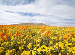
5.02 mi / 900 ft gainIf you're going during wildflower season, start your adventure at the visitors center at the end of 150th St. W. Parking in the lot outside the visitors center is $10, but there is ample street parking that is free. In the visitors center you can read more about the reserve, plan your hike, and s...Read more -
Los Angeles, California
Verdugo Peak via Hostetter Fire Road
5.07.39 mi / 1627 ft gainVerdugo Peak, at 3000 feet, is accessible from multiple directions and trails along the Verdugo Range. The most direct route to the top is Hostetter Fire Road, a 3.6-mile hard-packed dirt trail that climbs 1600 feet to the 3,126-foot summit. The hike begins at the dirt parking lot off of La Tuna ...Read more -
Los Angeles, California
Cahuenga Peak Loop Trail
3.88 mi / 1237 ft gainThe Cahuenga Peak Loop is perfect for trail runners and hikers. The trailhead is in Hollywood Hills - park off to the side on a street. This trail features beautiful wildflowers in the spring. Dogs are allowed on the trail if kept on leash. The trail can be dusty and dirty, so watch your step. Ke...Read more -
Burbank, California
Wildwood Canyon Loop
3.98 mi / 1680 ft gainThe Vital Link Trail is a steep and narrow out-and-back trail accessed though the Wildwood Canyon Park located in Burbank, CA. Parking at Wildwood Canyon is free and easy, and will be determined by which of the four trailheads you choose to start from. For the shortest and most direct route you...Read more -
Los Angeles, California
Wisdom Tree
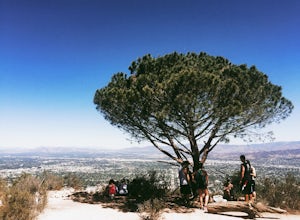
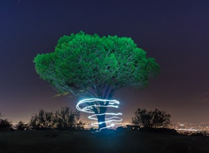
4.80.95 mi / 528 ft gainIn Griffith Park, park along Lake Hollywood Drive and walk the paved quarter mile up Wonder View Drive to the start of Wonder View Trail. Here, walk through the yellow gate and make the first right after the road turns to dirt. Head up this unmarked single track path heading east up the mountain....Read more -
Los Angeles, California
Aileen Getty Ridge Trail
5.03.55 mi / 1194 ft gainThe Aileen Getty Ridge Trail is a singletrack trail that runs between Mt. Lee and Burbank Peak (the location of the Wisdom Tree). Though there are many options to access this trail, the most direct route is from the west via the Wonder View Trailhead. Start by parking on Lake Hollywood Drive near...Read more

