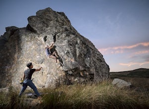
Tomales, California
Looking for the best hiking in Tomales? We've got you covered with the top trails, trips, hiking, backpacking, camping and more around Tomales. The detailed guides, photos, and reviews are all submitted by the Outbound community.
Top Hiking Spots in and near Tomales
-
Point Reyes Station, California
Sky Trail Loop
5.09.55 mi / 1818 ft gainSky Trail in Point Reyes National Seashore is a dramatic, mostly single-track trail that runs along the main spine of the Inverness Ridge and across highest mountains in Point Reyes, looming above the Olema Valley and Highway 1 which mark the San Andreas Fault rift zone and the dividing line betw...Read more -
Point Reyes Station, California
Sky Campground via Sky Trail
2.66 mi / 495 ft gainEntering Point Reyes National Seashore from Bear Valley Road the Sky Trailhead is a 4.9 mile drive. Camping in Sky Camp requires a Camping Permit. Once at the Sky Trailhead parking lot. The Sky Trailhead will be on the left side pulling in. The hike is not very strenuous and not all that lo...Read more -
Point Reyes Station, California
Hike the Laguna Trail & Coast Trail Loop
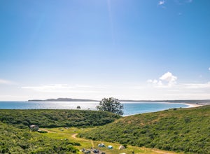
5.05.2 mi / 300 ft gainLeave your car on a side of the road. When navigating there, put "HI Hostel Point Reyes" in your navigation - you park literally on the other side of the road, opposite to the hostel. Go to the west and soon you'll find the start of Coast Trail with a tsunami warning sign. During first 1.8 mile y...Read more -
Point Reyes Station, California
Coast Campground via Laguna Trailhead
4.34.02 mi / 633 ft gainThis campground is the closest you can get to staying overnight on Pt. Reyes coastline if you're backpacking in. Once you get there, enjoy the view! The easiest way to get to the camp is from the slightly uphill hike along the Laguna Trail and the Firelane Trail. The trailhead for the Laguna Tra...Read more -
Nicasio, California
Hike and Fish at Nicasio Reservoir
5.03 mi / 300 ft gainNicasio is a quaint town just inland of the more popular coastal town of Point Reyes. It's most known for it's wine country, rolling hills, and the home of Skywalker Ranch, George Lucas's getaway home. Most visitors of this area either pass right on through for Point Reyes or use it's scenic road...Read more -
Santa Rosa, California
Joe Rodota Trail
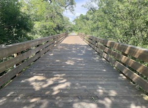
4.012.67 mi / 174 ft gainJoe Rodota Trail is an out-and-back trail where you may see wildflowers located near Sebastopol, California.Read more -
Santa Rosa, California
Santa Rosa Creek Trail: Willowside Road to Fulton Road
4.2 mi / 46 ft gainSanta Rosa Creek Trail: Willowside Road to Fulton Road is an out-and-back trail that takes you by a river located near Sebastopol, California.Read more -
Bodega Bay, California
Camp at Wright's Beach Campground
/ 32 ft gainThis campground is defined by the scenery: rugged headlands, craggy coastlines, natural arches, and quiet coves.Wright's Beach Campground features primitive camping - basic tent sites with picnic tables, fire rings, and amazing ocean views. This is a great location for Bay Area campers who want t...Read more -
Sonoma County, California
Kortum Trail
9.27 mi / 968 ft gainThe Kortum Trail in the Sonoma Coast State Park connects Goat Rock with Wrights Beach, winding along the top of the sea cliffs and affording incredible views of the California Coast and its numerous sea rocks and arches. To get there take the Pacific Coast Highway / Highway 1 to either Wright's...Read more -
Inverness, California
Limantour Beach
4.85.33 mi / 66 ft gainThe entire drive to Pt. Reyes is picturesque, but once you make it to Limantour, you and your dog can both get out and enjoy it! This area, between Drake's Bay and an estuary, allows you to spend time relaxing or head out for a run (keep the dog on leash). If you're lucky you might either get a c...Read more -
Point Reyes Station, California
Bear Valley to Coast Camp Loop
5.016.18 mi / 2818 ft gainPermit and Trail Camp Info To stay overnight in Point Reyes, you must stay at one of the Trail Camps. Camping anywhere else in the park is not allowed. Permits for the Trail Camps can be booked up to 6 months in advance. If you are looking to go on a weekend, then you'll want to start loo...Read more -
Santa Rosa, California
Hike Crane Creek Regional Park
4.03.5 miWith multiple loops of varying length, this park is great for anyone looking for a casual hike around a beautiful area in the foothills of Rohnert Park. Crane Creek has nice secluded picnic areas next to the creek in the cover of willow, alder, buckeye and bay trees. There's also an 18-hole disc ...Read more -
Sonoma County, California
Red Hill and Pomo Canyon Loop
4.84.73 mi / 981 ft gainPark in the Shell Beach parking lot, north of Bodega Bay proper but just south of Goat Rock State Beach on Highway 1. Cross the road to pick up the Dr. David C. Joseph Memorial Trail heading up away from the ocean. Follow the trail, staying right toward Red Hill. (The trail forks off down Pomo Ca...Read more -
Monte Rio, California
Islands in the Sky Vista Loop
4.03.83 mi / 883 ft gainThe Islands in the Sky Vista Loop in Monte Rio, California, is a moderately challenging hiking trail. Spanning approximately 3.83 miles, the loop offers a variety of terrain, including forested areas, open meadows, and rocky outcrops. The trail is well-marked and maintained, making it suitable fo...Read more -
Santa Rosa, California
Taylor Mountain Loop
4.24.89 mi / 1096 ft gainFrom the northern entrance to the park, you can access an 18-hole disc golf course as well as a number of trails. The Eastern Trail takes you up a steep 1,000 feet to the top of Taylor Mountain, where you can see most of Sonoma County laid out before you. Mt. St. Helena is visible in the distance...Read more -
Jenner, California
Bouldering at Sunset Boulders
5.00.6 miYou can see the boulders off the left side of the road. Couple of different pullouts you can park at to start your approach. It’s about half a mile from the road all downhill. It’s easy going when you’re on your way, but kind of a pain after you’re whooped from climbing. Bouldering, high balls, ...Read more


