Sonoma, California
Looking for the best hiking in Sonoma? We've got you covered with the top trails, trips, hiking, backpacking, camping and more around Sonoma. The detailed guides, photos, and reviews are all submitted by the Outbound community.
Top Hiking Spots in and near Sonoma
-
Stinson Beach, California
Cataract Trail Loop
4.58.7 mi / 1670 ft gainDuration: 3.5-4 hour hike at a moderate to quick pace with a short break for lunch. Starting at an elevation of 1989ft and maxing at 2001ft, you achieve 1428 of elevation gain through a beautiful peak and valley hike. From the free Rock Springs Parking Area, the basic trailheads to follow along...Read more -
Point Reyes Station, California
Coast Campground via Laguna Trailhead
4.34.02 mi / 633 ft gainThis campground is the closest you can get to staying overnight on Pt. Reyes coastline if you're backpacking in. Once you get there, enjoy the view! The easiest way to get to the camp is from the slightly uphill hike along the Laguna Trail and the Firelane Trail. The trailhead for the Laguna Tra...Read more -
Inverness, California
Tomales Point Trail
4.79.47 mi / 1165 ft gainThis hike will take you through the Tule Elk Preserve in Point Reyes Nation Seashore, and offers fantastic views of Bodega and Tomales Bay, as well as the Pacific Ocean. Start at the Tomales Point Trailhead near the Historic Pierce Point Ranch. Follow the trail for roughly three miles. This trai...Read more -
Point Reyes Station, California
Hike the Laguna Trail & Coast Trail Loop
5.05.2 mi / 300 ft gainLeave your car on a side of the road. When navigating there, put "HI Hostel Point Reyes" in your navigation - you park literally on the other side of the road, opposite to the hostel. Go to the west and soon you'll find the start of Coast Trail with a tsunami warning sign. During first 1.8 mile y...Read more -
Marin County, California
Dipsea Trail - Steep Ravine Loop
5.03.97 mi / 1204 ft gainThis is definitely a worthwhile short hike, with views of the Bay Area, Marin Headlands, Golden Gate, and the San Mateo coastline. It's a 3.8 mile loop which takes you through forests of Redwoods and out to the coastline, even above the clouds on a lucky day. The trailhead begins at the Pantoll ...Read more -
Mill Valley, California
Camp at Mt. Tam's Pantoll Campground
5.0Need an escape from SF, but can't seem to find an available campground, then head to Pantoll Campground in Mount Tamalpais State Park. If you get there early on friday (or even better Thursday afternoon), you should be able to lock down one of these first-come, first-serve campgrounds. Each of th...Read more -
Mill Valley, California
Steep Ravine Trail via Pantoll Station
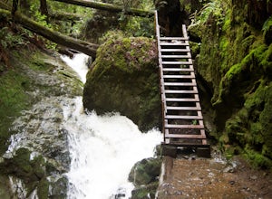
5.03.96 mi / 1079 ft gainThe trailhead Pantoll Station is easy to find on GPS and there are friendly rangers there as well to answer questions.Maps: Paper map are available at the trailhead Pantoll Station in Marin, CA. For a moderate hike, I suggest going the one and a half miles down the trail to the ladder and retu...Read more -
Mill Valley, California
Trojan Point
4.50.25 mi / 75 ft gainThe endlessly scenic Trojan Point can be reached by taking the Panoramic Highway to Pantoll road from Stinson Beach to the west, or Mill Valley / Highway 1 to the east. It can also be reached by taking West Ridgecrest Boulevard from the north from the Fairfax-Bolinas road. Park at the large par...Read more -
Inverness, California
McClures Beach
1.44 mi / 243 ft gainThis beach is really easy to get to. Just follow Pierce Point Road until you see the sign to the beach. It's an easy hike down from the parking lot. There is very little shade, so make sure to bring some sunscreen. Be extremely cautious with getting into the water. There is likely underwater cu...Read more -
Mill Valley, California
Canopy, Panoramic, Redwood Trail, Sun, Dipsea Trail Loop
4.74.31 mi / 1145 ft gainWhile there are other, less crowded redwood groves in the Bay Area, Muir Woods National Monument is easily one of the best. It is a beautifully maintained site, with wooden footpaths meandering between towering redwoods that are between 600 – 800 years old. It’s home to some true giants, with its...Read more -
Inverness, California
Abbotts Lagoon Trail
4.63.43 mi / 102 ft gainIf you like beaches, headlands, scenic landscapes, wildflowers, and tons of wildlife viewing, you should give this hike a try. Although it only takes about an hour to complete the out-and-back, the vibe surrounding this area is just begging you to slow down and enjoy your natural surroundings. T...Read more -
Kensington, California
Tilden Little Farm
4.0First make sure to stop at the store and stock up on fresh lettuce and celery for the animals. Your kids (or just the kid in you) will love to feed them! Note that they're only allowed to eat lettuce and celery, so don't try to feed them your own snacks or get creative. ;) If you want to make it...Read more -
Inverness, California
Hike the Estero Trail
5.08 mi / 200 ft gainJune sunshine blazes on your shoulders during this scenic stroll through the Point Reyes Seashore. The trail is alive and awash with colorful wildflowers around every corner.Beginning at the trailhead, just off Home Ranch Road, with a convenient parking lot and bathroom, you'll wade through a hal...Read more -
Stinson Beach, California
Matt Davis-Steep Ravine Loop
4.76.62 mi / 1726 ft gainThis loop is made up of three of the most popular Marin trails and for good reason. These trails offer not only expansive ocean views, but a variety of topography and environments. This 6+ mile loop offers up waterfalls, dense forests, redwoods, and open grasslands overlooking the pacific. Starti...Read more -
Stinson Beach, California
Matt Davis-Coastal Trail Loop
4.76 mi / 2231 ft gainThis hike is an alternative to the famous Matt Davis to Steep Ravine Loop. The hike starts at Stinson Beach, just behind the fire Station. I recommend parking at the Beach parking lot. The Matt Davis trail is one of the best constructed trails I have ever seen. After 2.2 miles, turn left on the ...Read more -
Stinson Beach, California
Dipsea Trail to Steep Ravine Trail Loop from Stinson
5.05.99 mi / 1568 ft gainDipsea Trail to Steep Ravine Trail Loop from Stinson is a loop trail that takes you by a waterfall located near Stinson Beach, California.Read more

