
Steep Ravine Trail via Pantoll Station
Mill Valley, California
Details
Distance
3.96 miles
Elevation Gain
1079 ft
Route Type
Out-and-Back
Description
Added by Karen Nierlich
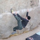
For science fiction fans this trail will remind you of Middle Earth from the Lord of the Rings. I dub this trail the rock star of mossy Bay Area places for its abundance of mossy trees, lichens and ferns. Also, there is a cool ladder to climb down in the middle.
The trailhead Pantoll Station is easy to find on GPS and there are friendly rangers there as well to answer questions.
Maps: Paper map are available at the trailhead Pantoll Station in Marin, CA.
For a moderate hike, I suggest going the one and a half miles down the trail to the ladder and return. There will be downhill switchbacks getting there and uphill on the way back. It's three miles roundtrip or you can head down the trail until it meets Shoreline HWY (~4 miles). There are logs along the trail if you are looking for rest spots. The trail follows a beautiful creek with mossy trees and ferns the whole way.
For a more challenging hike here are some options:
1) Down Steep Ravine Trail from Pantoll Station to where the trail meets the Dipsea Trail, and return back up Steep Ravine. (Approximately five miles and 50% uphill.)
2) Down Steep Ravine Trail and follow the Dipsea Trail to Stinson Beach. At Stinson Beach, locate the Matt Davis Trail behind the fire station at the end of the short block. Follow Matt Davis back uphill to Pantoll Station. Matt Davis will take you back to where you started. (Approximately seven-eight miles and uphill). Check out the Matt Davis - Steep Ravine Loop for more details on this hike (Note: this write-up has you starting at the Matt Davis Trailhead near the Stinson Beach fire station).
Dogs: Not allowed on this trail.
Weekend Crowds and Parking: Summer Weekends are crazy busy. Arrive before 9am if you can. Parking can be hard to find after 11 am. There is parking along the side of the roads, which is okay if you don’t mind walking along the road with cars passing by.
Download Outbound mobile app
Find adventures and camping on the go, share photos, use GPX tracks, and download maps for offline use.
Get the appFeatures
Steep Ravine Trail via Pantoll Station Reviews
This is a great hike on Mount Tam. I really like the wood ladder bridge on this trail. Something different. Pantoll station can be very busy on weekends but there are bathrooms there. Lots of good vista points with trees and waterfalls (if it’s rainy season) along the way.
5.0

This was an excellent hike! I would recommend taking the Steep Ravine Trail to Dipsea trail so that you're adventure ends at Stinson Beach! This trail was "easy" going out, relatively speaking since it was all downhill, but the way back was a challenge for sure! Just the right amount though. The ravine runs almost the entire way down the trail, so it's a constant beautiful view and the redwoods around there are of course lovely too. One suggestion, maybe bring a wallet/cash with you so that you can grab a snack or ice cream at the little cafe by the beach before turning around to finish the second half of the hike.
5.0
Leave No Trace
Always practice Leave No Trace ethics on your adventures and follow local regulations. Please explore responsibly!
Nearby

Camp at Mt. Tam's Pantoll Campground

Dipsea Trail - Steep Ravine Loop

Camp at Bootjack Campground in Mount Tamalpais State Park

Steep Ravine and Bootjack Trails Loop

Bootjack Campground to Muir Woods

Trojan Point
Discover
Community
Mobile Apps

© 2026 The Outbound Collective - Terms of Use - Privacy Policy