Signal Hill, California
Looking for the best photography in Signal Hill? We've got you covered with the top trails, trips, hiking, backpacking, camping and more around Signal Hill. The detailed guides, photos, and reviews are all submitted by the Outbound community.
Top Photography Spots in and near Signal Hill
-
Laguna Beach, California
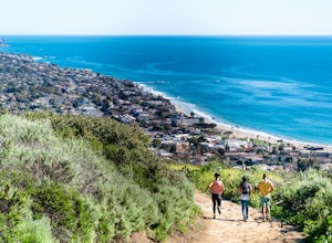
Trail Run the Boat Road and Laguna Ridge
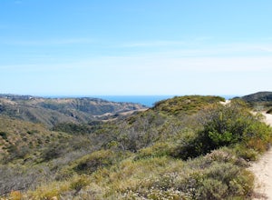
4.34 mi / 600 ft gainThere a numerous trails in the Laguna Coast Wilderness that proceed up and along the ridges and down into the canyons (or the reverse), and most are excellent for trail running, hiking, and mountain biking. A classic out-and-back (with many options for loops) begins at the end of Dartmoor Street ...Read more -
Altadena, California
Thalehaha Falls
1.71 mi / 679 ft gainThe trails starts in a foothill neighborhood of Altadena CA at the corner of Pleasantridge Dr. and Rubio Vista Rd. This is one of the better entries into the Angeles National Forest because it is one of the lesser known. Find a place to park on the street and head out on the trail into Rubio Cany...Read more -
Monrovia, California
Monrovia Falls
3.71.46 mi / 459 ft gainMonrovia Falls is closed indefinitely due to the Bobcat Fire and mudslides. Read more on the CityofMonrovia.org website. The Monrovia Falls are at the end of the main trail located in Monrovia Canyon Park. The park is easy to locate and has ample parking. Keep in mind you do have to pay a fee of...Read more -
Altadena, California
Echo Mountain and Inspiration Point Loop
4.110.16 mi / 3369 ft gainThe trail switchbacks up the mountain before reaching the first historic marker, in 3 miles. These are the remains of the Mount Lowe Railroad, which brought customers to Echo Mountain Resort, also in ruins, nearby. Explore the historic sites, then head up Castle Canyon Trail. A steep climb will ...Read more -
Laguna Beach, California
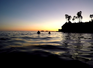
Scuba Dive Shaw’s Cove, Laguna Beach
Shaw’s Cove is located just 3 minutes North of Laguna Beach’s Main Beach Park and one beach south of Crescent Bay. There’s a dive shop placed conveniently above the cove so if you need to rent equipment, it’s right there. The shop is close enough to walk to the cove, but with 60 pounds of gear, t...Read more -
Laguna Beach, California
Kayak the Laguna Beach State Marine Preserve
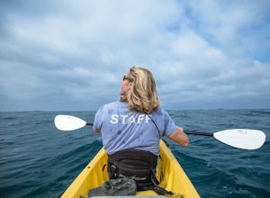
5.0Whether you're a beginning, intermediate, or advanced paddler, there are numerous ways to explore via sea kayak the protected waters off the coast of Laguna Beach. You can bring your own or rent and book a tour from several shops in town. An excellent starting point is at Fisherman's Cove just of...Read more -
Laguna Beach, California
Stand Up Paddleboard Fisherman's Cove
Fisherman's Cove is a protected beach and cove in Laguna Beach at the bottom of Boat Canyon that is tucked away from the hustle, bustle, and crowds that are often found at other nearby beaches. Further, parking is easily (relatively speaking) found along Cliff Drive. The beach itself, especially ...Read more -
Laguna Beach, California
Hike Willow Canyon, Laguna Coast Wilderness Park
5.06.7 mi / 1208 ft gainThis hike has been a must do since I was young. Do you love scenic views of the ocean and wildlife? You'll see plenty of both, from hawks searching for food to squirrels and deer running through the brush. This is my favorite route in this area but there are plenty of other trails to shorten or a...Read more -
Los Angeles, California
Parker Mesa Overlook via Paseo Miramar
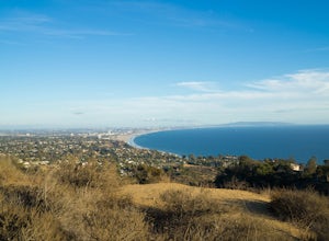
4.25.32 mi / 1099 ft gainThis 5.4-mile out-and back trail takes off from the end of the residential area of Paseo Miramar. Once you hike a little less than a quarter mile in, you'll connect with Los Liones Canyon Trail. Continue on Paseo Miramar Trail, which in another 2.5 miles, will connect you with the Parker Mesa Ove...Read more -
Laguna Beach, California
Water Tank Trail
4.33.05 mi / 502 ft gainThere a numerous trails in the Laguna Coast Wilderness that proceed up and along the ridges and down into the canyons (or the reverse), and most are excellent for hiking, trail running, and mountain biking. A classic out-and-back (with many options for loops) begins in Irvine Bowl Park at the en...Read more -
Heisler Park, California
Relax at Heisler Park
5.0Located in Laguna Beach, California, Heisler Park is just past Main Beach, so it's the perfect place to avoid the typical tourist crowds. There's plenty of parking at Heisler Park, however you will have to pay, so come with a friend to split the cost! Luckily, if you plan on going to catch the su...Read more -
Silverado, California
Hike to Black Star Canyon Falls
4.87.5 mi / 913 ft gainWaterfalls in Orange County are far and few between, with the best lying near and inside the Cleveland National Forest. Black Star Canyon Falls are some of the best just after a rain if you are heading out during a dry time of the season you should still expect to see some water. Free parking, ea...Read more -
Arcadia, California
Hermit Falls Trail
4.82.49 mi / 1014 ft gainNote: Hermit Falls is Temporarily Closed From Roberts Camp, many hikers will head to Sturtevant Falls, which is an amazing 60-foot waterfall. But, if you choose to head in the opposite direction on First Water Trail, you’ll be rewarded with a fresh water swimming hole at this 35-foot tumbling wa...Read more -
Malibu, California
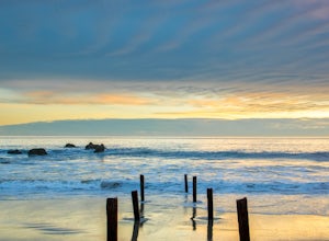
Ratner Beach
4.5Unlike most beaches in Los Angeles, this tiny little stretch of beach is usually empty, and is a little gem! It is the perfect place to get an unobstructed view of the sunset, and the sticks in the ground make for a picturesque sunset picture! Just be warned, this beach is right on PCH, so expect...Read more -
Arcadia, California
Mt. Wilson Loop from Chantry Flat
5.012.74 mi / 4852 ft gainMt. Wilson is one of the more difficult mountains in the San Gabriel to hike, making this adventure Intermediate. While 5,700 feet doesn't seem that tall, the mountain has a prominence of almost 5,300 feet, meaning that hike is steeper and longer than some of the other popular mountains that star...Read more -
Aliso Viejo, California
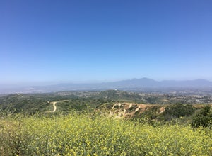
Top of the World via West Ridge Trail
5.04.76 mi / 443 ft gainDirections to get here are pretty straight forward via the map. You park your car in a residential neighborhood along the street, and from there, you can't miss the entrance. The trail is paved for the first 100yds or so and after you make a right turn at the top, you'll be on dirt and sand the r...Read more

