San Juan Capistrano, California
Looking for the best chillin in San Juan Capistrano? We've got you covered with the top trails, trips, hiking, backpacking, camping and more around San Juan Capistrano. The detailed guides, photos, and reviews are all submitted by the Outbound community.
Top Chillin Spots in and near San Juan Capistrano
-
Los Angeles, California
Watts Towers
3.0Watts Towers are a quick 15-20 minute ride from Downtown Los Angeles on the Metro. Since I love weird, interesting things, plus the towers are in my backyard, I had to take a trip to check them out! When getting off the train, I half expected to see the towers spiraling off in the distance. After...Read more -
Redlands, California
Run the Carriage Trail
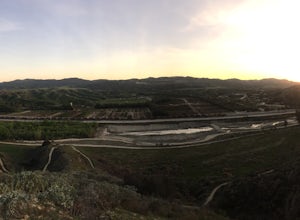
3.52.5 mi / 300 ft gainThere is room to park just off San Timoteo Road. On the other side of the trail is more parking off Alessandro. You can park your car on either side and start your run/walk/bike ride. This is a nice little "get away" trail to take a break from suburbia.Read more -
Del Mar, California
Sunset Seat in Del Mar
3.8In a place in our country where you can take an epic sunset picture nearly everyday, its hard say there is one location tin San Diego that is better than another. I'll let you in my new favorite secret spot to take amazing sunset pictures with a cool piece of art work at the location. Visit the t...Read more -
Rancho Palos Verdes, California
Terranea Beach Sea Cave
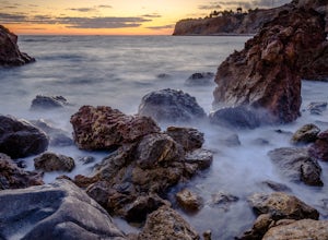
4.31.63 mi / 210 ft gainHead to the Pelican Cove parking lot where there’s plenty of free parking right at the trailhead. From the parking lot, take the Terranea Beach Trail and you will see views of the Point Vicente Lighthouse down the coast to your right. Continue on the trail through the luxury Terranea Resort whic...Read more -
Rancho Palos Verdes, California
Pelican Cove
0.38 mi / 95 ft gainGetting There Coming from San Pedro, make a U-turn at the Hawthorne Boulevard stoplight onto Palos Verdes Drive South. From here, you can access the parking lot for Pelican Cove, where you'll get a 120° view of the ocean. It might be tempting to take in the sunset from the car, but you should def...Read more -
Palomar Mountain, California
Hike to Palomar Observatory from the Palomar Observatory Campground
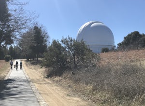
5.04.4 mi / 718 ft gainSituated in the Palomar Mountains of Cleveland National Forest, Palomar Observatory Campground offers many amenities for enjoyable camping and exploring the area. A portion of the campsites loop has been cleared of trees with level cement pads to allow campers to set up their own telescopes. Dr...Read more -
San Diego, California
Beach Trail
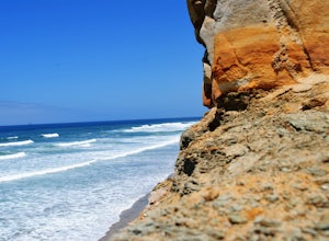
5.01.43 mi / 259 ft gainI'm stoked for those of you to find this adventure! Torrey Pines is home to a species of tree that is one of the most rare native pines in the United States. Below I have directions on how to get to the trailhead as well as the parking lot to park for the hike. There is a charge to get into the...Read more -
Palos Verdes Estates, California
Bluff Cove
4.40.56 mi / 144 ft gainParking for Bluff Cove is located along the sides of the street of Paseo Del Mar, and the trailhead is located right next to the street. Bluff Cove is one of those unique locations in that there are a variety of activities you can do here. It is a great location for surfing, paddle boarding, bod...Read more -
Avalon, California
Camp at Catalina's Two Harbors
4.8An island camping escape is a mere 50 minute boat ride away from the southern California coast. If you're feeling generous with your funds, you can also opt for a helicopter ride, leaving out of Long Beach and 15 minutes later landing in Catalina Island.Two Harbors campground is unique with the a...Read more -
Avalon, California
Visit Two Harbors, Catalina Island
5.0Just 30 miles from the commotion and congestion of Los Angeles, is a small island village that time seems to have left behind. You won't find the usual traffic, development, and big crowds here. You won't find movie theaters, concert venues, hotels, nightclubs, or sporting events either. At Cata...Read more -
San Diego, California
Torrey Pines Gliderport
4.5Park at the Torrey Pines Gliderport and walk to the railing over the cliffs. From there you can see north to Black's Beach and the Torrey Pines golf course. To the south you can see La Jolla Shores and La Jolla cove. Walk the path down to Black's Beach if you want some exercise. There is food and...Read more -
San Diego, California
Black's Beach via the Gliderport
4.30.7 mi / 269 ft gainPark at the Torrey Pines Gliderport, which is conveniently empty before sunrise. The hike down to Black's Beach features a steep hike down a winding path of natural and manmade steps along the cliff face, but stay left and cruise the bluff for endless opportunities to observe, reflect and explor...Read more -
San Diego, California
Black's Beach via the Ho Chi Minh Trail
4.30.61 mi / 259 ft gainFinding the actual trail is 80% of the adventure. Once you turn down La Jolla Farms Road you will follow it for about 3/4 of a mile and there won't be anything too apparent that you are there, except a few cars parked along the street. Make sure to plug in the directions from the map so you know ...Read more -
San Diego, California
Surfing at Black's Beach via the Main Gate
5.01 mi / 650 ft gainWith arguably some of San Diego’s best waves, Black’s Beach can be found in the vicinity of the University of California San Diego campus, at the southern end of Torrey Pines State Beach and north of La Jolla Shores. Stately eight-figure mansions now line the bluffs where pastures and the Black f...Read more -
San Diego, California
Los Penasquitos Canyon Loop
3.36.77 mi / 131 ft gainLos Penasquitos Canyon Loop After about a five minute hike on the trail you will start to enter into Los Penasquitos Canyon. Every section of the trail is different, one minute you are walking next to a stream with trees arching over the trail and another minute you are walking through an open f...Read more -
Claremont, California
Stoddard Peak Trail
4.05.93 mi / 1129 ft gainOn the way to Mount Baldy and within the trail system of the San Gabriel mountain range is the Stoddard Peak Trail. The Stoddard Peak Trail, which is basically the old Barrett-Stoddard fire road, goes through the Stoddard Canyon into Stoddard Flat, and then eventually leads to Stoddard Peak. The ...Read more


