San Bruno, California
San Bruno, California, is home to some of the best trails and outdoor activities. One of the top must-visit spots is the Sweeney Ridge Trail, a 7.7-mile round trip that offers scenic views of the Pacific Ocean and the San Francisco Bay Area. The trail is moderately challenging, with some steep inclines and rocky terrain, but the panoramic views at the top are worth the effort. Another popular outdoor adventure is the San Andreas Lake trail, a 3.5-mile path that skirts the beautiful San Andreas Lake. It's a flat, easy walk, perfect for bird watching and wildlife spotting. If you're into fishing, the lake is stocked with trout and bass. For a unique attraction, visit the nearby Crystal Springs Reservoir, a man-made lake surrounded by lush greenery. These outdoor activities make San Bruno a must-visit for those seeking scenic outdoor adventures.
Top Spots in and near San Bruno
-
Pescadero, California
Pick Berries at Swanton's Berry Farm
Take a spectacularly scenic drive or bike ride out to this quaint coastal berry farm. Look out onto the shimmering ocean while you pick the ripest and sweetest berries yourself. Head inside their shop to enjoy pre-made jams, pies, chocolate covered strawberries, and so much more. While you're ins...Read more -
Petaluma, California
Upland Game Bird Hunting/ Clay Shooting
I’m sure all you hunters and are well aware that there are few, if any, hunting opportunities in San Francisco or Marin County. However, many of you don’t know that an epic hunting club exists just an hour North of San Francisco. At the Black Point Game Bird Club, you can hunt ring-necked pheasan...Read more -
Los Gatos, California
Hike Los Gatos Trail to Jones Trail Loop
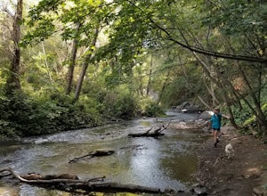
3.8 mi / 511 ft gainThis trail winds its way along the Los Gatos Creek and ends at the Lexington Reservoir before looping back to the start. It is 3.8 miles and makes for a great way to get exercise and relax in nature. You can hear the creek as you hike, and can even go down to it. There is a lot of green foliage t...Read more -
Nicasio, California
Hike and Fish at Nicasio Reservoir
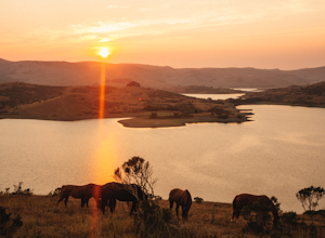
5.03 mi / 300 ft gainNicasio is a quaint town just inland of the more popular coastal town of Point Reyes. It's most known for it's wine country, rolling hills, and the home of Skywalker Ranch, George Lucas's getaway home. Most visitors of this area either pass right on through for Point Reyes or use it's scenic road...Read more -
San Jose, California
North Rim Trail to Eagle Rock
5.01.94 mi / 240 ft gainNorth Rim Trail to Eagle Rock is an out-and-back trail that takes you past scenic surroundings located near San Jose, California.Read more -
Point Reyes Station, California
Sky Trail Loop
5.09.55 mi / 1818 ft gainSky Trail in Point Reyes National Seashore is a dramatic, mostly single-track trail that runs along the main spine of the Inverness Ridge and across highest mountains in Point Reyes, looming above the Olema Valley and Highway 1 which mark the San Andreas Fault rift zone and the dividing line betw...Read more -
Point Reyes Station, California
Sky Campground via Sky Trail
2.66 mi / 495 ft gainEntering Point Reyes National Seashore from Bear Valley Road the Sky Trailhead is a 4.9 mile drive. Camping in Sky Camp requires a Camping Permit. Once at the Sky Trailhead parking lot. The Sky Trailhead will be on the left side pulling in. The hike is not very strenuous and not all that lo...Read more -
Antioch, California
Hike the Old Homestead Loop
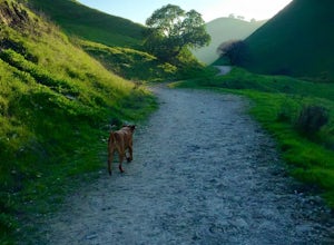
5.06.5 miThis is a fun day hike that takes you through the beautiful hills of the Black Diamond Mines Regional Preserve and a bit of the Contra Loma Recreational Area as well. You can hike here year round, but I suggest going in the spring time when the hills are covered in soft, green grass and the wild ...Read more -
Point Reyes Station, California
Coast Campground via Laguna Trailhead
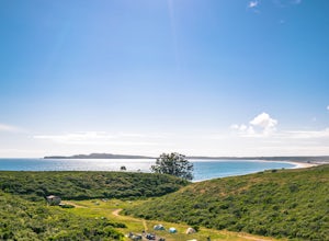
4.34.02 mi / 633 ft gainThis campground is the closest you can get to staying overnight on Pt. Reyes coastline if you're backpacking in. Once you get there, enjoy the view! The easiest way to get to the camp is from the slightly uphill hike along the Laguna Trail and the Firelane Trail. The trailhead for the Laguna Tra...Read more -
Davenport, California
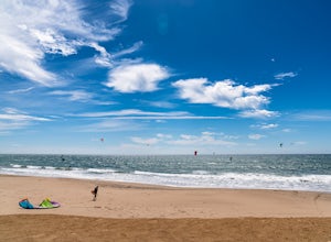
Kitesurf Waddell Beach
4.0Just north of Santa Cruz at the far west end of Big Basin State Park, Waddell Beach offers one of California's top spots for kiteboarding. Each spring and summer, you'll find consistent northwesterly afternoon sea breezes. With the added bonus of consistent waves from wind and ground swell, Wad...Read more -
Point Reyes Station, California
Hike the Laguna Trail & Coast Trail Loop
5.05.2 mi / 300 ft gainLeave your car on a side of the road. When navigating there, put "HI Hostel Point Reyes" in your navigation - you park literally on the other side of the road, opposite to the hostel. Go to the west and soon you'll find the start of Coast Trail with a tsunami warning sign. During first 1.8 mile y...Read more -
Inverness, California
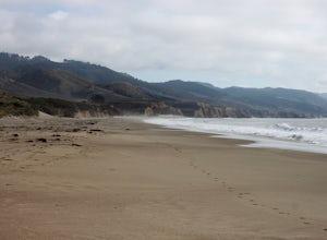
Walk along Limantour Beach
4.8The entire drive to Pt. Reyes is picturesque, but once you make it to Limantour, you and your dog can both get out and enjoy it! This area, between Drake's Bay and an estuary, allows you to spend time relaxing or head out for a run (keep the dog on leash). If you're lucky you might either get a c...Read more -
Livermore, California
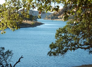
Del Valle Regional Park
4.0Looking for a quick summer escape filled with stand up paddling, canoeing, fishing, hiking, and picnics? Look no further than Del Valle Regional Park. Consistently considered one of the best campgrounds in the Bay Area, the centerpiece of Del Valle is a 5-mile long lake that allows swimming, fish...Read more -
Davenport, California
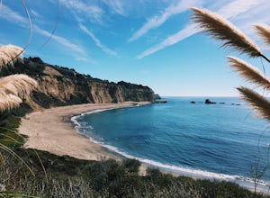
Hike around Greyhound Beach and Climb Greyhound Rock
0.7 mi / 0 ft gainThe trailhead is at the Greyhound Rock State Marine Conservation Area which is directly off Highway 1. There is a large paved parking lot with a good amount of trees so finding a shady parking spot isn't that difficult (if that's important to you). The parking lot is located on the beach cliffs ...Read more -
Livermore, California
Hike to Murietta Falls
4.012 mi / 4175 ft gainGet ready for one of the toughest, lung busting hikes in the east bay with over 6-miles and 4,000ft of climbing in one direction. When you make it to the hike, it's also important to realize that without recent rain, there many not actually be a waterfall. With that said, you're still getting in ...Read more -
Livermore, California
Paddle Lake Del Valle
4.0Lake Del Valle is a reservoir located in Livermore, California. The lake has boat motor boats, pedal boats, patio boats, canoes, and row boats available for rent. There is a dock and rental house in the marina.The lake is also a popular destination for picnics, barbecues, and camping. Parking fi...Read more

