San Bruno, California
San Bruno, California, is home to some of the best trails and outdoor activities. One of the top must-visit spots is the Sweeney Ridge Trail, a 7.7-mile round trip that offers scenic views of the Pacific Ocean and the San Francisco Bay Area. The trail is moderately challenging, with some steep inclines and rocky terrain, but the panoramic views at the top are worth the effort. Another popular outdoor adventure is the San Andreas Lake trail, a 3.5-mile path that skirts the beautiful San Andreas Lake. It's a flat, easy walk, perfect for bird watching and wildlife spotting. If you're into fishing, the lake is stocked with trout and bass. For a unique attraction, visit the nearby Crystal Springs Reservoir, a man-made lake surrounded by lush greenery. These outdoor activities make San Bruno a must-visit for those seeking scenic outdoor adventures.
Top Spots in and near San Bruno
-
Felton, California
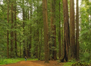
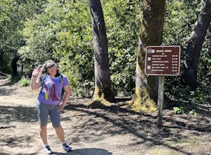
Redwood Grove Loop
4.00.93 mi / 144 ft gainHenry Cowell Redwoods State Park is located just a few miles north of the city of Santa Cruz, along Highway 9. The park is home to an array of hiking and biking trails, but the crown jewel of the park is the Redwood Grove Loop Trail, which is only a 1/4 mile in from the park's entrance. Many peo...Read more -
Felton, California
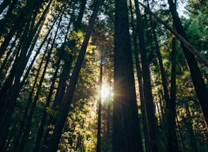
Observation Deck Loop in Henry Cowell Redwoods SP
4.35.3 mi / 869 ft gainThe trail starts at the Henry Cowell Redwoods State Park Visitors Center. Grab a map in the center, as your hike has you turning onto a few different trails to get to the observation deck. Starting at the Redwood Grove Loop Trail, follow the trail until it connects with the Pipeline Road Trail ...Read more -
Inverness, California
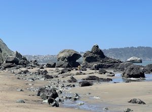
Marshall Beach Trail
5.02.41 mi / 305 ft gainMarshall Beach Trail is an out-and-back trail that provides a good opportunity to see wildlife located near Inverness, California.Read more -
Napa, California
Lake Marie Road, Marie Creek, Buckeye Trail Loop
3.55.8 mi / 961 ft gainEnter the parking lot just off of Hwy 221. Plan to pay a $5 entrance fee at the kiosk. The trail head begins at the edge of the parking lot where you'll soon be passing by the Martha Walker Native Habitat Garden on your right. Veer left to continue along Lake Marie Road where you'll enter the blu...Read more -
Napa, California
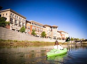
Kayak the Napa River
4.0The Napa River is one of the largest California Central Coast Range rivers, draining approximately 426 sq. miles on its 50 mile journey beginning just south of the summit of Mt. St. Helena to the San Pablo Bay, passing through many of the landmark towns of Napa Valley including an incredible 6 mi...Read more -
Santa Cruz County, California
Camp at Henry Cowell Redwoods Campground
4.8/ 665 ft gainNestled in the Santa Cruz Mountains, Henry Cowell Redwoods State Park is a great weekend option for Bay Area residents. With approximately 30 miles of hiking trails, the incredible Garden of Eden swimming hole, and proximity to Santa Cruz - this campground is not to be missed! On sunny days, view...Read more -
Santa Cruz, California
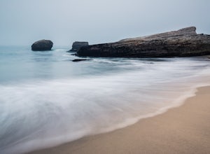
Explore Panther Beach
4.5Panther Beach's white sand, clear water, and interesting rock formations make it one of the most stunning beaches along this stretch of CA1. But this is a hidden gem for a reason - there are no signs along CA1 for Panther Beach. You need to keep you eyes peeled for cars parked along the side of t...Read more -
Santa Cruz, California
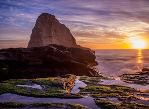
Photographing the Sunset at Panther Beach
5.0Probably my favorite beach in the Santa Cruz area. Panther Beach lies just south of Davenport along the beautiful Hwy 1. Park at a large dirt pull out on the left hand side if your heading north from Santa Cruz. The trail down to the beach is steep and not that well maintained so watch your step....Read more -
Mount Hamilton, California
Stargaze at Lick Observatory
3.8Hop on Road 130 heading out of San Jose and follow the winding two lane road up, up, up to to the top of Mt. Hamilton and the Lick Observatory. There are lots of deer, wild turkey, and pigs in the area. If you are lucky you will get to see a herd of deer grazing in a meadow. But be careful that y...Read more -
Napa, California
Westwood Hills Park Loop
4.02.12 mi / 476 ft gainThis park can get a little crowded on weekends, so best to go early if possible. In terms of parking, there's a lot at the trailhead, but also plenty of available street parking. The loop can be broken up in a various ways as there are several offshoots from the main trailhead/trail leaving fro...Read more -
Santa Cruz, California
Hike the Rincon Fire Trail
5.01 mi / 300 ft gainThe Rincon Fire Trail Starts at a small dirt parking lot next to CA-9 and traverses down the mountain to the San Lorenzo River Connecting with the Pipeline Trail. The trail can be a simple one of a mile out and back or up to 5 miles depending on your preference. The elevation will change by about...Read more -
Fairfield, California
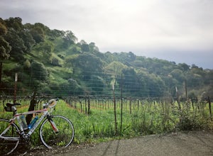
Bike the Gordon Valley to Wooden Valley Scramble
5.013.5 mi / 498 ft gainThis is a 13.5 mile loop route in Fairfield, California. The route has a total ascent of 498 feet and has a maximum elevation of 369 feet.Begin your ride at the corner of Oliver Road and Mankas Corner Road. Along Mankas Corner Road you'll pass the Napa Grass Farmer community farm and Il Fiorello ...Read more -
Marshall, California
Kayak Tomales Bay
5.0Kayak Beautiful Tomales bay and experience the bioluminescence ecology of the bay. Timed during the lowest crescent of the moon, and starting around sunset, you will paddle into the sunset and wait until it is completely dark, continuing on around the bay to experience the bio-luminescence natur...Read more -
Napa, California
Alston Park Loop Trail
2.76 mi / 184 ft gainAlston Park Loop Trail, located in Napa, California, is a 2.76-mile loop trail that offers a moderate level of difficulty for hikers. The trail is primarily used for hiking, walking, and running and is accessible year-round. The trail is well-maintained and clearly marked, making it suitable for ...Read more -
Santa Cruz, California
Surf Four Mile Beach
4.0Four Mile is a reef/point break that is a couple of miles north of town. This spot usually picks up more swell than in town so it is a popular spot for many locals to surf. When the swell picks up, it offers long rights towards the beach. The current can be strong when there is a lot of swell in ...Read more -
Santa Cruz, California
Photograph the UC Santa Cruz Arboretum
5.0No matter the time you'll decide to visit the UC Santa Cruz Arboretum, you'll have thousands of interesting plants and birds to see and watch. The Arboretum is located on the west side of UCSC campus, between the main campus entrance and the west entrance. Parking is 5$ for adults and 2$ for chil...Read more

