Napa Valley, California
Looking for the best photography in Napa Valley? We've got you covered with the top trails, trips, hiking, backpacking, camping and more around Napa Valley. The detailed guides, photos, and reviews are all submitted by the Outbound community.
Top Photography Spots in and near Napa Valley
-
Corte Madera, California
Ring Mountain Loop
4.02.65 mi / 597 ft gainRing Mountain Open Space is an easy but uphill trail that take you to the top where you can explore more trails. Take the 101 exit for Paradise Dr in Corte Madera, follow the road, and park on the side of the road once you pass Westward Dr. Even though there are many places to start the trail fo...Read more -
Tiburon, California
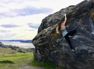
Bouldering at Ring Mountain
0.5 mi / 400 ft gainItching to climb outdoors near San Francisco? With only a quick drive from the city, Ring Mountain is a beautiful nature preserve overlooking the city of San Francisco offering two main rock formations, Turtle Rock (Pictured) and Split Rock. Split Rock is the slabby rock south of the parking ar...Read more -
Mill Valley, California
Summit of Mt. Tamalpais Loop
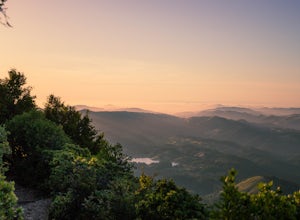
5.01.15 mi / 394 ft gainMt. Tam is a large park with plenty of amazing viewpoints, but the East routes and the East Peak are best for sunsets. Once you're at the top, it's an amazing spot to view a large number of Marin trails, which can help you can get a head start on planning your next adventure. At 2,570 feet, this ...Read more -
Inverness, California
Abbotts Lagoon Trail
4.63.43 mi / 102 ft gainIf you like beaches, headlands, scenic landscapes, wildflowers, and tons of wildlife viewing, you should give this hike a try. Although it only takes about an hour to complete the out-and-back, the vibe surrounding this area is just begging you to slow down and enjoy your natural surroundings. T...Read more -
Mill Valley, California
Temelpa Trail
4.52.94 mi / 1929 ft gainThe Mt. Tam Hill Climb via Temelpa Trail is an iconic, "best-of" climb in the trail running community, drawing some of the world's greatest athletes to experience its breathtaking views and technical downhill. Surprisingly though, outside of locals and the running community, the trail remains lar...Read more -
Stinson Beach, California
Cataract Falls
4.22.81 mi / 1184 ft gainThe Bay Area is home to many beautiful waterfalls, but Cataract Falls located about an hour north of San Francisco is one of the most stunning. Be sure to head out on this hike after a recent rain. Cataract Falls is a picturesque waterfall located in the Mt. Tamalpais Watershed near Stinson Be...Read more -
Point Reyes Station, California
Hike the Laguna Trail & Coast Trail Loop
5.05.2 mi / 300 ft gainLeave your car on a side of the road. When navigating there, put "HI Hostel Point Reyes" in your navigation - you park literally on the other side of the road, opposite to the hostel. Go to the west and soon you'll find the start of Coast Trail with a tsunami warning sign. During first 1.8 mile y...Read more -
Inverness, California
Hike the Estero Trail
5.08 mi / 200 ft gainJune sunshine blazes on your shoulders during this scenic stroll through the Point Reyes Seashore. The trail is alive and awash with colorful wildflowers around every corner.Beginning at the trailhead, just off Home Ranch Road, with a convenient parking lot and bathroom, you'll wade through a hal...Read more -
Berkeley, California
Wildcat Peak via Nimitz Way
4.74.16 mi / 459 ft gainTilden Park is a beautiful recreational area with scenic hiking trails, a swimming lake, small animal farm, a steam train and botanical gardens. The versatility of this park makes it very family and kid friendly, and those who are looking for a moderate hike within the park have almost forty mile...Read more -
Bodega Bay, California
Bodega Head Nature Trail
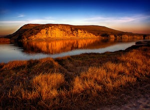
4.71.67 mi / 121 ft gainSitting west of the San Andrea fault, the Bodega Head is a massive chunk of granite from the Salinian Block, a geological terrane that contains Point Reyes and the Farallon Islands, and shares its origins with the Sierra Nevada mountains, the Head itself having been carried hundreds of miles to t...Read more -
Bootjack Campground, California
Bootjack Campground to Muir Woods
8.61 mi / 1594 ft gainGetting permits into Muir Woods can be hard, but if you want to work for it, there's a much better way to visit the National Monument. To do this loop into Muir Woods National Monument, first drive to the Bootjack Parking Area in Mt. Tamalpais State Park. The Bootjack Parking Area should be fou...Read more -
Mill Valley, California
Camp at Bootjack Campground in Mount Tamalpais State Park
4.0Bootjack Campground is located within California's Mount Tamalpais State Park. There are a couple of campsites within the park, but if you are driving on the Panoramic Highway from Mill Valley, this will be the first campground you pass. The fee is $25 fee to camp, but they have bathrooms and ru...Read more -
Mill Valley, California
Steep Ravine and Bootjack Trails Loop
5.06.66 mi / 2083 ft gainThis hike is best done in the winter and spring in order for the creeks and waterfalls to be flowing. Park at the Bootjack Campground in Mount Tamalpais State Park. Cross the road to reach the Bootjack trail. Continue on this until you reach the Alpine trail. Go right towards the Pantoll Ranger ...Read more -
Marin County, California
Picturesque Views from Mt. Tam's East Ridge
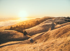
5.0This road provides one of the most scenic views of the pacific from north of the Golden Gate. It's a little bit of a windy drive or ride along Highway 1 or Panoramic Highway (depending on which way you choose) to get to East Ridgecrest. But, if you remembered to pack a picnic, brought your friend...Read more -
Stinson Beach, California
Cataract Trail Loop
4.58.7 mi / 1670 ft gainDuration: 3.5-4 hour hike at a moderate to quick pace with a short break for lunch. Starting at an elevation of 1989ft and maxing at 2001ft, you achieve 1428 of elevation gain through a beautiful peak and valley hike. From the free Rock Springs Parking Area, the basic trailheads to follow along...Read more -
Inverness, California
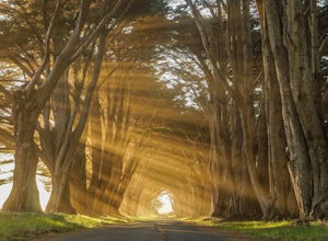
Photograph the Cypress Tree Tunnel in Point Reyes
4.3Just north of San Francisco, there's a row of giant Monterey cypress trees that forms a “tree tunnel”. Loved by Bay Area locals, it's a tucked away spot in the Point Reyes National Seashore for photographers to capture early morning sun rays, or for anyone to get some moments of solitude. At the ...Read more


