Loma Mar, California
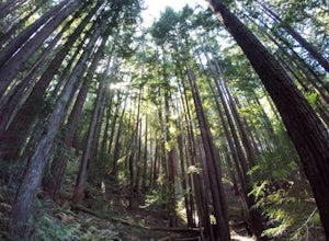
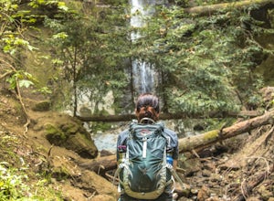
Loma Mar, California, is a must-visit for those seeking top outdoor adventures. One of the best trails and outdoor activities in the area is the Pescadero Creek County Park Loop. This 10.6-mile hiking trail offers scenic views of the creek, tall redwood trees, and unique rock formations. The trail is rated moderate, making it suitable for hikers with some experience. Along the trail, you may spot local wildlife, including deer and various bird species. In addition, the park is home to a variety of plant species, adding to the rich biodiversity of the area. Near Loma Mar, you'll find the Pescadero Marsh Natural Preserve, a great spot for bird-watching and photography. So, if you're looking for a blend of adventure and natural beauty, Loma Mar is the place to be!
Top Spots in and near Loma Mar
-
Half Moon Bay, California
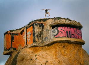
Devil's Slide Bunker
4.3The Devil's Slide Bunker is perched out on a point the defiantly juts out into the ocean. The Bunker is covered in constantly changing graffiti, which provides a stunning contrast to the gorgeous seaside. Hop on Highway 1 South. Just south of Pacifica there is a tunnel. Once you go through the t...Read more -
Fremont, California
Lake Elizabeth Loop
3.02.1 mi / 69 ft gainLake Elizabeth is located in central Fremont. It offers a nice break from the city streets and can be enjoyed by walkers, joggers, and bikers alike. It is a park for all ages. Other attractions include volleyball nets, multiple playgrounds, and aqua adventure park, geese, and peddle boats. ...Read more -
Santa Cruz, California
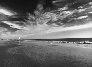
Beach Day at Lighthouse Field State Beach
4.0This beach is less crowded compared to other beaches in Santa Cruz. I got there early on a Saturday and found easy street parking. There was plenty of space to spread out on the soft sand. Later in the day I saw dolphins several times! This is close to the Santa Cruz Surfing Museum. It’s als...Read more -
Fremont, California
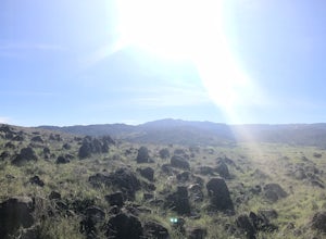
Mission Peak via Hidden Valley Trail
4.26.16 mi / 2116 ft gainBreathtaking views of the Bay Area are your reward for making this climb to the top of Mission Peak. It’s a 3-mile trek to the top of the peak and then back down the same way. This is a moderate hike that provides a nice workout – so be prepared. Park at the Stanford Avenue entrance gate. There ...Read more -
Santa Cruz, California
Bonfire at Seabright State Beach
5.0This is a wide, beautiful beach that's an amazing spot to spend the day and enjoy a bonfire at night. Seabright is probably the most popular spot in Santa Cruz for a bonfire, due to its convenient proximity to the Beach Boardwalk. But luckily, this beach is tucked in between the San Lorenzo River...Read more -
San Jose, California
Explore Santa Teresa County Park
4.58.3 mi / 2053 ft gainThe Santa Teresa County Park loop is perfect for wildlife viewing! Be ready to see deer, coyote, hawks, turkeys, pigs and cows. The trail is rated as moderate - be cautious with mud if you are visiting the park after a rain shower. Dogs are allowed in the park, but must be kept on leash. There i...Read more -
Santa Cruz, California
A Beach Bonfire in Santa Cruz at Twin Lakes SB
This one-mile stretch of beach is the perfect option for those looking for a peaceful Santa Cruz experience, but without the crowds. The beach features soft sand, playful surf, an awesome view of Walton Lighthouse, and a handful of fire pits to choose from. It's a great spot to spend the entire d...Read more -
Los Gatos, California
Mountain Bike Soquel Demonstration Forest
11 mi / 2070 ft gainAs with many trail systems there are multiple routes and loops available at Sequel Demonstration forest of varying lengths and difficulty. The 3 main trails are all accessed via the same parking area on highland way. The most popular trail is the all skill levels "Flow" trail, followed by two sho...Read more -
Pacifica, California
Surf at Pacifica State Beach
4.5If you're looking for a place to surf and Ocean Beach isn't quite your speed or Santa Cruz is too far, head to Pacifica, specifically Linda Mar. Linda Mar is usually more wind protected and user-friendly than ocean beach. Break out your longboard or hybrid board and head to this beach. There is e...Read more -
San Bruno, California
Sweeney Ridge via Sneath Lane
4.53.88 mi / 646 ft gainStarting from the parking lot on Sneath Lane Trail, you’ll head through the gate and continue on the path up Sweeney Ridge. This is a 5.7 mile out-and-back trek. There is a 600 ft. elevation gain, which comes mainly in the first 1.5 miles of the trail. Your legs and lungs may hurt a bit, but if t...Read more -
Capitola, California
Camp at New Brighton Campground
/ 0 ft gainThis Capitola camping spot is the place to be if you're looking to do a variety of activities in a variety of landscapes. You can swim, fish, or explore the nearby forest of Monterey Pine and coastal Oak. In the evening, walk into Capitola for live music and great fish tacos. The S.S. Palo Alto,...Read more -
Capitola, California
New Brighton Beach Trail
0.85 mi / 112 ft gainNew Brighton Beach Trail is an out-and-back trail that takes you past scenic surroundings located near Aptos, California.Read more -
Santa Cruz, California
Surf Pleasure Point
4.0Pleasure Point is located on the east side of Santa Cruz, California. It is a right hand point break that breaks year round. It is a popular surf spot for many people that live in the San Francisco Bay Area. There are 3 different peaks that break at Pleasure Point. Sewers, which is the furthest ...Read more -
Santa Cruz, California
Surf the Hook
4.0The hook is a surf spot found on the east side of Santa Cruz, located along East Cliff drive. If you keep driving past Pleasure Point, you'll get to it. It's a right hand point break that is usually smaller in size than Pleasure Point. It's a very crowded spot due to the easy access parking lo...Read more -
San Jose, California
North Rim Trail to Eagle Rock
5.01.94 mi / 240 ft gainNorth Rim Trail to Eagle Rock is an out-and-back trail that takes you past scenic surroundings located near San Jose, California.Read more -
Aptos, California
Hike to Nisene Marks' Maple Falls
4.68.5 mi / 900 ft gainAs you enter the park, you'll need to pay $8 for parking via a self-pay envelope, so it's recommended that you bring exact change. At the park booth, be sure to grab a map. The hike can be a little tricky with no cell service and limited trail signage. Once you've grabbed your map, keep driving p...Read more

