Kenwood, California
In Kenwood, California, the best trails and outdoor activities include hiking the Sugarloaf Ridge State Park trail. This trail is a must-visit for its scenic views of the Sonoma Valley and Mount Saint Helena. With a moderate difficulty level, it winds through forests, meadows, and along creeks. You'll come across a waterfall and the headwaters of Sonoma Creek. Another top trail is the Annadel State Park trail, known for its unique rock formations and a large lake. It's perfect for hiking, mountain biking, and horseback riding. For a different kind of outdoor adventure, visit the Kunde Family Winery. It offers a scenic hike through its vineyard with a wine tasting at the end. These outdoor activities make Kenwood a superb destination for those seeking scenic, outdoor adventures.
Top Spots in and near Kenwood
-
San Rafael, California
Terra Linda Sleepy Hollow Ridge Trail
5.05.85 mi / 1089 ft gainThis San Rafael neighborhood trail is quite popular, but there is plenty of room for everyone and the parking is easy. After you park at the trailhead, you walk (or bike) up a relatively short and steep path that takes you to the beginning of the trail. This hike takes you along a scenic ridge ...Read more -
San Geronimo, California
Roys Redwood Preserve Loop
5.02.37 mi / 430 ft gainRoy's Redwoods Preserve is an easily missed pocket of Redwoods off Nicasio Valley Road in Marin County. Don't miss it: heading North on Sir Francis Drake Blvd turn right onto Nicasio Valley Rd--the gate for this little park is about a half mile up on the right. From the main entrance you enter a ...Read more -
Bodega Bay, California
Miwok Campground at Doran Regional Park
5.0Doran Regional Park is located along the coast just south of the town of Bodega Bay, California. There are 5 campgrounds at Doran and Miwok is the tent-only campground with 13 campsites. There is a parking lot at the campground and bathrooms with coin-operated showers. FEES: If camping, your e...Read more -
Sonoma County, California
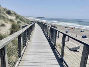
Salmon Creek State Beach
4.0Salmon Creek State Beach located is located just off Highway 1, north of Bodega, California. This beach has a parking lot and restroom on the cliff side, just a short walk down to the beach. DogsBoth North and South Salmon Creek sections of the state beach are not dog friendly due to the Federa...Read more -
Bodega Bay, California
Doran Beach
5.04.02 mi / 75 ft gainDoran Beach is nestled within the picturesque landscape of Doran Regional Park near Bodega Bay, California. Offering pristine shores and captivating vistas, this is a coastal gem that allows visitors a more protected coastal landscape than nearby Salmon Creek State Beach. Explore sandy beaches ...Read more -
Bodega Bay, California
Bodega Dunes Beach
4.0Bodega Dunes Beach is located through the same entrance as Bodega Dunes Campground. There is a fee to enter the parking area for day use, but you can also access it without payment if you have a CA State Parks Pass. From the parking area heading toward the beach, you will see two picnic areas wi...Read more -
Lagunitas, California
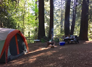
Redwoods Camping at Samuel P Taylor
These West Marin campsites are often overlooked. It does get busy during the summer, but take the rest of the year to explore this state park. The main campground boasts more than 50 campsites with restrooms, hot pay showers, and piped drinking water. A few spaces can accommodate trailers, but t...Read more -
Lagunitas, California
Swim at the Inkwells
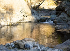
4.5These natural swimming holes are filled with water flowing from Kent Lake, so they're usually pretty refreshing. And by refreshing, we mean cold. We know this first-hand by testing the pools in the winter months. Let's just say if you can stay in for more than 5 seconds, you're a hero. If you jum...Read more -
Inverness, California
Abbotts Lagoon Trail
4.63.43 mi / 102 ft gainIf you like beaches, headlands, scenic landscapes, wildflowers, and tons of wildlife viewing, you should give this hike a try. Although it only takes about an hour to complete the out-and-back, the vibe surrounding this area is just begging you to slow down and enjoy your natural surroundings. T...Read more -
Bodega Bay, California
Bodega Head Nature Trail
4.71.67 mi / 121 ft gainSitting west of the San Andrea fault, the Bodega Head is a massive chunk of granite from the Salinian Block, a geological terrane that contains Point Reyes and the Farallon Islands, and shares its origins with the Sierra Nevada mountains, the Head itself having been carried hundreds of miles to t...Read more -
Lagunitas, California
Bolinas Ridge Loop
10.27 mi / 1568 ft gainNestled in the Samuel P. Taylor State Park this ten miler was a perfect escape from the chaos of the city. Hikers are able to pay a $10.00 park entry fee that includes plenty of parking spaces and restrooms before you hit the trail. The hike starts along the Cross Marin Trail, a path popular to ...Read more -
Vacaville, California
Bike the Lake Berryessa Loop
55.82 mi / 1007 ft gainBegin your ride in Vacaville, California out of Alamo Creek Park (street parking is available and free). Head north on Alamo Drive and veer left onto Foothill Drive, then left (South) onto Pleasants Valley Road. After two miles, veer left onto Cherry Glen Road. Stay to the right when you reach th...Read more -
Point Reyes Station, California
Bear Valley to Coast Camp Loop
5.016.18 mi / 2818 ft gainPermit and Trail Camp Info To stay overnight in Point Reyes, you must stay at one of the Trail Camps. Camping anywhere else in the park is not allowed. Permits for the Trail Camps can be booked up to 6 months in advance. If you are looking to go on a weekend, then you'll want to start loo...Read more -
Vacaville, California
Bike the Cantelow Climb
5.019.68 mi / 1119 ft gainBegin your ride from Lagoon Valley Park in Vacaville, California. There is a parking lot here if you drive to the start of your ride (the park entrance fee is $3 per vehicle per day). Head out of the parking lot and turn right onto Rivera Road where you'll cross over Hwy 80. The road becomes Cher...Read more -
Point Reyes Station, California
Sky Trail Loop
5.09.55 mi / 1818 ft gainSky Trail in Point Reyes National Seashore is a dramatic, mostly single-track trail that runs along the main spine of the Inverness Ridge and across highest mountains in Point Reyes, looming above the Olema Valley and Highway 1 which mark the San Andreas Fault rift zone and the dividing line betw...Read more -
Point Reyes Station, California
Sky Campground via Sky Trail
2.66 mi / 495 ft gainEntering Point Reyes National Seashore from Bear Valley Road the Sky Trailhead is a 4.9 mile drive. Camping in Sky Camp requires a Camping Permit. Once at the Sky Trailhead parking lot. The Sky Trailhead will be on the left side pulling in. The hike is not very strenuous and not all that lo...Read more

