June Lake, California
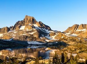
June Lake, California, offers some of the top trails and outdoor activities for those seeking scenic adventures. A must-visit trail is the Rush Creek Trail, a moderate difficulty hike with stunning views of the Sierra Nevada Mountains, the Ansel Adams Wilderness, and the pristine Silver Lake. Another top trail is the Fern Lake Trail, a challenging uphill hike that rewards with views of the beautiful Fern Lake. For a more relaxed outdoor activity, you can enjoy fishing in the crystal-clear waters of June Lake or Gull Lake. Nearby, the Mono Lake Tufa State Natural Reserve is home to unique rock formations and a variety of bird species. These are just a few examples of the best outdoor adventures in and near June Lake.
Top Spots in and near June Lake
-
Mammoth Lakes, California
Backpack from Mammoth Mountain to Yosemite Valley via the John Muir Trail
5.052 mi / 6300 ft gainCross country hiking can be a daunting idea. There are so many things to plan for, and such a long distance to cover. If you are an experienced backpacker, and you want to get a taste of hiking on the John Muir Trail this hike might interest you. Planning GPS Map (Caltopo): https://caltopo.com...Read more -
Mammoth Lakes, California
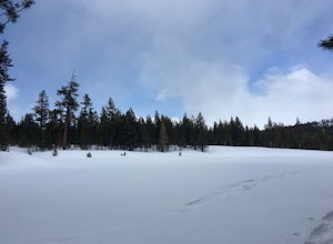
Snowshoe Shady Rest Park
2 mi / 100 ft gainShady Rest Park is located on Sawmill Road just minutes from the Mammoth Lakes town center. Start off by crossing through the parking lot headed north towards the large open field covered in snow. The open field is a great place to walk around and become comfortable with wearing and walking in sn...Read more -
Lee Vining, California
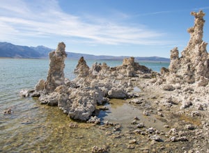
Mono Lake's South Tufa Loop
4.40.91 mi / 39 ft gainMono Lake is was formed at least 760,000 years ago, making it one of North America's oldest lake. Explore the coastline of this unique lake filled with unusual rock formations called tufas. Photograph the tufa towers with the majestic mountains in the background. The towers can make for some very...Read more -
Mammoth Lakes, California
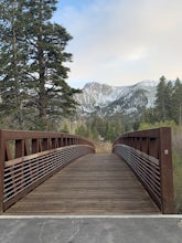
Waterford Bridge
The Waterford Gap bridge creates a picturesque view of the Eastern Sierra as it crosses over Mammoth Creek as part of the town loop and connects Majestic Pines Dr, which runs up to Eagle Lodge, with old Mammoth Road, which is a main road along the south and east edges of town. This is a great spo...Read more -
Mammoth Lakes, California
Panorama Dome
4.00.91 mi / 259 ft gainThis is a great short hike, located near the turn off for Twin Lakes. Once you reach the top, you’ll be rewarded with 360 degree views of the lakes basin, the town, Mammoth Mountain, and the White Mountains. There was a little snow left at the top, when we hiked it over Memorial Day weekend. Eve...Read more -
Lee Vining, California
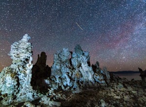
Explore the Mono Lake Tufas under the Milky Way
5.0This past spring, I got the urge to photograph the Milky Way over the other-worldly landscape of Mono Lake, a large, desert saline lake at the edge of the eastern Sierras in California. One of the the lake's defining features is it’s incredible tufa rock formations, a variety of limestone. The e...Read more -
Lee Vining, California
Mono Lake Vista Point
Mono Lake Vista Point is a quick pull off on the right side of Highway 395 as you’re headed south toward Mono City. The pull off is fairly big and is a great spot to pull over quickly to take in a view of Mono Lake and the greater area.Read more -
Mammoth Lakes, California
McLeod Lake
5.01.84 mi / 390 ft gainStart your journey at the Mammoth Pass Trailhead at the back of the parking lot for Horseshoe Lake. From the start, the trail ascends steadily through dense pines, and big granite stair steps. Although it is a moderately steep route (and the altitude doesn't help), it is only about 0.6 miles to ...Read more -
Mammoth Lakes, California
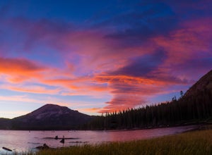
Photograph Lake Mary, Mammoth Lakes
4.0Lake Mary is the largest of the 11 lakes in the Mammoth Mountain area. Explore the lake’s perimeter and find your own perfectly peaceful place to watch one of Mammoth’s signature stunning sunsets. Parking is easy to come by either on the side of the road or at the marina parking lot up the road.B...Read more -
Mammoth Lakes, California
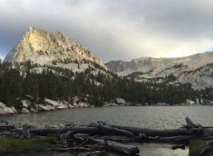
Crystal Lake via Mammoth Crest Trail
4.82.5 mi / 1257 ft gainIn Lake George, park along Lake George Road and walk towards Crystal Crag Trailhead sign to begin the hike. If you couldn't find it, you can head to the boat rentals by the lake and you will see a sign saying trailhead is behind you. The trail is well maintained and it is really easy to follow. ...Read more -
Mammoth Lakes, California
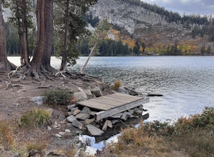
Lake George Trail
5.01.34 mi / 89 ft gainThe Lake George Loop is perfect for exploring the shoreline and fishing near the top of the Mammoth Lakes wilderness. The lake can get quite cold due to the elevation and surrounding mountains not allowing the sun to hit it for an extended time, but if you go during mid-day you should have a refr...Read more -
Tuolumne County, California
Lyell Loop
35.88 mi / 5541 ft gainStart the hike at the Mono pass trail. You'll eventually take the fork towards Parker Pass a couple miles in. We tackled the trail in late spring, and it quickly became clear that there was still enough snow to make our lives difficult. As we climbed out of the Parker drainage, the trail essenti...Read more -
Tuolumne County, California
Mono Pass to Silver Lake Trailhead via Koip Peak Pass
20.25 mi / 3606 ft gainThis trip begins in Yosemite National Park and can be completed as an out-and-back or by hiking one-way to the Ansel Adams Wilderness and exiting at Silver Lake on the east side of the mountains. Start at the Mono/Parker Pass trailhead, a few miles past Tuolumne Meadows. Don't forget to make a pe...Read more -
Mammoth Lakes, California
Sherwin Lakes Trail
5.04.42 mi / 850 ft gainJust outside the town of Mammoth Lakes, CA is the Sherwin Lakes Trailhead. An easy 10 minute drive down some dirt roads will get you to the dirt parking lot where you can safely leave your vehicle and begin your fairly easy 2.5 mile hike to Sherwin Lakes. (Valentine Lake is not much further beyon...Read more -
Mammoth Lakes, California
Valentine Lake via Sherwin Lakes Trail
5.09.76 mi / 2026 ft gainPark at the Sherwin Lakes Trailhead. Begin your ascent through scrubby foliage and old pines. Once you arrive at a junction with a bench, turn around. Note that the uphill climb is pretty decent past Sherwin Lakes, so if you're feeling overly winded after the arriving at these lakes, this may be...Read more -
Tuolumne County, California
Photograph Dana Fork
Yosemite is filled with some amazing views but rarely do you get to experience these views by yourself. This hidden treasure is located off of Tioga Pass, is near some of Yosemite’s most popular hikes, and offers an outstanding sunrise and sunset views without the crowds. Located 2.5 miles Sout...Read more

