Big Creek, California
Looking for the best hiking in Big Creek? We've got you covered with the top trails, trips, hiking, backpacking, camping and more around Big Creek. The detailed guides, photos, and reviews are all submitted by the Outbound community.
Top Hiking Spots in and near Big Creek
-
Yosemite National Park, California
Buena Vista Lake via Chilnualna Falls Trailhead
24.64 mi / 5453 ft gainHiking and camping at Buena Vista Lake is a beautiful way to see the south side of Yosemite… the name says it all. With beautiful 360 degree views from Buena Vista Peak you get to look at the backside of Half Dome, up to Clouds Rest and all the domes and peaks in-between. You can reach the trail...Read more -
Yosemite National Park, California
Hike to the Top of Chilnualna Falls
4.39.2 mi / 2300 ft gainMany visitors to Yosemite head straight to the valley and don't often explore the other areas of the park. So if you are interested in staying away from the massive crowds and getting to enjoy the beauty of the park a little more quietly, the Wawona is a great option for a getaway. The Chilnualna...Read more -
Yosemite National Park, California
Backpack to Johnson Lake
24 mi / 4500 ft gainYour trek begins at the Chilnualna Falls trailhead in Wawona near the South Gate in Yosemite. The first suggestion I have is to check the weather in the area to make sure you won't be slowed down by rain or snow. It's about 12 miles from the trailhead to the lake and if you are a swift hiker and ...Read more -
Hume, California
Hike and Fish Hume Lake
2.73.5 mi / 100 ft gainThis spot is less than four hours from the Bay Area and offers everything you would ever want to do in the outdoors. The interesting thing about Hume Lake is that it is actually a Middle School and High School camp in the Summer and Winter. That being said, it is not the place to go if you are lo...Read more -
Mammoth Lakes, California
Waterford Bridge
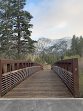
The Waterford Gap bridge creates a picturesque view of the Eastern Sierra as it crosses over Mammoth Creek as part of the town loop and connects Majestic Pines Dr, which runs up to Eagle Lodge, with old Mammoth Road, which is a main road along the south and east edges of town. This is a great spo...Read more -
Mammoth Lakes, California
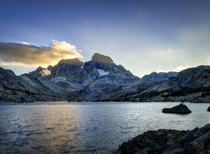
Backpack to Garnet Lake
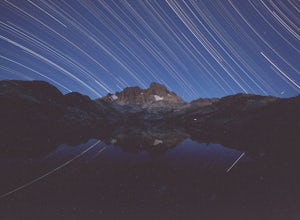
5.014 mi / 2030 ft gainAlthough this trip specifically describes how to get to Garnet Lake, there are several other pristine alpine lakes (Shadow Lake and Thousand Islands Lake) along this looped trail, only a few short miles away from each other, that are just as worthy if you have the time. A minimum of 3 days/2 nigh...Read more -
Hume, California
Walk the General Grant Tree Trail
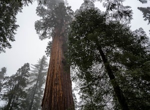
5.00.5 miThe trailhead starts at the back of the parking area, a sign will direct you.This short yet beautiful walk will lead you past amazing sights. Starting counter clockwise you will quickly pass the Fallen Monarch. Feel free to walk inside this massive fallen tree. As you continue you soon reach G...Read more -
Hume, California
General Grant Loop Trail
0.58 mi / 171 ft gainGeneral Grant Loop Trail is a loop trail that takes you by a river located near Cedar Grove, California.Read more -
Bishop, California
Backpack Across Mt. Humphreys Basin
30 mi / 3375 ft gainBefore heading out, you will need to get a backpacking permit to stay overnight in this area. You can buy one here to pick up in town at the Bishop, CA Ranger Station, in the morning.The trailhead begins at North Lake campground (9,345'), in a beautiful lush area, with streams and aspen groves. A...Read more -
Bishop, California
Backpack to Upper Lamarck Lake
5.05.8 mi / 1562 ft gainStarting out at North Lake Campground, the trail to Lamarck Lakes is a fairly gradual ascent. After climbing out of the meadows near the trailhead, you will find yourself on a ridge with few trees to block the great views of Grass Lake and the valley below. Lake Sabrina is on the other side of ...Read more -
Mammoth Lakes, California
Sherwin Lakes Trail
5.04.42 mi / 850 ft gainJust outside the town of Mammoth Lakes, CA is the Sherwin Lakes Trailhead. An easy 10 minute drive down some dirt roads will get you to the dirt parking lot where you can safely leave your vehicle and begin your fairly easy 2.5 mile hike to Sherwin Lakes. (Valentine Lake is not much further beyon...Read more -
Mammoth Lakes, California
Valentine Lake via Sherwin Lakes Trail
5.09.76 mi / 2026 ft gainPark at the Sherwin Lakes Trailhead. Begin your ascent through scrubby foliage and old pines. Once you arrive at a junction with a bench, turn around. Note that the uphill climb is pretty decent past Sherwin Lakes, so if you're feeling overly winded after the arriving at these lakes, this may be...Read more -
Mariposa County, California
Camp at Wawona in Yosemite National Park
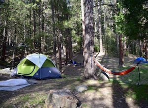
Wawona offers over 90 campsites in 3 loops, including 1 group site, 2 horse sites, and RV/ camper access.Every loop has at least 1 bathroom with flush toilets, but keep in mind that there are no showers at this campground.Pets are allowed, but must be kept on leash at all times.Each campground co...Read more -
Bishop, California
Sailor Lake Backpack & Climb of Mt. Haeckel
5.013 mi / 2500 ft gainThe basic part of this adventure is a backpack to Sailor Lake. From there you can enjoy small dayhikes to the nearby lakes or waterfalls, go fishing, enjoy some photography or just lounge in camp and gaze at the beautiful scenery. Although Sailor Lake looks smaller than the nearby lakes it stil...Read more -
Bishop, California
Backpack the Piute Pass Trail in the John Muir Wilderness
21 mi / 2000 ft gainWith so many famous hiking trails in the Sierras, its hard to find a trail as isolated as the Piute Pass Trail. This trail allows you to hike in the John Muir Wilderness, Inyo National Forest, and Sierra National Forest in one 20 mile section of trail. You will encounter amazing wilderness, spect...Read more -
Mammoth Lakes, California
Agnew Meadows to Tuolumne Meadows
5.030.27 mi / 4757 ft gainUnlike most through hikes that require two cars or hitchhiking, you can accomplish this with only one car by using a YART. Another benefit is that by entering in Mammoth, it is usually much easier to get permits as opposed to starting in Yosemite where permits can be harder to get. Then once yo...Read more

