Big Creek, California
Looking for the best camping in Big Creek? We've got you covered with the top trails, trips, hiking, backpacking, camping and more around Big Creek. The detailed guides, photos, and reviews are all submitted by the Outbound community.
Top Camping Spots in and near Big Creek
-
Lakeshore, California
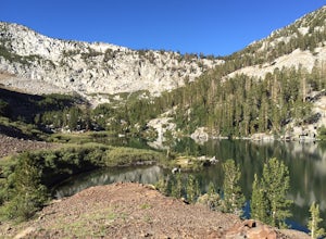
Hike to George Lake
9.2 mi / 1050 ft gainThe hike to George Lake starts out about 4 miles after you turn off 168 onto Kaiser Pass Rd. You'll want to park at the parking lot right before Badger Flat Campground. The parking lot is easy to notice and it is located on the right hand side of the road, two pit toilets and bear lockers are loc...Read more -
Lakeshore, California
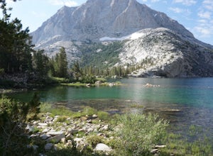
Backpack to Crater Lake, Sierra National Forest
8.4 mi / 2100 ft gainStarting at Lake Florence, this hike starts out with a climb up and keeps this up over the next 3 miles. After about 3 miles of climbing you reach another lake, Dutch Lake which provides shade and a nice place to rest. From there it's a relatively flat 1.2 miles in to your destination. Once at Cr...Read more -
Bass Lake, California
Climb and Camp at Shuteye Ridge
5.0The Journey to your final destination can get a little tricky once you get on the dirt roads. From the Bay Area it will take you about 3 hours to get into Oakhurst, then another hour to get to the Wilderness Area simply because of the windy and not maintained roads. On that note I would suggest t...Read more -
Shaver Lake, California
Camp at Voyager Rock Campground
4.0The paved road ends at the Maxson Trailhead parking lot on the SE side of Courtright Reservoir. The adventure starts with a glance to the left, down a rock-strewn dirt track that leads off further into the wilderness. You're wondering, "Is that the trail?" and "Do I dare?"The Dusy-Ershim Trail of...Read more -
Bass Lake, California
Camp at Greys Mountain Campground
/ 5293 ft gainFrom Greys Mountain Campground, Sierra National Forest is your oyster! Enjoy hiking, swimming, fishing, mountain biking, boating, paddle boarding, kayaking, canoeing, and more. Each site is equipped with a picnic table and a fire ring. The campground has vault toilets and (sometimes) potable wate...Read more -
Oakhurst, California
Camp at Nelder Grove Campground in Sierra National Forest
0 mi / 0 ft gainSites are located along Willow Creek with plenty of shape. Right out of the campground you can hike nearby Bull Buck Trail and discover the giant sequoia trees. This is a first-come first-serve campground so arrive early.Directions: Take Hwy 41 north from Fresno; continue thru Oakhurst to Sky Ran...Read more -
Madera County, California
Backpack to Lower Merced Pass Lake
4.023 mi / 880 ft gainLMPL (let's be honest, the full name is a mouthful) is situated just below the crest of Merced Pass, and can be accessed by hiking south from Yosemite Valley, or north from Chiquito Pass. This is a stunning and much less crowded spot to camp, or a great way to access some of the less climbed moun...Read more -
Mammoth Lakes, California
Duck Lake via Duck Pass Trail
4.79.29 mi / 1880 ft gainThe Duck Pass trail in the John Muir Wilderness combines breathtaking views, wildflowers and plenty of icy mountain lakes for swimming into a trail that is moderate in both difficulty and distance. With multiple lakes along the way to pitch your tent and plenty of day hike options from a base cam...Read more -
Hume, California
Camp at Princess Campground
Situated just off the stretch of road that connects the two sections of Kings Canyon, Princess Campground is the perfect home base for exploring both Kings Canyon and Sequoia National Parks. In addition to its central location, it takes reservations, so you can book a roomy spot well in advance o...Read more -
Mammoth Lakes, California
Photograph Lake Mary, Mammoth Lakes
4.0Lake Mary is the largest of the 11 lakes in the Mammoth Mountain area. Explore the lake’s perimeter and find your own perfectly peaceful place to watch one of Mammoth’s signature stunning sunsets. Parking is easy to come by either on the side of the road or at the marina parking lot up the road.B...Read more -
Bishop, California
Backpack to Ruby Lake
5.04 mi / 1000 ft gainAt 10,200 feet, the trailhead (Little Lakes Valley) for Ruby Lake is one of the highest (if not the highest) in the Sierra. Meaning you get right to the heart of the mountains quickly. Ruby Lake itself is at 11,200 feet elevation.How to get there: At Tom's Place off of Hwy 395, turn southwest int...Read more -
Bishop, California
Hike to Little Lakes Valley in the John Muir Wilderness
5.03.2 mi / 300 ft gainThe Little Lakes Valley located in the John Muir Wilderness provides easy access to spectacular views of High Sierra peaks as well as a long list of beautiful alpine lakes.The area is accessed via the Mono Pass Trail starting from Mosquito Flat/Little Lakes Trailhead. From the trailhead at the e...Read more -
Mammoth Lakes, California
Relax at Laurel Lakes
0 mi / 0 ft gainThe Laurel Lakes trip, just south of Mammoth Lakes, is a worthwhile day trip that can easily be made into a hiking/camping trip.To get there, make your way to Laurel Lakes Rd via Sherwin Creek Rd either from Old Mammoth Rd or from the 395. The road to the lakes is not too bad initially but you'll...Read more -
Bishop, California
Hike Pine Creek Pass to Lower Pine Lake
10 mi / 2500 ft gainThe Pine Creek Pass is usable for day hiking and overnight adventures. If you'd like to spend the night, be sure to pickup a wilderness permit! If you plan to bring a four legged friend, make sure to indicate that on your wilderness permit request. There are several lakes you can stop at througho...Read more -
Mammoth Lakes, California
Backpack from Mammoth Mountain to Yosemite Valley via the John Muir Trail
5.052 mi / 6300 ft gainCross country hiking can be a daunting idea. There are so many things to plan for, and such a long distance to cover. If you are an experienced backpacker, and you want to get a taste of hiking on the John Muir Trail this hike might interest you. Planning GPS Map (Caltopo): https://caltopo.com...Read more -
Yosemite National Park, California
Backpack to Crescent Lake
20 mi / 4100 ft gainCrescent Lake is another beautiful spot a long the Beuna Vista loop. Starting at the Chilnualna Trailhead in Wawona, you start your journey climbing about 4.6 miles and 2,300 feet to the top of Chilnualna Falls (always a good place to rest). Beyond the falls, continue a long the trail and always ...Read more

