Big Bear, California
Big Bear, California is known as a top destination for outdoor adventurers. With its scenic mountains, lakes, and trails, it offers a variety of top activities and attractions. Hiking, fishing, and camping are popular options. For a unique experience, take a trip to the Alpine Slide at Magic Mountain, which is a luge-style cart ride down the mountain. For a more relaxing experience, visit Big Bear Lake to take in the views while kayaking or paddle boarding. If you’re looking for something more adventurous, explore the San Bernardino National Forest, where you can go mountain biking, rock climbing, and horseback riding. There are also plenty of must-visit attractions in the area, like the Big Bear Solar Observatory and the Big Bear Discovery Center. With so many activities and attractions, Big Bear, California is the perfect place to explore nature and have an unforgettable adventure.
Top Spots in and near Big Bear
-
Forest Falls, California
Summit Mt. San Gorgonio
4.717 mi / 5840 ft gainA hiking permit is required to hike in the San Gorgonio Wilderness. Apply for the permit early as the Vivian Creek Trail is the second most popular trailhead for the area and quotas fill up in advance. The permits are free and the entire process can be handled via fax or mail. All the information...Read more -
San Bernardino County, California
Aztec Falls
3.31.23 mi / 16 ft gainFrom Lake Arrowhead, take the 173 to Hook Creek Road until you dead end onto Squint Ranch Road. Take a right at the first fork in the road, and park in the lot for Splinters Cabin. The dirt road can be a bit rocky and might not be the best for small cars. Once you're there, be sure to display you...Read more -
Pioneertown, California
Pioneertown to Big Bear via Burns Canyon Road and 2N02
18.8 mi / 3287 ft gainThe Pioneertown to Big Bear trail via Burns Canyon Road and 2N02 is a unique hiking route in Pioneertown, California. This trail is known for its diverse terrain and stunning views. The trail starts in the historic Pioneertown and winds its way up to Big Bear, a popular mountain resort. The tra...Read more -
Pioneertown, California
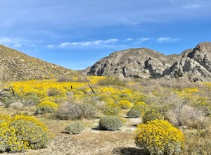
Indian Trail Loop at Pipe's Canyon
6.16 mi / 892 ft gainIndian Trail Loop at Pipe's Canyon is a loop trail where you may see beautiful wildflowers located near Pioneertown, California.Read more -
Apple Valley, California
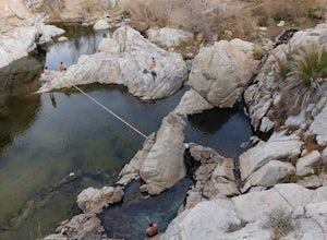
Deep Creek Hot Springs
4.23.64 mi / 948 ft gainDeep Creek Hot Springs is nestled along the Mojave River at an elevation of 3,000 feet in the San Bernardino Mountains. This year-round mineral water retreat consists of three pools the size of large hot tubs, that range in temperature from around 96 degrees in the first pool to 102 in the third....Read more -
San Bernardino County, California
Deep Creek Hot Springs via Bradford Ridge
4.04.75 mi / 1335 ft gainLocated in the San Bernardino National Forest and part of the Pacific Crest Trail, the Deep Creek Hot Springs are a relaxing site for those of us without access to a Jacuzzi. There are at least 4 pools of hot (not just warm) water that you can soak in with your fellow neighbor (who may or may not...Read more -
Pioneertown, California
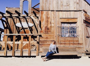
Visit Historic Pioneertown
Here in California we have a lot of desert to sift through. When trying to figure out how to navigate the mass, you have to know the places worth fighting the brutal heat or chilling cold. Pioneertown will lure you in regardless. You will see why as you make your way up the 4-mile winding road of...Read more -
Morongo Valley, California
Big Morongo Canyon Trail
11.65 mi / 1401 ft gainBig Morongo Canyon Trail is a loop trail where you may see wildflowers located near Morongo Valley, California.Read more -
Whitewater, California
Red Dome via Pacific Crest Trail
4.3 mi / 387 ft gainRed Dome via Pacific Crest Trail is an out and back trail that takes you by a lake located near Whitewater, CaliforniaRead more -
Whitewater, California
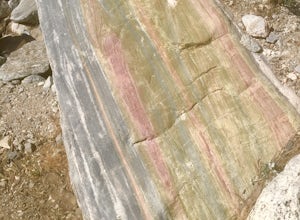
Rainbow Rock Canyon
6.3 mi / 1112 ft gainRainbow Rock Canyon is an out and back trail that takes you by a lake located near Whitewater, CaliforniaRead more -
9160 Whitewater Canyon Road, California
San Gorgonio Overlook via Pacific Crest Trail (Whitewater)
10.19 mi / 1775 ft gainSan Gorgonio Overlook via Pacific Crest Trail (Whitewater) is an out-and-back trail that takes you by a lake located near Whitewater, California.Read more -
9160 Whitewater Canyon Road, California
Pacific Crest Trail: Whitewater Preserve to Stone House
12.38 mi / 1588 ft gainPacific Crest Trail: Whitewater Preserve to Stone House is an out-and-back trail that takes you by a river located near Whitewater, California.Read more -
9160 Whitewater Canyon Road, California
Whitewater Ranger Station to Cottonwood TH via PCT
7.79 mi / 1421 ft gainWhitewater Ranger Station to Cottonwood TH via PCT is a point-to-point trail where you may see beautiful wildflowers located near Whitewater, California.Read more -
Cabazon, California
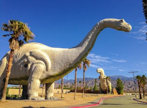
Check Out the Cabazon Dinosaurs
4.3For any fans of Pee-Wee’s Big Adventure or The Wizard, the Cabazon Dinosaurs are instantly recognizable. A roadside attraction off of Hwy 10 - 90 miles east of Los Angeles - the dinosaurs, heralded as the “World’s Biggest Dinosaurs", are a quick adventure.To get to the dinosaurs, you’ll travel on...Read more -
Crestline, California
Hike the Heart Rock Trail
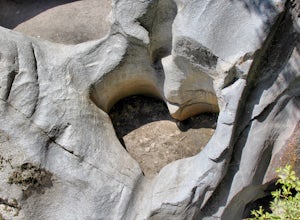
4.51.8 miThis short but nice hike near Crestline, CA in the San Bernadino Forest is one for the whole family. Although finding the trailhead/parking lot can be a bit confusing, it is definitely worth it. Driving in from the Inland Empire/LA Area, follow The Rim of the World Trail (SH18) until you see the...Read more -
Redlands, California
Run the Carriage Trail
3.52.5 mi / 300 ft gainThere is room to park just off San Timoteo Road. On the other side of the trail is more parking off Alessandro. You can park your car on either side and start your run/walk/bike ride. This is a nice little "get away" trail to take a break from suburbia.Read more

