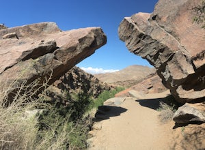
Big Bear, California
Big Bear, California is known as a top destination for outdoor adventurers. With its scenic mountains, lakes, and trails, it offers a variety of top activities and attractions. Hiking, fishing, and camping are popular options. For a unique experience, take a trip to the Alpine Slide at Magic Mountain, which is a luge-style cart ride down the mountain. For a more relaxing experience, visit Big Bear Lake to take in the views while kayaking or paddle boarding. If you’re looking for something more adventurous, explore the San Bernardino National Forest, where you can go mountain biking, rock climbing, and horseback riding. There are also plenty of must-visit attractions in the area, like the Big Bear Solar Observatory and the Big Bear Discovery Center. With so many activities and attractions, Big Bear, California is the perfect place to explore nature and have an unforgettable adventure.
Top Spots in and near Big Bear
-
Lytle Creek, California
Old CC Spur Trail via Big Tree Cucamonga Rd
5.11 mi / 1138 ft gainOld CC Spur Trail via Big Tree Cucamonga Rd is an out-and-back trail that takes you by a waterfall located near Fontana, California.Read more -
Palm Springs, California
Skyline Trail to Aerial Tramway Top Station
5.09.41 mi / 8238 ft gainSkyline Trail to Aerial Tramway Top Station is a point-to-point trail where you may see beautiful wildflowers located near Palm Springs, California.Read more -
Palm Springs, California
Museum Trail
1.52 mi / 860 ft gainThe Museum Trail is a very steep climb with a 1,000 feet elevation gain in just one mile but has some great views of downtown Palm Springs. The hike starts behind the Palm Springs Art Museum. This trail can also access the Cactus to Clouds Trail that goes all the way to the top of Mt. San Jacinto...Read more -
Riverside County, California
Hike the Covington Crest Trail
4.2 mi / 200 ft gainAccessing Covington Flats in Joshua Tree National Park requires a high ground-clearance overland vehicle. In the summer months a standard car might make it to the parking lot after the 7.5 mile off-road drive, but should always be prepared for soft sand. Bring spare water and emergency tools inca...Read more -
Joshua Tree, California
Joshua Tree West Side Trail
4.03.22 mi / 302 ft gainJoshua Tree West Side Trail is a loop trail where you may see beautiful wildflowers located near Twentynine Palms, California.Read more -
Mountain Center, California
Tahquitz Peak via Devils Slide Trail
5.08.31 mi / 2238 ft gainTahquitz Peak via Devils Slide Trail is a moderately trafficked 8+ mile out and back trail located near Idyllwild, California. This trail is one of the most popular hikes in the San Jacinto area that features a fire lookout tower at the peak and amazing views of the valley below. At an elevation...Read more -
Palm Springs, California
South Lykken Trail to Simonetta Kennett Viewpoint
3.66.45 mi / 1654 ft gainThe South Lykken Trail is the south half of the 9.5-mile Carl Lykken Trail, which weaves along a series of mountain ridges above downtown Palm Springs. Dogs are not permitted on this trail. This section of the trail runs 3.2 miles one-way. You will gain just over 1600ft of elevation at the high...Read more -
Mountain Center, California
Mount San Jacinto via Devil's Slide
4.514.57 mi / 4475 ft gainMt. San Jacinto is the second tallest peak in Southern California at 10,834’. Although this route requires a fair amount of work, the effort is more than rewarded by the expansive views, forest, meadows, and dramatic topography. You will need an Adventure Pass ($5/day) to park at Humber Park, as...Read more -
Palm Springs, California
South Carl Lykken Trail - North Section
3.42 mi / 1076 ft gainSouth Carl Lykken Trail - North Section is an out-and-back trail that takes you by a waterfall located near Palm Springs, California.Read more -
Riverside, California
Hike Mt. Rubidoux
4.32.7 mi / 500 ft gainFeaturing over 161 acres and over 3.5 miles of combined paved and dirt trails, Mount Rubidoux Park in Riverside, CA is a beautiful natural environment and adventure location. Although some say this is just a "hill", this Inland Empire gem offers a quick escape from the pace of city life. Just m...Read more -
Palm Springs, California
Araby and Berns Trail Loop
4.76 mi / 1293 ft gainAraby and Berns Trail Loop is a loop trail that takes you past scenic surroundings located near Palm Springs, California.Read more -
Palm Springs, California
Murray Hill via Araby Trail
5.08.85 mi / 2844 ft gainMurray Hill is the highest point in the surrounding trail system. You can access it from Araby Trail or anyone of the others in the area. It's about 9 miles round-trip and a healthy 2,850 vertical feet gain. From the top of the Shannon Trail bear right until you reach the Wildhorse Trailhead. Go...Read more -
Palm Springs, California
Araby Trail
4.58 mi / 1545 ft gainThis hike takes you up to Bob Hope’s massive mushroom shaped house. The neighborhood also includes a house where Steve McQueen lived and the Elrod House featured in the James Bond film “Diamonds are Forever”. It’s a fairly easy hike up to Bob’s but really climbs after you pass the estate. You c...Read more -
Palm Springs, California
Earl Henderson and Shannon Trail Loop
4.31 mi / 1257 ft gainThis is a short but sweet trail close to the Araby and Garstin Trails. Great views of Palm Springs and the San Jacinto Mountains. Parking area is off of Lansdale Street. From here, head down the Earl Henderson Trail and you will see where in connects with the Shannon Trail. You can choose to swit...Read more -
Palm Springs, California
Murray Hill Loop
8.16 mi / 2260 ft gainMurray Hill Loop is a loop trail that takes you past scenic surroundings located near Palm Springs, California.Read more -
Palm Springs, California
Andreas Canyon
5.01.03 mi / 154 ft gainAndreas Canyon in Indian Canyons is located very close to Palm Springs in the Agua Caliente band of Cahuilla Indians Reservation. It is one of the few places with abundant shade and running fresh water in an otherwise dry desert landscape. Enjoy a longer hike to a waterfall (Seven Falls) or stay ...Read more

