Temple Bar Marina, Arizona
Looking for the best photography in Temple Bar Marina? We've got you covered with the top trails, trips, hiking, backpacking, camping and more around Temple Bar Marina. The detailed guides, photos, and reviews are all submitted by the Outbound community.
Top Photography Spots in and near Temple Bar Marina
-
Mohave County, Arizona
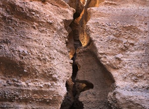
Spooky Slot Canyon
5.00.82 mi / 102 ft gain…Who doesn’t enjoy a little slot canyon fun, especially when it’s just off the highway. This (spooky) canyon is a fascinating slot canyon, consisting of conglomerate rock in the Lake Mead area in Arizona, not far southeast from the Hoover Dam. Most people don’t know even know this slot is here, s...Read more -
Willow Beach, Arizona
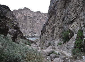
Canoe Black Canyon on the Colorado River
5.020 miThis 10-mile canoe trip starts at Willow Beach and reaches all the way to the Hoover Dam, giving you front row seats to beautiful canyon walls, waterfalls, hot springs, (sauna) caves, hiking trails, and much more. There are multiple campsites along the river but not all have pit toilets so bring ...Read more -
Willow Beach, Arizona
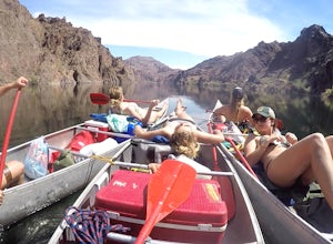
Canoe Camp from Willow Beach to Hoover Dam on the Colorado River
5.0First off, there is a lot of paddling involved...nothing too crazy, but just consistent. Most people start from the Hoover Dam and just float/ paddle down to the Arizona Hot Springs/ Camp and then finish at Willow Beach. But that also involves permits and you need to book it at least 6 months in ...Read more -
Clark County, Nevada
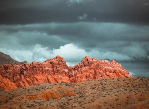
Hike the Bowl of Fire in the Muddy Mountains Wilderness
8 mi / 500 ft gainThe Bowl of Fire, tucked away in the Muddy Mountains Wilderness, is made up of the same dramatic conglomerate as that of the Valley of Fire, only almost no-one stops to visit as they blitz by on Northshore Road in the Lake Mead National Recreation Area.To get there take the Northshore Road 16 mil...Read more -
Boulder City, Nevada
Goldstrike Hot Springs
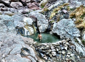
4.54.54 mi / 1293 ft gainThe first mile is flat and deceivingly easy as you walk under a highway bridge and in between looming canyon walls. But don't get too comfortable -- at around the 1.5 mile mark you will reach the first of eight ropes along the trail and the challenge begins. You will need to use these ropes to ...Read more -
Boulder City, Nevada
PWC Beach in Lake Mead National Recreation Area
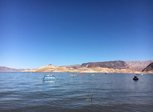
4.3This man-made lake on the Colorado River is underrated in my opinion. It has everything an outdoor enthusiast could want from scuba diving, hiking, horseback riding, all kinds of water sports, and plenty of camping options. This beach is near Boulder City. Use the Boulder City Entrance, g...Read more -
Boulder City, Nevada
Hike the Railroad Tunnel Trail
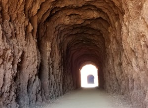
3.77.2 mi / 1332 ft gainThese tunnels were built to support the construction of the Hoover Dam. If you decide to go all the way to the dam, there is an elevator for accessibility along with stairs. This hike is relatively flat, and perfect for children - but mind the distance. Driving directions: From Las Vegas, NV, t...Read more -
Clark County, Nevada
Camp at Boxcar Cove
0 mi / 0 ft gainThe shoreline of "Lake" Mead is what you would expect of a large, man-made reservoir with fluctuating water levels (muddy & unpleasant), but that is not to say that the Lake Mead National Recreation Area is not filled with incredible places to explore (it is), and Boxcar Cove is a solid spot ...Read more -
Clark County, Nevada
Explore Elephant Rock, NV
4.3Elephant Rock is a beautiful red sandstone arch right at the West Entrance of Nevada's first state park, The Valley of Fire.Elephant Rock is easy to find. From I-15 take exit 75 and travel west. The exit is easy to find and there's an indian smoke shop and casino. If you forgot to get supplies yo...Read more -
Clark County, Nevada
Hiking Charlie's Spring in The Valley of Fire
6.7 miCharlie's Spring is a small oasis in the Valley of Fire State Park just outside of Las Vegas, Nevada. The unmarked trail is flat and follows a wash for 2.5 miles down dry sandstone waterfalls, a small slot canyon and ends in a small spring surrounded by cattails and bushes, a start contrast to th...Read more -
Boulder City, Nevada
Hike the Sunset View Trail
4.00.1 mi / 0 ft gainThe trail is .1 miles, and is perfect for all skill levels and for families who want to see some of the scenery in Lake Mead National Recreation Area. The trail is accessible year round and allows dogs.Read more -
Clark County, Nevada
Hike the Prospect Trail in the Valley of Fire
4.511 miComing from the adventure guide map you can buy at the Visitors Center, which you should do, they describe the Prospect Trail in the following:"Hikers and equestrians enjoy 5.5 miles of outback trail between Valley of Fire Highway and White Domes. Many work out the logistics of being picked up o...Read more -
Clark County, Nevada
Hike the Pinnacle Loop in the Valley of Fire
5.0Pinnacle Loop is an unmaintained poorly marked trail leading to a cluster of sandstone towers, hidden close to some of the more popular areas of the Valley of Fire like Atlatl Rock and a campground.Getting TherePinnacle Loop shares the same trailhead as the popular Atlatl Rock picnic area and pet...Read more -
Clark County, Nevada
Hike the Petroglyph Canyon Trail to the Mouse's Tank
0.8 mi / 25 ft gainStart the hike from the parking area for the Petroglyph Canyon Trail. The trail is not difficult to hike, but has deep sand in some places. There are very good views of the rock formations and of the desert vegetation and there are a couple of places where petroglyphs can be seen. The view at the...Read more -
Clark County, Nevada
Hike to Mouse's Tank in Valley of Fire State Park
5.01.5 miThis short hike takes you through a red sandstone canyon covered in beautiful Native American rock art. The incredible amount and concentration of petroglyphs on this hike make this a must-see in Valley of Fire State Park.There is a parking lot roughly one mile north of the visitor center where t...Read more -
Clark County, Nevada
Hike the Rainbow Vista Trail
5.01.1 mi / 95 ft gainStart the hike from the parking area. At the beginning, the trail is rather sandy. Further in, the trail gets easier and has wonderful views of the surrounding rocks and there is interesting desert vegetation. The colors in the rocks are incredible! This is one one the prettier hikes in the park.Read more

