Rio Verde, Arizona
Looking for the best hiking in Rio Verde? We've got you covered with the top trails, trips, hiking, backpacking, camping and more around Rio Verde. The detailed guides, photos, and reviews are all submitted by the Outbound community.
Top Hiking Spots in and near Rio Verde
-
Scottsdale, Arizona
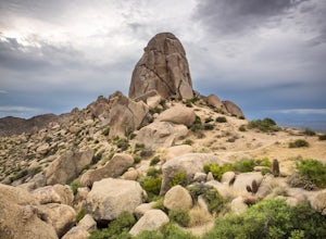
Tom's Thumb
4.33.98 mi / 1236 ft gainThe infamous “thumb” can be seen from most places in the valley – a white burst of rock jutting skyward out of the desert ridgeline. The new Tom’s Thumb Trailhead in 2012 has nice restrooms and offers tons of information about the surrounding rock climbing areas, day hikes and desert knowledg...Read more -
Scottsdale, Arizona
Marcus Landslide Trail
5.03.77 mi / 561 ft gainNamed after a landslide that scientists say occurred over 500,000 years ago, this interpretive hiking trail in the McDowell Sonoran Preserve is a perfect easy outing for families and nature lovers alike. It begins from the Tom's Thumb trailhead (shared parking lot), which is another beautiful hi...Read more -
Fountain Hills, Arizona
Hike the Dixie Mine Trail
2.05.5 mi / 591 ft gainThe MineDixie mine was established in 1877, when mining scouts noticed the large amount of quartz in the area. The Dixie Mine was sold many times throughout the 20th Century and was ruled no longer efficient in 1977 when it was sold to the McDowell Mountain Regional Park. The PetroglyphsThe area ...Read more -
Scottsdale, Arizona
Upper Ranch and Brown's Ranch Road Trail
3.98 mi / 154 ft gainUpper Ranch and Brown's Ranch Road Trail is a loop trail where you may see wildflowers located near Scottsdale, Arizona.Read more -
Scottsdale, Arizona
Sunrise Trail to Sunrise Peak
4.83.73 mi / 1037 ft gainSunrise Peak, also known as Sunrise Trail, is located at the residential foothills of the McDowell Mountains in Scottsdale, Arizona. The trail will start next to a residential neighborhood, but after about a quarter mile you'll be immersed in the pristine Sonoran Desert. The trail will lead you t...Read more -
Scottsdale, Arizona
Pinnacle Peak Trail
4.43.87 mi / 896 ft gainPinnacle Peak is a 3.8 mile out-and-back hike along a beautifully groomed trail with a moderate gain of ~1,000ft. This distinctive 600ft granite summit can be seen from most of the surrounding valley and offers spectacular views of the McDowell Mountains, iconic Four Peaks, Granite Mountain and t...Read more -
Scottsdale, Arizona
Gateway Loop
4.54.32 mi / 764 ft gainThe Gateway Trailhead is one access point into the McDowell Sonoran Conservancy in Scottsdale and is my favorite “Gateway” into the treasure trove of great trails and vistas in the McDowell Mountains. The Gateway Trailhead provides great accessibility for a quick hike or trail run at the end of t...Read more -
Scottsdale, Arizona
Hike Bell's Pass
7.3 mi / 1700 ft gainStarting at 1800 ft elevation, the trail begins at Gateway Loop. This part of the trail will start off pretty flat and be more crowded than Bell's Pass depending on the day and time you are hiking. If you enjoy running this would be the time to do it before you reach Bell's Pass and the incline i...Read more -
Fort McDowell, Arizona
Hike the Lower Salt River Nature Trail
2.52.4 miThis scenic loop offers views of Four Peaks, the Salt River & Verde River, and a desert landscape with plenty of wildlife. Keep an eye out for eagles, wild horses, and other wildlife while you're on the trail. This trail starts from the Phon D Sutton Recreation site, which is located at the...Read more -
Mesa, Arizona
Photograph the Salt River Wild Horses at Coon Bluff
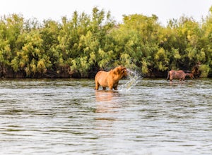
5.0Wild horses have roamed the banks of the lower Salt River since long before the Tonto National Forest was created in 1902. It is thought that these wild horses have descended from a herd brought to the area by a Spanish missionary in the 1600's. In 2015 the United States Forest Service had pu...Read more -
Maricopa County, Arizona
Hike the Goldfield Ovens Loop
7.5 mi / 575 ft gainA Tonto Day Pass is required for this hike as you will park your vehicle at the Blue Point Picnic Area. The trail starts North of the restrooms which are located at the backside of the parking lot. The trail takes you through a mesquite filled area alongside large rock faces. Be sure too look for...Read more -
Fort McDowell, Arizona
Hike Butcher Jones Trail Around Saguaro Lake
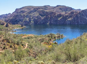
4.64 mi / 300 ft gainButcher Jones Recreational Area truly has a little bit of everything. However, the highlight of the area is the Butcher Jones Trail, a 4 mile out and back trail that is suitable for all skill levels. With minimal elevation gain and beautiful views, it can't be beat!The trailhead is located right ...Read more -
Apache Junction, Arizona
Hike the Wind Cave Trail
4.32.9 mi / 790 ft gainThis is a great trail for a run or for stretching your legs exploring the caves in Usery Mountain Regional Park. Keep in mind that the trail leads you up to the cave and is the end point. To get better views of the area, you'll have to climb up past the caves, where the trail is not marked.Read more -
Tonto Basin, Arizona
Hike to Brown's Peak
5.06 mi / 1957 ft gainStarting at the trailhead you will begin hiking through oak trees and forest. At numerous times throughout the hike Roosevelt Lake can be seen to the northwest. Approximately 3 miles into your hike you will reach a small campsite in the saddle of the mountain. This is your turnaround point if you...Read more -
Cave Creek, Arizona
Elephant Mountain Fortress Hike
5.05.5 mi / 867 ft gainThis hike beings at Spur Cross Ranch in Cave Creek, which is a lush riparian area flowing with Saguaros. Starting at the trailhead, you will start this loop by hiking clockwise on Tortuga trail which will connect with the Elephant Mountain trail at 1.5 miles. As you start to ascend the Elephant M...Read more -
Apache Junction, Arizona
Hike the Boulder Canyon Trail
4.010 mi / 1500 ft gainParking for the trailhead is actually in the same lot as the marina. There is a restaurant, campground, and restrooms all in the vicinity of the parking lot. The actual trailhead is on the other side of the street opposite the parking lot entrance road. The hike begins an uphill climb. In a c...Read more

