Prescott, Arizona
Top Spots in and near Prescott
-
Sedona, Arizona
Chapel Trail to Broken Arrow Trail to Mystic Trail Loop
3.77 mi / 446 ft gainChapel Trail to Broken Arrow Trail to Mystic Trail Loop is a loop trail that takes you by a river located near Sedona, Arizona.Read more -
Morristown, Arizona
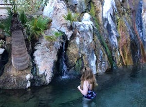
Experiencing Castle Hot Springs
The grounds of this location are absolutely incredible – food is amazing, and the hot springs are magical. Each hot spring boasts its own naturally occurring hybrid mix of minerals, which vary from place to place depending on the geology of the area. For the storied history of this location and ...Read more -
Morristown, Arizona
Hiking in Hells Canyon Wilderness
Spanning 9,951 acres of backcountry a few miles northwest of Lake Pleasant and about 25 miles north of Phoenix, Hells Canyon Wilderness area offers a quick way to escape into an untamed swath of desert that’s more paradise than purgatory.I have to say, this entire trail is 36.3 miles (and is tec...Read more -
Sedona, Arizona
Brins Mesa - Soldier Pass Loop
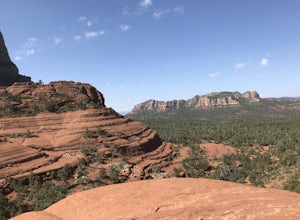
5.07.6 mi / 1040 ft gainThis loop starts from Vultee Arch Rd. Important to note that doing this loop from here requires a high clearance 4x4. In this direction, the trail starts off flat and crosses a dry creek bed several times. The trail is relatively easy to follow. This section passes through junipers that offer som...Read more -
Sedona, Arizona
Soldier's Pass Trail to Brins Mesa Trail
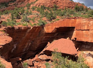
4.84.4 mi / 617 ft gainStarting at the trailhead is a parking lot for around 14 vehicles, arrive early in the morning if you want to be guaranteed a parking spot. Otherwise the hike starts off relatively easy with a quick stop at Devil's Kitchen; a big hole in the ground where a rock has now fallen in (see pictures). ...Read more -
Sedona, Arizona
Devils Kitchen
5.00.35 mi / 23 ft gainGreat spot for photos, and is at the beginning of one of the best trails in Sedona. The parking lot can get full easily, since this is a very popular trail. The sinkhole is close to the trailhead, but I encourage you to continue on down the Soldier’s Pass trail. As with all outdoor advent...Read more -
Sedona, Arizona
Broken Arrow Trail to Chapel of the Holy Cross
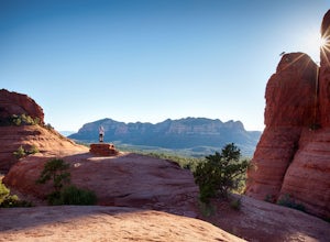
4.54.91 mi / 640 ft gainThe Broken Arrow Trail is stunning. To reach the Broken Arrow Trail from the town of Sedona, head south on 179-S for approximately 1.5 miles and turn left on Morgan Road. Drive down Morgan Road until you reach the end of the asphalt and it turns into a dirt road. Drive down the dirt road approx...Read more -
Sedona, Arizona
Broken Arrow Trail to Chicken Point
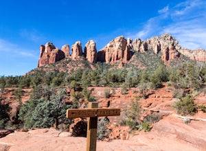
4.62.79 mi / 420 ft gainStart your hike at the Broken Arrow Trailhead, just .2 miles past the end of Morgan Rd. You will be immediately greeted by Sedona slickrock trails and red rock views for days! Take a minute to sneak a peek at Devil's Dining Room Sinkhole around 0.6 miles in. It has a sign and is just of to the ri...Read more -
Camp Verde, Arizona
The Bull Pen
5.01.87 mi / 92 ft gainThis trail starts at the end of Bullpen Rd and your adventure begins in beautiful thickets of trees and plants. The going is easy and the tempting sound of rushing water is on your right as you continue parallel to West Clear Creek. The trail will veer left up a rocky old service road but pay att...Read more -
Black Canyon City, Arizona
Explore Pueblo La Plata
0.25 miPueblo La Plata is the largest ancient Indian ruin in Agua Fria National Monument and dates back to before 1200 A.D. The ruin at one time had 80 to 90 rooms for living quarters. Now the sight seems like just a pile of rubble. However there is significant research continuing on the mesa of Agua Fr...Read more -
Sedona, Arizona
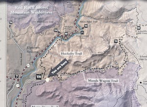
Huckaby Trail
4.05.95 mi / 797 ft gainHuckaby Trail is an out-and-back trail that takes you by a river located near Sedona, Arizona.Read more -
Williams, Arizona
Hike the Kelsey Spring/Hog Hill/Dorsey Spring Loop
13.4 mi / 2200 ft gainThis hike starts at the Kelsey Spring Trailhead. Park at the end of Forest Service Road 538G. There is parking for about 6-7 cars. Just past the signage for the trail, which is also called Kelsey Winter Trail, there is a trail registration box. Be sure to sign in. The trail descends steeply for t...Read more -
Sedona, Arizona
Wilson Mountain Trail
11.78 mi / 3051 ft gainWilson Mountain Trail is an out-and-back trail that takes you by a river located near Sedona, Arizona.Read more -
Sedona, Arizona
Hike to the Wilson Mountain Summit - South Overlook
4.59.5 mi / 2600 ft gainEver wanted to see Sedona from a bird’s eye view? Sure, you could spring for a helicopter tour. Or…you could hike Wilson Mountain Summit! No other location in Sedona will offer you a view that is so expansive and so breathtaking (and one where you are actually looking DOWN on the helicopters givi...Read more -
Sedona, Arizona
Fly Fish Oak Creek
4.0Oak Creek is spring fed from the upper reaches of Oak Creek Canyon. It flows into the Verde River and the upper sections provide for some excellent trout fishing. The trout is stocked from Page Springs Hatchery, below this area the water becomes to warm for trout to survive. While in the area, yo...Read more -
Yavapai County, Arizona
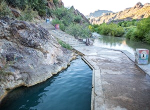
Verde Hot Springs
3.32.46 mi / 118 ft gainThe pools at the Verde Hot springs are the remnants from an old resort built in the 1920's. The resort was a once thriving tourist attraction and also rumored to be one of Al Capone's hideouts. In the 1960's a fire destroyed the resort only leaving behind the foundation and the thermal pools al...Read more

