Globe, Arizona
Looking for the best photography in Globe? We've got you covered with the top trails, trips, hiking, backpacking, camping and more around Globe. The detailed guides, photos, and reviews are all submitted by the Outbound community.
Top Photography Spots in and near Globe
-
Rogers Trough Trailhead, Arizona
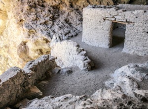
Hike Rogers Canyon Trail
5.08 mi / 1108 ft gainThe Superstition Wilderness is a vast rugged landscape where you can find the cultural remains of ancient Hohokam, Salado, Apache, and Yavapais tribes. Rogers Canyon Trail takes you to one of the most impressive and best preserved archaeological sites this region has to offer. These Salado ruin...Read more -
Superior, Arizona
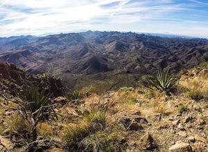
Hike Picketpost Mountain
4.74.4 mi / 2200 ft gainFrom the parking lot you will start out on the Arizona Trail until you reach the turn off to begin your accent up the mountain. This part of the trail isn't well maintained, and is a scramble, so be ready to use those hands. The trail is marked with cairns though and there is enough traffic tha...Read more -
Pinal County, Arizona
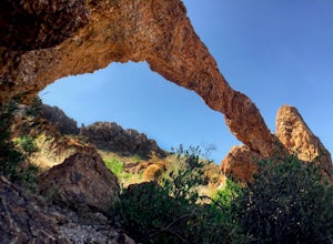
Photograph Elephant Arch
4.00.4 mi / 250 ft gain...For this very short stroll to Elephant Arch, I'd like to clarify that it's more of a sightseeing and/or photo opportunity trip than a hiking trip. It's so close that it can be seen from the side of the road. So just forewarning! Nonetheless, if you love natural wonders then it's a landmark you...Read more -
Roosevelt, Arizona
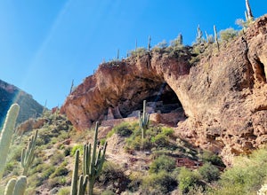
Visit Tonto National Monument
3.71.5 mi / 305 ft gainExplore two remarkably preserved American Indian cliff dwellings that date back to the 13th century. Set within a shelter bluff on the side of steep cliffs, the Upper and Lower Cliff Dwellings are well protected, and have great views of the surrounding Sonoran Desert. If you get to the park early...Read more -
Young, Arizona
Camping on Roosevelt Lake Overlook
5.0Stumbled upon this phenomenal spot while dual-sporting through the Sierra Ancha range.Turning off 188 the Globe-Young Highway winds down into a valley and crosses the Salt River before passing some small homesteads and farms. It then climbs into the foothills of the Sierra Ancha mountain range. A...Read more -
Gold Canyon, Arizona
Fremont Saddle via Peralta Canyon Trail
4.74.53 mi / 1378 ft gainAfter taking Peralta Road all the way to the end, park your car in the parking lot and you'll see the sign for the trail head. Sign in at the register and then begin our hike on Peralta Trail. This trail winds through the canyon and then takes you up switch backs until you reach the saddle. The ...Read more -
Gold Canyon, Arizona
Weavers Needle Loop
5.012.37 mi / 2608 ft gainThis is a difficult hike! Plan on a lot of time and an early start. I did this hike in a clockwise direction (Peralta Trail) which really doesn't matter much but I recommend the direction to get the steepest part of the hike done first. Most people just do an out and back hike to Freemont Saddle ...Read more -
Gold Canyon, Arizona
Bluff Springs Loop
4.014.55 mi / 2523 ft gainFrom the Peralta Trailhead, start hiking on Bluff Springs Trail. This trail will wind over a few hills past incredible views, and then take you down into a wash. In the wash you will intersect with the Terrapin Trail. Turn left onto the Terrapin Trail, and it will take you out of the wash and pa...Read more -
Gold Canyon, Arizona
Catch a Sunset at Three Sisters
5.0Three Sisters is a huge rock formation in the southern area of the Superstition Mountains. This spot is only about an hour outside of Phoenix and it's a great spot to do photography in the evening or morning.This is accessed from the Wave Cave parking lot on the way to the nearby Peralta Trailhe...Read more -
Gila County, Arizona
Cibecue Falls
4.32.94 mi / 600 ft gainThe Hike It’s a bumpy ride down an old dirt road to get to the trailhead to hike Cibecue Falls. Use extreme caution on this road as there are very narrow sections with sheer cliffs. The road follows along the Salt River giving you a nice viewpoint of the Salt River Canyon. On your way in, yo...Read more -
Winkelman, Arizona
Hike Aravaipa Canyon
5.08 mi / 200 ft gainWelcome to the beauty of wilderness and serenity! Within the boundaries of Aravaipa Canyon, you will not find any designated trails, campsites, or facilities. This canyon is one of Arizona’s hidden gems, and it is not mentioned in many travel books or in international travel magazines – yet. ...Read more -
Gold Canyon, Arizona
Hieroglyphic Trail
5.02.9 mi / 614 ft gainThis hike is a great beginner hike for those who want to experience the beauty of the Superstitions. I suggest going early in the morning because this trail gets very crowded later in the day (especially on weekends). To get to the trailhead from US60, turn north onto Kings Ranch Road where you ...Read more -
Gold Canyon, Arizona
Peak 5057 via Hieroglyphic Trail
5.07.45 mi / 3045 ft gainTo get to the trailhead from US60, turn north onto Kings Ranch Road where you will begin the winding path through the neighborhoods. From Kings Ranch Road, turn east on Baseline Ave, north on Mohican Road, west on Valley View Drive, north on Whitetail Road, and east on Cloudview Ave until it com...Read more -
Apache Junction, Arizona
Kayak Canyon Lake Reservoir
4.5Canyon Lake is located in a National Recreation Area. It was created by the damming of the Salt River, in Arizona, specifically by the Morman Flat Dam. The lake sits at an elevation of 1,660' and has a mean depth of 130', and an area of 1.484 mi². We launched our kayaks from the boat launch area ...Read more -
Apache Junction, Arizona
Hike the Dutchman's Second Canyon Loop
5.016 miTo get to the trail head, drive past Lost Dutchman State Park on the 88 and then take the dirt road (on your right) with arrows leading you to First Water Trail Head. There is an outhouse at the trailhead, so I suggest visiting it before you begin this hike. I also started this hike about an ho...Read more -
Apache Junction, Arizona
Hike Black Mesa Loop
4.59 miFrom First Water Trailhead, a short walk east brings you to the junction of the Dutchman trail and the Second Water trail. If you follow the Dutchman trail to the right you'll be heading southeast for a while, catching glimpses of Weaver's Needle in the distance. You can complete the loop going...Read more

