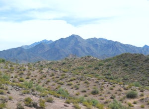
Apache Junction, Arizona
Looking for the best photography in Apache Junction? We've got you covered with the top trails, trips, hiking, backpacking, camping and more around Apache Junction. The detailed guides, photos, and reviews are all submitted by the Outbound community.
Top Photography Spots in and near Apache Junction
-
Phoenix, Arizona
Mojave Connector Trail #202
2.18 mi / 820 ft gainThe best starting point to access this hike is parking at the Mojave Picnic Area and heading up the Mojave Trail #200. At .4 miles, you will hit the junction and stating point for the Mojave Connector Trail. Head left at the saddle and begin a rapid ascent up switchbacks to a small flattened summ...Read more -
Phoenix, Arizona
Mojave Trail #200
4.51.88 mi / 430 ft gainThe entrance for the Piestewa Peak area is located at 2701 E. Squaw Peak Drive. The Mojave Picnic Area & Trailhead is the first parking area on the right. This is a very popular trail when the outside temps drop a bit so get there early for sunset hikes to ease parking. The trail begins on t...Read more -
Phoenix, Arizona
Freedom Trail Loop
5.03.8 mi / 1093 ft gainAs the third longest trail in the Phoenix Mountain Preserve, the Freedom Trail provides a great option for those looking for a longer hike, which can also be made even a bit longer by bolting on the Piestewa Summit hike along the way (adds 1.2 miles additional and a view from the top!). Many look...Read more -
Phoenix, Arizona
Piestewa Peak Summit
4.42.25 mi / 1050 ft gainPiestewa Peak, formerly known as Squaw Peak and conveniently located in the heart of the Phoenix metropolitan area, is a relatively short hike that yields impressive views of the city and is a perfect spot to watch the sunset. Piestewa Peak is a popular spot for locals who do not want to drive or...Read more -
Coolidge, Arizona
Explore Casa Grande Ruins National Monument
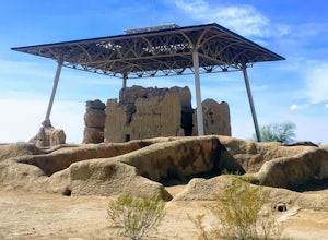
4.00.25 mi / 10 ft gainNo one really knows why the people from the Sonoran Desert built this mud skyscraper. Some scientists believe it was built as a astronomical observatory. What ever the reason, the Casa Grande Ruins National Monument is a engineering marvel that was built in the 1300's. People have been so puzzled...Read more -
Roosevelt, Arizona
Visit Tonto National Monument
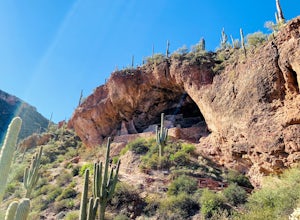
3.71.5 mi / 305 ft gainExplore two remarkably preserved American Indian cliff dwellings that date back to the 13th century. Set within a shelter bluff on the side of steep cliffs, the Upper and Lower Cliff Dwellings are well protected, and have great views of the surrounding Sonoran Desert. If you get to the park early...Read more -
Phoenix, Arizona
Hike Holbert Trail to Dobbins Lookout
4.04.1 mi / 1135 ft gainDobbins lookout is a popular high point in South Mountain Park that offers views of the entire Phoenix area. It's accessible by road or by trail with no entry fee. Consider going in the evening for the best views.If you plan to hike to the top, the shortest route is the Holbert trail. Take a l...Read more -
Phoenix, Arizona
North Mountain Trail
4.71.42 mi / 571 ft gainBeginning from the start of the trail on 7th Street, this short hike can be a good quick workout that offers great views of the greater Phoenix area. Be aware that this hike is a fairly steep climb 600 feet to the top. Once you reach the summit of North Mountain you'll find great views of the...Read more -
Phoenix, Arizona
Apache Wash Loop Trail
5.79 mi / 541 ft gainThis hike begins at the Apache Wash Trailhead where you will find restrooms and a covered rest area. This loop is simple to follow and offers various shortcuts along with an access to an optional summit climb. The loop begins from the north-east end of the parking lot near the restrooms. Turn l...Read more -
Cave Creek, Arizona
Hike the Go John Trail
5.05.6 mi / 804 ft gainAs you park at the trailhead, you have the option to take this trail in either direction. I recommend that you travel north, which will immediately provide 0.75 miles of elevation gain. You will then reach a pass with panoramic views of the Tonto National Forest. A bench in this area provides the...Read more -
Cave Creek, Arizona
Elephant Mountain Fortress Hike
5.05.5 mi / 867 ft gainThis hike beings at Spur Cross Ranch in Cave Creek, which is a lush riparian area flowing with Saguaros. Starting at the trailhead, you will start this loop by hiking clockwise on Tortuga trail which will connect with the Elephant Mountain trail at 1.5 miles. As you start to ascend the Elephant M...Read more -
Young, Arizona
Camping on Roosevelt Lake Overlook
5.0Stumbled upon this phenomenal spot while dual-sporting through the Sierra Ancha range.Turning off 188 the Globe-Young Highway winds down into a valley and crosses the Salt River before passing some small homesteads and farms. It then climbs into the foothills of the Sierra Ancha mountain range. A...Read more -
Glendale, Arizona
Run at Thunderbird Park
5.02 mi / 475 ft gainThis is a great spot to go for a quick run or a short hike if you're in North Phoenix. Thunderbird park is easily accessible with free entry and a number of picnic areas.There are 3 main hills with a variety of trail options to hike up/around each. From the top you'll find a nice view of valley...Read more -
Glendale, Arizona
Deem Hills Loop
3.55 miLocated in north Phoenix, the Deem Hills recreation area features a dog park, playground, soccer field, and trailhead leading into the neighboring hills. To begin your hike, get around the dog park by starting at the Circumference trailhead on the north side of the parking lot. To complete th...Read more -
Goodyear, Arizona
Hike Estrella Mountain's Baseline Trail
4.02.4 mi / 259 ft gainBaseline Trail is a 2.4 mile moderately trafficked loop trail. This trail features lovely wild flowers and is rated as intermediate. You can use this trail not just for hiking but you can also use the trail for running as well as mountain biking. On the trail you are allowed to bring your furry f...Read more

