Apache Junction, Arizona
Looking for the best photography in Apache Junction? We've got you covered with the top trails, trips, hiking, backpacking, camping and more around Apache Junction. The detailed guides, photos, and reviews are all submitted by the Outbound community.
Top Photography Spots in and near Apache Junction
-
Tonto Basin, Arizona
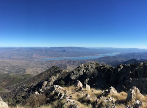
Hike to Brown's Peak
5.06 mi / 1957 ft gainStarting at the trailhead you will begin hiking through oak trees and forest. At numerous times throughout the hike Roosevelt Lake can be seen to the northwest. Approximately 3 miles into your hike you will reach a small campsite in the saddle of the mountain. This is your turnaround point if you...Read more -
Phoenix, Arizona
Hike the West Park Loop Trail in Papago Park
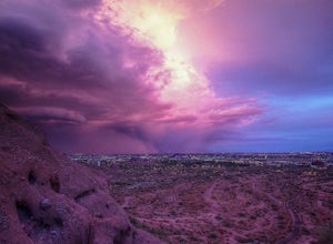
4.44 miThis trail begins from the parking lot on the west side of Galvin Parkway. To the east of the parking lot is a single track, dirt trail that heads north towards the big buttes. It continues counterclockwise around the big butte and heads south around the smaller butte. It continues west around th...Read more -
Superior, Arizona
Hike Picketpost Mountain
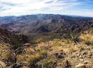
4.74.4 mi / 2200 ft gainFrom the parking lot you will start out on the Arizona Trail until you reach the turn off to begin your accent up the mountain. This part of the trail isn't well maintained, and is a scramble, so be ready to use those hands. The trail is marked with cairns though and there is enough traffic tha...Read more -
Scottsdale, Arizona
Gateway Loop
4.54.32 mi / 764 ft gainThe Gateway Trailhead is one access point into the McDowell Sonoran Conservancy in Scottsdale and is my favorite “Gateway” into the treasure trove of great trails and vistas in the McDowell Mountains. The Gateway Trailhead provides great accessibility for a quick hike or trail run at the end of t...Read more -
Scottsdale, Arizona
Marcus Landslide Trail
5.03.77 mi / 561 ft gainNamed after a landslide that scientists say occurred over 500,000 years ago, this interpretive hiking trail in the McDowell Sonoran Preserve is a perfect easy outing for families and nature lovers alike. It begins from the Tom's Thumb trailhead (shared parking lot), which is another beautiful hi...Read more -
Scottsdale, Arizona
Tom's Thumb
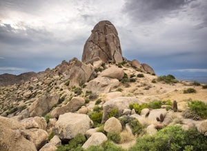
4.33.98 mi / 1236 ft gainThe infamous “thumb” can be seen from most places in the valley – a white burst of rock jutting skyward out of the desert ridgeline. The new Tom’s Thumb Trailhead in 2012 has nice restrooms and offers tons of information about the surrounding rock climbing areas, day hikes and desert knowledg...Read more -
Scottsdale, Arizona
Boulder the Unknown Handcrack near Tom's Thumb
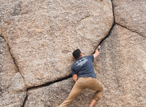
V-easy. 20 feet. Start on the Tom's Thumb Trail about .1 mi. Then take the Mesquite canyon trail left (SE) for .2mi. It will connect with the Feldspar trail. Turn left (E) and continue on until you see the climber access sign. Continue on the well marked trail towards the Girlie Man climbing area...Read more -
Scottsdale, Arizona
Climb Brusin' and Crusin' on Gardner's Wall
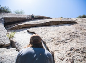
This is a 100 foot 5.8 trad climb. Access the Hanging Garden's climbing area off of the Tom's Thumb Trail. About half way up the trail you will see signage for "Rock Climbing Access Route." On the sign you will see an arrow pointing towards Gardner's Wall. This is the direction you want to take. ...Read more -
Scottsdale, Arizona
Climb Girlie Man Near Tom's Thumb
5.9+ 3 bolt slab. About 65ft. To get there you will start on the Tom's Thumb Trail for about .1 mi. Then take the Mesquite canyon trail left (SE) for .2mi. It will connect with the Feldspar trail. Turn left (E) and continue on until you see the climber access sign. Continue on the well marked tra...Read more -
Scottsdale, Arizona
Climb Hanging Garden's on Gardner's Wall
This is a 2 pitch 5.6 trad climb. About 130 feet in total. Access the Hanging Garden's climbing area off of the Tom's Thumb Trail. About half way up the trail you will see signage for "Rock Climbing Access Route." On the sign you will see an arrow pointing towards Gardner's Wall. This is the dire...Read more -
Scottsdale, Arizona
Climb Sphincter Boy Near Tom's Thumb
5.9 trad route. About 60ft. Can be set up as a Top Rope. To get there you will start on the Tom's Thumb Trail for about .1 mi. Then take the Mesquite canyon trail left (SE) for .2mi. It will connect with the Feldspar trail. Turn left (E) and continue on until you see the climber access sign. Cont...Read more -
Phoenix, Arizona
Hike Marcos de Niza Ridgeline / National Loop
5.02.8 mi / 640 ft gainThis is somewhat of a hidden gem in South Mountain Park, the largest municipal park in the United States, even though it's right there for all to see. The best way to take advantage of this trail is to attack the ridgeline with an intense hiking pace or trail run, connecting it to the National Tr...Read more -
Phoenix, Arizona
Echo Canyon Trail on Camelback Mountain
4.52.46 mi / 1214 ft gainIf you live near or around Phoenix, you know that Camelback Mountain is pretty hard to miss. Due to the mountain's height, this hike isn't exactly what you would call easy. There are two sides of the mountain you can hike, Echo Canyon and Cholla Trail. Echo Canyon is shorter, but still an extreme...Read more -
Phoenix, Arizona
Climb the Praying Monk
4.30.5 miPark at the Echo Canyon Parking Area.From the trailhead, hike up Echo trail until your reach the saddle. At the saddle, you will turn south and start taking the climbers trail to the headwall, which is just past the sign that says "caution, active bee area." Once you reach the headwall, there a...Read more -
Phoenix, Arizona
Quartz Ridge Trail
4.52.29 mi / 509 ft gainQuartz Ridge in the Phoenix Mountain Preserve (also known as Trail 8A) is a great escape getaway trail that can be done as a single track or combined with many intersecting trails. It is a very popular trail for hikers, trail runners, pet walkers, sky gawkers and more! The trailhead sits in a sm...Read more -
Scottsdale, Arizona
Pinnacle Peak Trail
4.43.87 mi / 896 ft gainPinnacle Peak is a 3.8 mile out-and-back hike along a beautifully groomed trail with a moderate gain of ~1,000ft. This distinctive 600ft granite summit can be seen from most of the surrounding valley and offers spectacular views of the McDowell Mountains, iconic Four Peaks, Granite Mountain and t...Read more

