John Morgan Harrison
Outdoor gear Product Developer and Designer, filling my free time with exploration and art.
Hike through Hurricane Creek Park
Tuscaloosa, Alabama
4.0
7 mi
/ 200 ft gain
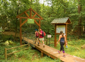
There are two access points to the park from the Parking lot area. The first is just up the road to the east of the top of the parking area, this is the trailhead to the exit portal trail, which is about .2 miles to reach the central hub. From the hub, there are two separate loops that wind through the park, with multiple offshoots and paths that lead down to swimming holes and small beaches al...
Bouldering at Moss Rock Preserve
Birmingham, Alabama
5.0
1 mi
/ -50 ft gain
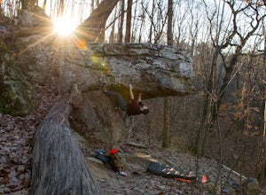
Moss Rock has abundant parking, and easy access to all climbing areas. There is no fee for use or facilities, however there are several small local restaurants and often times a food truck within walking distance of the parking lot.There are two major bouldering areas as well as hiking trails and a large waterfall and creek area.A map can be found here with problem ratingsThe rock at Moss Rock ...
Walls of Jericho via Alabama Trailhead
Estillfork, Alabama
4.5
5.8 mi
/ 1417 ft gain
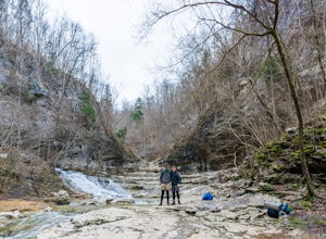
Around 5pm, we hiked down the only clearly marked trail that departs from the parking lot. The path begins with gentle switchbacks and great views of the forest, occasionally passing by small waterfalls, sinkholes, and caves; and arriving at the Hurricane Creek crossing (log with handrail) after about 2 miles. After the crossing, the terrain levels out, following Turkey Creek for 1.5 miles as t...
Hike to Ruffner Mountain's Hawk's View Overlook
Birmingham, Alabama
4.8
2 mi
/ 200 ft gain
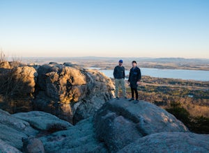
Park at the little league baseball fields that are across the road from the access point where the trail meets the road on the southeastern corner of the preserve that you can see on the map. Hike up a gentle incline NW on the Ridge and Valley Trail for about fifteen minutes to the trail intersection with the Possum Loop Trail, where you head left on Possum and follow the sign towards the overl...
Mountain Bike in Chewacla SP
Auburn, Alabama
5.0
27 mi
/ 1000 ft gain
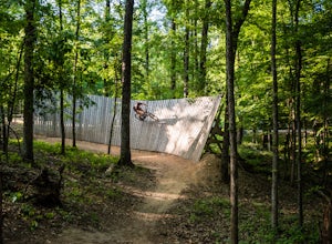
Few places in the southeast have as wide a range of mountain biking as CSP, which includes standard XC trails, a well groomed and extensive dirt jump area, flow trails, and a wicked feature area complete with a massive wall ride and Oregon-downhill-style 2x4 ramp features. Everything is ridable on a standard mountain bike, but drop that seat low (or off completely) for the dirt jumps! Also, cal...
Camp at Sand Rock
Leesburg, Alabama
5.0
1 mi
/ -100 ft gain
We camped in a rooftop tent, but many people used traditional tents and hammocks. After purchasing a camping permit, drive right up to your campsite. There are three general camping areas.First is the more exposed (to the often strong winds) campsites along the tops of the cliffs that are closest to the park office and facilities (covered tables, a very nice restroom, and a spigot) and have a g...
Take in the View from Bald Rock in Cheaha State Park
Delta, Alabama
3.5
1 mi
/ 1 ft gain
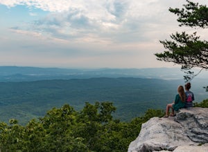
Bald Rock is maybe the most easily accessible views I have ever experienced. This is not to lessen the beauty of the location, but to convey that this spot is quite fool-proof, and can be enjoyed by literally anyone. However, I do recommend this view at sunrise during the summer because of how crowded it gets. I first checked it out when I was taking two inexperienced friends camping (was the f...
Visit the Coon Dog Cemetery
Tuscumbia, Alabama
5.0
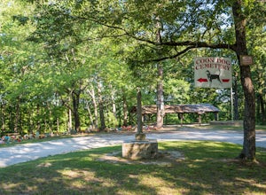
Located in "the middle of nowhere" the Coon Dog Cemetery is a great picnic spot for your road trip, on a scenic road that will let you bypass a portion of the bland interstate. There are a pair of outhouses but no running water, so bring your owner your picnic lunch. Although there are no Red Ferns growing over the markers, this place is definitely a special piece of Alabama heritage and the ai...
Canoe and Cliff Jump at Lake Nicol
Tuscaloosa, Alabama
4.0
1 mi
/ 40 ft gain
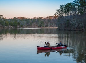
Lake Nicol has several miles of unofficial trails that circle the west bank of the lake which features up to forty foot cliffs that provide both cliff jumping and an excellent view of the lake. Lake Nicol also has a boat/kayak/canoe launch area right next to the parking area. Nicol is over three miles long, and with different inlets, cliffs, and an island to explore, there is plenty to do on th...
Community
© 2024 The Outbound Collective - Terms of Use - Privacy Policy

