Sechelt, British Columbia
Top Spots in and near Sechelt
-
Whistler, British Columbia
4.8
17.17 mi
/ 5289 ft gain
Take the Sea to Sky Highway (HWY 99) north from Vancouver up towards Whistler. Turn off the highway about 30 minutes before Whistler Village onto Daisy Lake Road. There are signs along the highway indicating the Garibaldi Lake turn off. The trailhead is located at the end of Daisy Lake Road. Ther...
Read more
-
Whistler, British Columbia
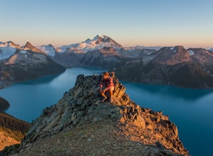
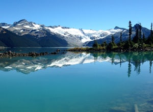
Garibaldi Lake is a huge basin of beautiful turquoise water measuring almost 10 square kilometers (2460 acres), and located at nearly 5000ft above sea level. The lake is over 800 feet deep, filled with pristine glacial water. You’ll be surrounded by big snowy mountains, which remain bright white ...
Read more
-
Whistler, British Columbia
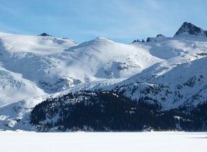
Exploring Garibaldi Park by snowshoe is an experience you'll never forget. There is nothing like being in a forest wilderness in the stillness of winter. There are lots of places to snowshoe in the Whistler area, but here are two of the most exciting (yes, snowshoeing can be exciting!) Cheakamus ...
Read more
-
Salt Spring Island, British Columbia
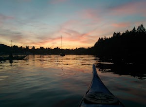
Salt spring island has plenty of amazing put in points for an afternoon of sea kayaking, but the ganges harbour is sheltered and easily accessible.For the put in points you have two options: The salt spring marina or churchill beach. Churchill beach would be the easier of the two with the added b...
Read more
-
Denman Island, British Columbia
Fillongley Park is located on Denman Island. To get there take the Denman Island Ferry from Buckley Bay, off Hwy #19A on central Vancouver Island. Take the Buckley Bay exit #101 from Hwy #19A. Once on the island, follow Denman Road to Swan Road. Turn left on Swan Road, then right on Beadnell Road...
Read more
-
Fanny Bay, British Columbia
4.3
3.84 mi
/ 515 ft gain
Starting at the Rosewall Creek Provincial Park parking lot you take the trail upstream of the creek passing under the inland island highway bridge. This trail eventually leads out of the provincial park boundary, but don't worry you haven't gone too far.
It is about a 7 km roundtrip hike and the...
Read more
-
Duncan, British Columbia
3.0
6.5 mi
/ 2473.8 ft gain
Mt Prevost is a local favourite for hikers, mountain bikers and if you can believe even hang gliders. Most people know it for the large war memorial tower that is perched on the cliff edge, standing guard over the valley below.The big draw of Mt Prevost is easy access to a significant distance an...
Read more
-
Port Alberni, British Columbia
The Hole in The Wall is located just outside the city of Port Alberni, British Columbia. The day hike is easy enough to bring kids on the adventure, is dog friendly and offers a beautiful view of some of Port Alberni's history. Previous to the 1960's, the Hole In The Wall was the opening for a pi...
Read more
-
Coquitlam, British Columbia
Important: if you are planning on bringing a dog, and they are skittish around loud noises make sure to keep them leashed. This trail is beside the gun club and can spook dogs. You stop hearing the guns once you reach the powerline roadTo reach the trailhead, follow Harper Road until you reach th...
Read more
-
Coquitlam, British Columbia
To reach the trailhead, follow Harper Road until you reach the Port Coquitlam Gun Club, then park along the side of the road. Walk past the yellow gate and take the first trail to your left. About 10 minutes down the trail, you will reach a gravel logging road. Take an immediate left down the pat...
Read more
-
Salt Spring Island, British Columbia
From Ganges head south on Fulford-ganes road toward Fulfrod harbour. Turn right on Dukes road then a right on Seymour Heights. Seymour Heights turns into a dirt road, with a number of pot holes but nothing a non 4x4 car can't handle. At the trail head there is a small turn around and not a ton of...
Read more
-
Whistler, British Columbia
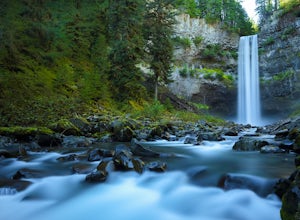
Brandywine Falls is a spectacular 70 metre waterfall. It is best seen from the viewpoint which also presents some marvelous views of Daisy Lake and the surrounding mountains. But you can also get to the bottom with a bit of scrambling down the side of the cliff.Brandywine Falls is located along t...
Read more
-
Surrey, British Columbia
Crescent beach is a great place to end your day, by taking some sunset pictures. It often lights up the sky and really pops with colour. It is best to park at the main parking lot near the pier and start from there. The beach walk from the pier to the end is just over a kilometre, so is very shor...
Read more
-
Mayne Island, British Columbia
The tiny island of Mayne is located in the chain of Gulf Islands just off the coast of Vancouver Island. For a small Island that can be biked across in a couple of hours, it offers some amazing views and photo opportunities. Mayne Island is just a stop away from Victoria and is located right abov...
Read more
-
Youbou, British Columbia
Heather Mountain is a moderate well marked out and back hike through managed forest land.
The hike brings a wonderful feeling of solitude as there are no towns or buildings visible even with distant views in all directions. It is also quite lightly tracked: we saw no other hikers on the entire r...
Read more
-
Alberni-Clayoquot F, British Columbia
I have lived on Vancouver Island my entire life yet I had never heard about this world class trail until last summer. A 24km point to point coastal trail that travels the length of the Alberni Inlet from the coast right to the town? Through paradise meadows, along sun drenched bluffs, past water...
Read more

