Port Renfrew, British Columbia
Looking for the best photography in Port Renfrew? We've got you covered with the top trails, trips, hiking, backpacking, camping and more around Port Renfrew. The detailed guides, photos, and reviews are all submitted by the Outbound community.
Top Photography Spots in and near Port Renfrew
-
Victoria, British Columbia
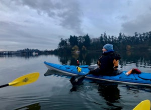
Paddle Victoria Harbour's Waterways
Victoria Harbor located on the southwestern tip of Vancouver Island, British Columbia is the southernmost port in Canada. Enjoying a moderate climate year round, one will quickly see why it is also known as Canada's busiest port. Pleasure boats, water taxis, large car and passenger ferries, tugbo...Read more -
Victoria, British Columbia
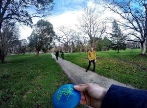
Beacon Hill Park
5.0Beacon Hill Park is the jewel of Victoria's crown. Spanning 200 acres and connecting Downtown to the ocean alongside Dallas Road, Beacon Hill Park is one of the highlights of visiting the Capitol city on Vancouver Islands southern tip. Every corner of the park features unique flora, fauna and p...Read more -
Port Angeles, Washington
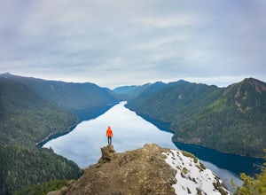
Mount Storm King
4.73.91 mi / 2251 ft gainThe trailhead is located right next to the Storm King ranger station adjacent to Lake Crescent right off Hwy 101 just past Port Angeles if heading West. It shares the same trail as, and breaks off left from the Marymere Falls trail (also worth seeing) about a quarter mile in (look for signage). ...Read more -
Port Angeles, Washington
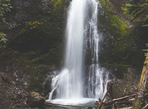
Marymere Falls
4.31.93 mi / 531 ft gainMarymere Falls (90 ft.) is located in Olympic National Park, near Lake Crescent. The falls can be accessed by a short, well-maintained dirt trail through old-growth lowland forest consisting of fir, cedar, hemlock, and alder trees. The creek descends from Aurora Ridge and tumbles over Marymere Fa...Read more -
Port Angeles, Washington
Ancient Groves
5.00.49 mi / 105 ft gainGreat little hike to explore while in the Sol Duc area. I would strongly recommend doing this hike near sunset as the sun will stream through the trees and light everything up in a beautiful glow. The hike will take you to a cliff edge to walk along and get views of the Sol Duc river below. Ver...Read more -
Nanaimo, British Columbia
Hike to Ammonite Falls
4.82.69 mi / 558 ft gainThe falls cascades off of a sheet of rock that is filled with Ammonite fossils, thus the name Ammonite Falls! The trailhead is very distinct and has a parking lot close to the start of the trail. From the Nanaimo Parkway (#19) head onto Jingle Pot Road. Follow that for a few kilometres and turn ...Read more -
Nanaimo, British Columbia
Catch a Sunset at Sugarloaf Mountain
You can easily put Sugarloaf Mountain Park into your GPS when in Nanaimo, but lets, just say you have an old school map. First make your way from the Island Highway onto Departure Bay Rd. Just before you get to Hammond Bay Rd turn onto Little John Way and take your first left, then take your firs...Read more -
Port Angeles, Washington
Run Ediz Hook "The Spit"
4.73 mi / 0 ft gainEdiz Hook or as locals call it, "the Spit" is a 3 mile long sand spit that extends out from Port Angeles along the Juan De Fuca. The views of the surrounding mountains and Vancouver Island, the marine life, beaches, and picnic areas make this a prime spot for a memorable run. We parked at the lo...Read more -
Alberni-Clayoquot A, British Columbia
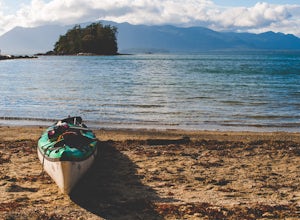
Kayaking the Broken Group Islands
The Broken Group Islands are an internationally acclaimed sea kayaking destination. They can only be done properly on a multi-day trip and it’s not recommended for novice paddlers. The stunning archipelago located on the west coast of Vancouver Island features hundreds of islands, lagoons, caves,...Read more -
Nanaimo, British Columbia
Scramble Down to Nanaimo's Hidden Cove
Firstly, use google maps to take you to Stephenson Rd in Nanaimo. About a mile down, the road forks, follow the left road (It says no exit, but the road just ends at a property so you will need to turn around to get back out). Continue down the road another half mile or so and you will see a smal...Read more -
Port Angeles, Washington
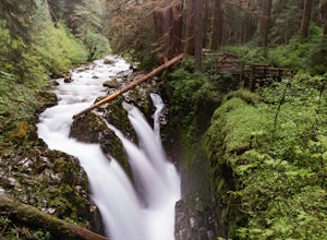
Sol Duc Falls and Deer Lake
4.67.17 mi / 1729 ft gainThe hike to Sol Duc Falls is a simple 0.8 mile walk to a roaring falls on the Sol Duc River. If you’re up for more of a hike, continue on the trail to Deer Lake from Sol Duc Falls. At the fork in the trail, turn left and hike up away from the Lover's Lane Trail. The trail steepens and the rocky ...Read more -
Port Angeles, Washington
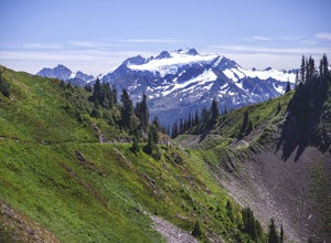
High Divide and 7 Lakes Basin
5.019.93 mi / 5056 ft gainA day spent plying the trails of the High Divide in Olympic National Park changes an outdoorsman. This moderate to strenuous loop boasts the best views on the peninsula, a chance to see foraging black bears and abundant deer, stunning waterfalls and marvelous old growth forests. By the time you f...Read more -
Friday Harbor, Washington
Hike to Lovers Leap on Stuart Island
5 mi / 200 ft gainThis hike is only doable if you are already on Stuart Island! There is no public transportation to Stuart Island, so you must already be there or have a plan to be there in order to complete this hike.I frequent this island during the summer months and it is one of my favorites. I always stay in ...Read more -
Port Angeles, Washington
Madison Falls
4.00.16 mi / 98 ft gainMadison Falls is at the end of a 200 foot paved pathway. It is approximately 60 feet tall and lingers in the midst of incredible lush forest. Enjoy it from a viewing point of up close and personal where you can see the greenest of moss growing up along the rocks.Read more -
Alberni-Clayoquot A, British Columbia
Hike to Keeha Beach
5.03.7 miFar on the west coast of Vancouver Island, accessed only by a harrowing dirt road, is a wild and rugged coast begging to be explored. Bamfield is about a 3 hour drive from Nanaimo, half of which is on the gnarliest (and most active) logging road I've ever been on - and I grew up driving on loggin...Read more -
Bamfield, British Columbia
Swing on the West Bamfield Rope Swing
5.0On the island of West Bamfield, accessible only by foot and by taking a ferry from East Bamfield, itself only accessible via a 60 mile brutal dirt road from Port Alberni, is a taste of the free-wheeling, regulations-be-damned old-Vancouver-Island-made-manifest in an epic rope swing that hurls its...Read more

