Port Renfrew, British Columbia
Looking for the best photography in Port Renfrew? We've got you covered with the top trails, trips, hiking, backpacking, camping and more around Port Renfrew. The detailed guides, photos, and reviews are all submitted by the Outbound community.
Top Photography Spots in and near Port Renfrew
-
Port Renfrew, British Columbia
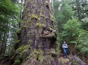
Hike to the Red Creek Fir
I’m blessed with a husband who is crazy enough to agree to my endless adventures! When I suggested we go find the tallest Douglas Fir Tree in the world, and we happened to be in the area, my husband again said, “why not!”For anyone who just has to see it for themselves, here’s some directions:Fo...Read more -
Port Renfrew, British Columbia
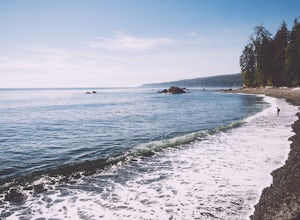
Camp and Surf at Sombrio Beach
5.01 miHeading west from Victoria, take the TransCanada Highway to Hwy 14. Continue past Sooke towards Port Renfrew. Look for the sign that reads Sombrio Beach Trailhead (approximately 45 minutes past Sooke) and take the left. Note that this dirt road can be incredibly rugged (aka full of potholes) and ...Read more -
Port Renfrew, British Columbia
Hike the Botanical Beach and Botany Bay Loop
2.2 miThe loop trail is a short 3.5km trail that is well maintained and open year round. There's negligible elevation gain and aside from the odd slippery section the trail is easily accessible for all ages and skill levels. It is definitely busy in the Spring and Summer months but is manageable in the...Read more -
Port Renfrew, British Columbia
Hiking the Juan de Fuca Marine Trail
5.029.2 miThis is no walk on the beach. There are many ascents and descents that range from not so steep to hold on for your life as the mud cliff crumbles steep. You might think 200m of elevation gain isn't much, but it is a constant ascend and descend trail in the moderate-difficult sections.A high level...Read more -
Port Renfrew, British Columbia
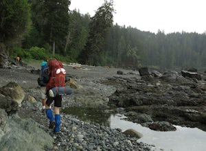
Backpacking the West Coast Trail
5.0The trail requires a permit from May 1 - September 16. All other dates have restrictions. Check Parks Canada website for more details.You can start from the north or south end of the trail. There are buses provided by the Pacific Rim National Park that will shuttle you back to your car or to the ...Read more -
Port Renfrew, British Columbia
Hiking through the Avatar Grove
To get to the Avatar Grove, drive to Port Renfrew along West Coast highway 14. Turn right onto Deering Rd and cross the long bridge over the San Juan River. Stay right at the next Y intersection, and then left at the T intersection. At the next Y keep left and cross a tall bridge over the crys...Read more -
Port Renfrew, British Columbia
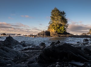
Explore Botanical Beach
5.01 miThis is a gorgeous beach with so much going on. It's a quick walk from the parking lot (about .8 miles), or you can do the entire Botanical Beach Loop which is 3.5km. Go at low tide for amazing tidal pools and exploring caves if the tide is at its lowest. You can beach hop and climb up to some...Read more -
Shirley, British Columbia
Beach Day at Sandcut Beach
The adventure begins during the rugged wooded hike from the gravel parking lot to the stunning beach (10 minutes). Once you reach the stone and pebble beach, plant yourself down to enjoy the 180 degree view of the Juan de Fuca Strait (and a picnic lunch if you’ve come prepared!).Head east to find...Read more -
Honeymoon Bay, British Columbia
Hike Castle Grove of the Upper Walbran River Valley
3.2 miThe opportunity to travel deep into a region where ancient forests still stand, telling their story of centuries past, can't be overlooked. One of the last remaining areas of such beauty and rarity still exists deep in the heart of the southern interior on Vancouver Island. This spot is known as ...Read more -
Duncan, British Columbia
Explore the Kinsol Trestle
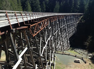
4.01.6 miThe Kinsol Trestle is a highlight of the Cowichan Valley Trail, which travels from Shawnigan Lake to Lake Cowichan and then onward to Duncan. The trestle is easily reached via a 1.3km, wheelchair accessible section of the CVT from the trailhead on Renfew Road. Originally built in 1911 for the r...Read more -
Sooke, British Columbia
Hike and Swim at Sooke Potholes
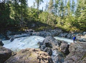
4.2The Sooke Potholes seem to have something for everyone. Those seeking quick and easy beach access can enjoy short, well-groomed trails that lead straight to the pebble beaches from each of this spot’s multiple parking lots. There are also a number of paths leading to viewpoints overlooking the ri...Read more -
Duncan, British Columbia
Hike Mount Prevost
3.06.5 mi / 2473.8 ft gainMt Prevost is a local favourite for hikers, mountain bikers and if you can believe even hang gliders. Most people know it for the large war memorial tower that is perched on the cliff edge, standing guard over the valley below.The big draw of Mt Prevost is easy access to a significant distance an...Read more -
Sooke, British Columbia
Hike Mount Manuel Quimper
The Sooke Hills is a geographic region of low hills with elevations between 350m (Mt. Wells) to a high of 682m (Mt. Empress), located in the area bounded on three sides by Highway 1 to the east, Highway 14 to the south and the Sooke River to the west. Though heavily logged 100+ years ago, in the ...Read more -
Sooke, British Columbia
Hike Whiffin Spit
1.5 mi / 0 ft gainLocated in Sooke, between the Sooke Harbour and the Juan de Fuca Strait is Whiffin Spit Park. An easy 2.4km out and back trail with minimal elevation gain that you can walk to the end and back in about an hour. The dog-friendly gravel trail takes you down the spit to the end where you will find a...Read more -
Neah Bay, Washington
Hobuck Beach
4.0Cape Flattery, the most northwesterly point of the lower contiguous 48 states is accessed via an easy trail which includes many board walks and sets of stairs. Maintained by the Makah Tribe of Indains, the trail provides spectacular views of the Pacific Ocean, Tatoosh Island, nearby rocky cliffs...Read more -
Neah Bay, Washington
Cape Flattery
4.62.09 mi / 528 ft gainDid you know that Cape Flattery is the northwesternmost point in the continental United States? This is the place where the Straight of Juan de Fuca collides with the Pacific, creating strong currents and loud crashing waves. This short and accessible hike leads you through a forest to an unfor...Read more

