Parksville, British Columbia
Looking for the best hiking in Parksville? We've got you covered with the top trails, trips, hiking, backpacking, camping and more around Parksville. The detailed guides, photos, and reviews are all submitted by the Outbound community.
Top Hiking Spots in and near Parksville
-
Denman Island, British Columbia
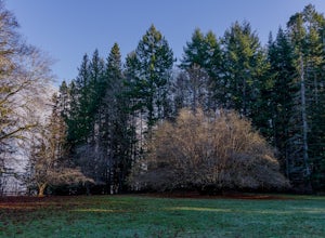
Explore Fillongley Provincial Park
4.01.6 mi / 60 ft gainFillongley Park is located on Denman Island. To get there take the Denman Island Ferry from Buckley Bay, off Hwy #19A on central Vancouver Island. Take the Buckley Bay exit #101 from Hwy #19A. Once on the island, follow Denman Road to Swan Road. Turn left on Swan Road, then right on Beadnell Road...Read more -
Youbou, British Columbia
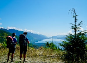
Hike Heather Mountain
20.5 mi / 3822.2 ft gainHeather Mountain is a moderate well marked out and back hike through managed forest land. The hike brings a wonderful feeling of solitude as there are no towns or buildings visible even with distant views in all directions. It is also quite lightly tracked: we saw no other hikers on the entire r...Read more -
Fanny Bay, British Columbia
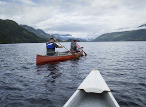
Canoe Great Central Lake and Hike to Della Falls and Love Lake
80.8 mi / 1148.3 ft gainTo get the the Della Falls trail head in Strathcona Park, you must cross Great Central Lake. This is a 45 km journey via either canoe, kayak, or speedboat. We chose to canoe, and it took approximately 9 steady hours. We parked our vehicles just on the edge of Central Lake Road across from Great C...Read more -
Powell River, British Columbia
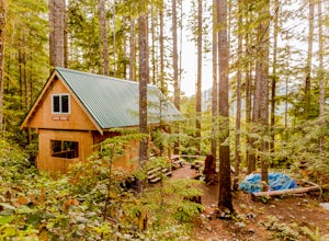
Backcountry Hike and Hut Camp the Northern Portion of the Sunshine Coast Trail
31.1 mi / 3937 ft gainThis adventure is a 50km backcountry hiking and camping trip and should not be attempted without prior backcountry experience. It is recommended you attempt this trail in a group. Below is a detailed description of how to get to the trail and your options for huts while on the trail:The Sunshin...Read more -
Comox, British Columbia
Run at Goose Spit Regional Park
5.0For a mid week adventure that is closer to home, nothing beats a climb up the stairs at Goose Spit Regional Park. The Goose Spit stairs are a fantastic addition to the Comox Valley's urban playgrounds, beaches, trails and green spaces. There are 165 steps to the main lookout, with an additional 2...Read more -
Bowen Island, British Columbia
Hike Mount Gardner on Bowen Island
10.6 mi / 2358.9 ft gainMount Gardner is the highest point on Bowen Island. I love visiting Bowen. It is a 20 minute ferry ride from Horseshoe Bay but feels a world’s away from the city. I climbed to the top of Mount Gardner a few years ago during the summer, but had yet to do it in the winter. I was excited to see wha...Read more -
Duncan, British Columbia
Hike Mount Prevost
3.06.5 mi / 2473.8 ft gainMt Prevost is a local favourite for hikers, mountain bikers and if you can believe even hang gliders. Most people know it for the large war memorial tower that is perched on the cliff edge, standing guard over the valley below.The big draw of Mt Prevost is easy access to a significant distance an...Read more -
Duncan, British Columbia
Mountain Bike Maple Mountain
The Maple Mountain trail network has been enjoyed for countless years by hikers, but not until recently did the mountain receive the attention it deserved for mountain biking. Over the last few years the Cowichan Trail Stewardship Society in conjunction with the approval of the local municipality...Read more -
Comox-Strathcona C, British Columbia
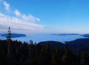
Hike Mount Becher
Trail access begins at the end of Forbidden Plateau Road, at the site of the old abandoned ski lodge. It is an ugly place to begin a hike to such a beautiful summit, but do not let that deter you. Past the trash of forest parties, around the remnants of the old ski lodge and over the washed out r...Read more -
West Vancouver, British Columbia
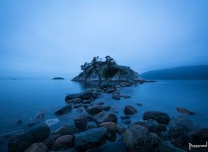
Explore WhyteCliff Park, West Vancouver
4.4Escape to the vanishing horizon of the Pacific Ocean, where time is measured by the rhythm of waves.Located near West Vancouver's Horseshoe Bay neighbourhood, Whytecliff Park is home to more than 200 marine animal species and is one of the first Marine Protected Areas in Canada. You're almost gua...Read more -
Comox-Strathcona C, British Columbia
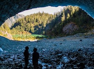
Century Sam Lake
4.03.62 mi / 1342 ft gainThe next time you have the opportunity, I recommend you pay Century Sam Lake a visit. This short day hike complete with a spectacular emerald green lake, towering rock cliffs and summer snow caves make this a 'must do' for mid Island adventurers. This day hike is a well kept secret – and often...Read more -
West Vancouver, British Columbia
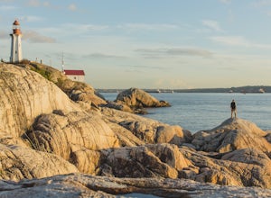
Explore Lighthouse Park
4.5To get to Lighthouse Park, head westbound along Marine Drive in West Vancouver. As Marine Drive continues past little shops and businesses, it will begin to narrow and the road will wind around the coastline. Continue past Caufield Cove Marina and watch for the Lighthouse Park sign on your left. ...Read more -
Alberni-Clayoquot D, British Columbia
Climb Triple Peak
4.05.6 mi / 3149.6 ft gainAccess to Triple Peak mountain is found via the Marion Creek Main logging road approximately 48km west of Port Alberni on your left hand side along highway #4 headed towards Tofino. The road can present seasonal challenges and is rough so best to have a high clearance and 4x4 capable vehicle if p...Read more -
Honeymoon Bay, British Columbia
Hike Castle Grove of the Upper Walbran River Valley
3.2 miThe opportunity to travel deep into a region where ancient forests still stand, telling their story of centuries past, can't be overlooked. One of the last remaining areas of such beauty and rarity still exists deep in the heart of the southern interior on Vancouver Island. This spot is known as ...Read more -
West Vancouver, British Columbia
Hike to Cypress Falls in West Vancouver
4.03.1 mi / 400 ft gainDrive the the end of Woodgreen Pl in West Vancouver, and you will pass the tennis courts on your right. You will see a little dirt road that heads up into the woods on your left - drive up this road ~30 feet into the parking lot. From the Parking lot, hike up the trail beside cypress creek (this ...Read more -
Port Renfrew, British Columbia
Hiking through the Avatar Grove
To get to the Avatar Grove, drive to Port Renfrew along West Coast highway 14. Turn right onto Deering Rd and cross the long bridge over the San Juan River. Stay right at the next Y intersection, and then left at the T intersection. At the next Y keep left and cross a tall bridge over the crys...Read more

