Mission, British Columbia
Top Spots in and near Mission
-
North Vancouver, British Columbia
4.5
5.5 mi
/ 1476 ft gain
This trip is best done in a 3-5 hour window. The trail meanders up past several peaks until you reach the summit and a panoramic view of Vancouver and the mountains.Start at the Mount Seymour Parking Lot, walk uphill and follow the trail to the left of the ski hill until you get to the the trail ...
Read more
-
North Vancouver, British Columbia
A perfect way to get outside before or after work. Dog mountain is an easily accessible snowshoe trail that takes you up to the short peak from the Mt. Seymour parking lot. This is a perfect spot for sunrise or sunset photography, and you can catch great 360 views from the top. Start at the BC Pa...
Read more
-
North Vancouver, British Columbia
The trail begins in the furthest northwest corner of the parking lot, by a big trail map. The start of the trail is gradual and meanders through the forest. The trail then begins to become more technical and requires scrambling over rocks and up areas with roots. Although this hike has minimal ga...
Read more
-
North Vancouver, British Columbia
4.0
3.1 mi
/ 492.1 ft gain
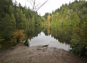
From the Mt. Seymour ski area parking lot, head towards the Mystery Peak Express. Once you have passed the base of the Mystery Peak Express, you will continue up the trail to your left (right goes to dog mountain, straight to the 3 peaks of Seymour). Follow the trail all the way up to the lake. T...
Read more
-
Whatcom County, Washington
4.7
13.4 mi
/ 4902 ft gain
The best way to describe the location is due east of Bellingham. After driving through gorgeous roads to reach Twin Lakes Road (fire service road 3065), you are treated to about a 4-mile drive up to the trailhead for Yellow Aster Butte (8.3 miles RT with 2850' of gain) and Tomyhoi Peak. The drive...
Read more
-
Whatcom County, Washington
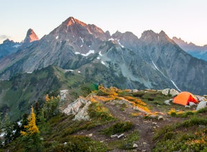
Yellow Aster Butte has to be one of the most visually rewarding hikes in the Mt. Baker-Snoqualmie National Forest for the effort required to get there. Abundant with lush, rolling mountain meadows, hikers can be treated to an abundance of wildflowers, heather fields, and berry patches with dreamy...
Read more
-
North Vancouver, British Columbia
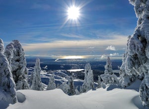
You'll see traction of all sorts in the Mt. Seymour area during Winter months, including: yak tracks, microspikes, crampons, snowshoes, skis (with and without skins), and my personal favourite, the magic carpet.The Mt. Seymour trail parallels the Seymour downhill ski area. It follows up and over...
Read more
-
Fraser Valley D, British Columbia
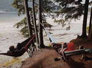
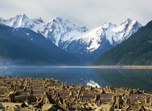
Southwest of Hope and just east of Chilliwack, Jones Lake is a recreation site at a reservoir lake in the coastal mountain range, managed by BC Hydro. Set below granite mountain peaks and surrounded by a dense forest (that is unfortunately being logged), this lake isn't pristine, but it sure is p...
Read more
-
Fraser Valley D, British Columbia
Jones Lake Reservoir is approximately 25 km southwest of the town of Hope, British Columbia. Directly off of BC Highway #1 at the community of Laidlaw. To reach the lake, you will have to drive 9 km (5.6 mi.) on a steep and pretty beat up gravel road. The Jones Lake Forest Service Road is car ac...
Read more
-
Whatcom County, Washington
Despite this trip report being titled "to Winchester Mountain", the fun doesn’t stop there. Even though Winchester Mountain is the most popular summer hike departing from Twin Lakes, this whole area turns into a fun-zone during the winter.Upon reaching higher ground above the lakes, this zone off...
Read more
-
Whatcom County, Washington
4.8
3.28 mi
/ 1335 ft gain
Winchester Mountain is said to have the greatest reward for least amount of effort in all the North Cascades. One of the last fire-lookouts in the region stands on the summit. Views from the summit of Winchester Mountain are beautiful and dramatic to say the least. Being one of the easiest hikes...
Read more
-
Bellingham, Washington
Take Chuckanut Drive to the trailhead which is located directly across from the entrance to Larrabee State Park. A small lot in front of the trail has space for 8-10 cars, or you can park at the State Park and walk across the road (carefully!) to reach the trailhead. Either way you will need a Di...
Read more
-
North Vancouver, British Columbia
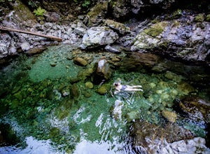
From the last field at inter city park, continue walking down the road to the Lynn Canyon trail. Follow the trail up the wooden boardwalks and to the first open area on the trail. When you can see the creek to your left, head down to the creek. To get to this particular swimming hole, you will ha...
Read more
-
North Vancouver, British Columbia
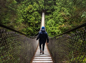
Lynn Canyon Suspension Bridge spans Lynn Canyon and is located near the popular Lynn Headwaters Park. To get there, exit the Trans Canada Highway onto Lynn Valley Road. Shortly after passing through the centre of the Lynn Valley community, turn right onto Peters Rd. This road will turn into "P...
Read more
-
North Vancouver, British Columbia
Head over to the Lower Seymour Conservation Reserve and hop on your two-wheeler to enjoy this stunning 20k ride.
Your ride will begin at the trailhead, where hikers walk off to rice lake. Stay off to the right, where there is an obvious bike path (2 paved lanes). This trail will take you ~11kms ...
Read more
-
Deming, Washington
Arrive at the upper ski resort parking lot (approx. 4300 feet elev.) and snowshoe, skin, or split board up. Make your way toward Artist Point and eventually Huntoon Point, gaining approximately 1500 feet of elevation over approximately 3 miles (one way). Past Huntoon Point, there are several grea...
Read more

