Comox-Strathcona D, British Columbia
Top Spots in and near Comox-Strathcona D
-
Comox-Strathcona D, British Columbia
5.0
7.5 mi
/ 2132.5 ft gain
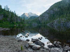
Driving: From Campbell River, take Highway 28 West to the bridge over Upper Campbell Lake/Buttle Lake. Do not cross the bridge, but take the road down the East side of Buttle Lake. Follow Buttle Lake road south to Jim Mitchell Lake road which is on the left just after the Thelwood Creek Bridge. ...
Read more
-
Comox-Strathcona D, British Columbia
5.0
1.2 mi
/ 131.2 ft gain
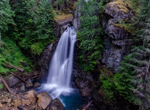
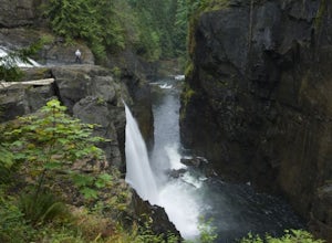
This waterfall is a pretty stellar sight. Located in one part of Strathcona Provincial Park, it plunges about 90 feet from a small slot canyon into a wide deep canyon. From the view point you can feel the mist from the waterfall on your face. For a different perspective, there is a small trail ju...
Read more
-
Comox-Strathcona C, British Columbia
4.0
3.62 mi
/ 1342 ft gain
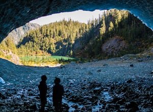
The next time you have the opportunity, I recommend you pay Century Sam Lake a visit. This short day hike complete with a spectacular emerald green lake, towering rock cliffs and summer snow caves make this a 'must do' for mid Island adventurers.
This day hike is a well kept secret – and often...
Read more
-
Comox-Strathcona D, British Columbia
5.0
9.23 mi
/ 5512 ft gain
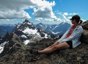
Our trip, as pictured, was completed as a single-day trail run / hustle. The climb is typically done, however, as a weekend trip with a camp either in the lower meadow, along the ridge leading to the Queen's Face or in the upper cirque.
As for climbs in the Island Alpine, for detailed route desc...
Read more
-
Comox-Strathcona D, British Columbia
The Elk River Trail is one of the most popular destinations in Strathcona Provincial Park and for good reason. Not only is this one of the only trails in the Park that doesn't go 'straight up' a mountain, but it also takes you to one of the most beautiful spots on all of Vancouver Island. The E...
Read more
-
Comox-Strathcona C, British Columbia
Trail access begins at the end of Forbidden Plateau Road, at the site of the old abandoned ski lodge. It is an ugly place to begin a hike to such a beautiful summit, but do not let that deter you. Past the trash of forest parties, around the remnants of the old ski lodge and over the washed out r...
Read more
-
Black Creek, British Columbia
Seaview Game Farm, located on Vancouver Island between Courtenay and Campbell River is a prime jumping off point to paddle the Strait of Georgia and check out some of the best beaches the coast has to offer. Located right on the beachfront, Seaview offers camping at RV sites but, for the best ex...
Read more
-
Campbell River, British Columbia
Once you park, you'll walk along the tracks roughly northeast-ish and then cross over the tacks. The trail marker is shown at the parking lot to the falls, where you can enjoy some wooden carvings. When you head out on the trail, continue straight. You will come to a gravel road used for construc...
Read more
-
Courtenay, British Columbia
Mixing of sea and river waters at the Courtenay River Estuary means its an abundant place for wildlife. Coupled with incredible views of the Comox Glacier to the west, it's no wonder this is a popular spot to paddle in the small island town of Courtenay.
Head over to Comox Valley Kayaks and Cano...
Read more
-
Heriot Bay, British Columbia
Sayward Lakes Canoe Route
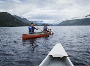
This is an easy canoe route through a series of lakes west of Campbell River on Vancouver Island BC. It is ideal for beginner or intermediate level trippers, providing a good multi-day trip through a mix of remote lakes and lakes with serviced campsites. The trip feature...
Read more
-
Comox, British Columbia
For a mid week adventure that is closer to home, nothing beats a climb up the stairs at Goose Spit Regional Park. The Goose Spit stairs are a fantastic addition to the Comox Valley's urban playgrounds, beaches, trails and green spaces. There are 165 steps to the main lookout, with an additional 2...
Read more
-
Alberni-Clayoquot D, British Columbia
4.0
5.6 mi
/ 3149.6 ft gain
Access to Triple Peak mountain is found via the Marion Creek Main logging road approximately 48km west of Port Alberni on your left hand side along highway #4 headed towards Tofino. The road can present seasonal challenges and is rough so best to have a high clearance and 4x4 capable vehicle if p...
Read more
-
Fanny Bay, British Columbia
To get the the Della Falls trail head in Strathcona Park, you must cross Great Central Lake. This is a 45 km journey via either canoe, kayak, or speedboat. We chose to canoe, and it took approximately 9 steady hours. We parked our vehicles just on the edge of Central Lake Road across from Great C...
Read more
-
Denman Island, British Columbia
Fillongley Park is located on Denman Island. To get there take the Denman Island Ferry from Buckley Bay, off Hwy #19A on central Vancouver Island. Take the Buckley Bay exit #101 from Hwy #19A. Once on the island, follow Denman Road to Swan Road. Turn left on Swan Road, then right on Beadnell Road...
Read more
-
Fanny Bay, British Columbia
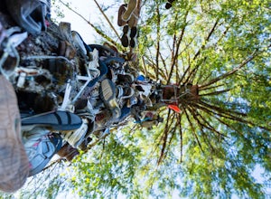
Does your sole need heeling? If you can muster the feet you may just meet Old Mother Hubbard.
To get there take Highway 4 / The Pacific Rim Highway west out of Port Alberni towards Tofino. After the second bridge, take your third right onto Central Lake Road approximately 5.3 miles. The Great Cen...
Read more
-
Alberni-Clayoquot C, British Columbia
The mountains of the South Central Range of Vancouver Island that skirt Highway 4 leading to Tofino are often overlooked as in that region surfing is the big draw, while the larger peaks of Strathcona Peak call to others. I feel this spot is a true gem of the island, with unparalleled biodiversit...
Read more

