Sawback, Alberta
Looking for the best photography in Sawback? We've got you covered with the top trails, trips, hiking, backpacking, camping and more around Sawback. The detailed guides, photos, and reviews are all submitted by the Outbound community.
Top Photography Spots in and near Sawback
-
Sawback, Alberta
Climb Mt. Cory
3.0Park at the viewpoint parking lot on the left side of the highway, approximately 2.8 km (1.7 mi) after turning off of the Trans Canada Highway. The trailhead is easily located on the north side of the highway. The approach is short but steep and sustained. It starts as a trail and finishes as a s...Read more -
Sawback, Alberta
Hike to Bourgeau Lake and Harvey Pass
5.012.5 mi / 3360 ft gainThe trailhead for Bourgeau Lake/Harvey Pass is on the west side of Trans-Canada Highway approximately 5 miles west of Banff. The turn-off is approximately 0.9 miles past the Sunshine Village Ski Resort exit. There is a small parking lot and a restroom at the trailhead. Enter through the gate to...Read more -
Edgewater, Alberta
Ski Sunshine Village
5.0Do you like skiing wide open slopes of light, fluffy powder? How about staring off at massive, jagged peaks while you do it? Then do I have the resort for you… Sunshine Village in the heart of Banff National Park offers something for everyone on the slopes. There are ample wide open groomers for ...Read more -
Improvement District No. 9, Alberta
Hike to Healy Pass
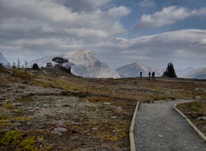
7.5 mi / 2198.2 ft gainHead up to Healy Pass in late September or early October to check out the beautiful larch trees in their golden glory. Sunshine Meadows, Assiniboine, and other amazing views can be seen from the top of this easy trail. Start your adventure in the Sunshine Village ski resort parking lot. Head behi...Read more -
Improvement District No. 9, Alberta
Sunshine Village Gondola and Standish Quad Chairlift Hike
6.2 mi / 902.2 ft gainIf you're looking for an adventure in the Banff area that's not as crowded as the main tourist attractions but offers as spectacular of views, check this gem out. Make sure to check hours of operation before going, gondola/ ski lift are not always running. Ride the gondola all the way to the to...Read more -
Banff, Alberta
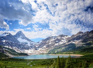
Mount Assiniboine: Sunshine Village to Mount Shark
5.036.37 mi / 5869 ft gainThis trek specifically covers the distance from Sunshine Village to Mount Shark. You will need a car at Mt. Shark, as there are no shuttles from that location to Canomre or any local areas. Otherwise, you can try to hitch a ride back – your best bet is to talk with some locals or visit the Canmor...Read more -
Banff, Alberta
Explore Vermillion Lakes in Banff National Park
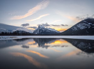
4.7Vermillion Lakes is one of the best spot's in Banff to catch a sunrise or sunset depending on the season. Although it's one of the most popular locations for photographers, there are so many different areas around the lakes that you'll never feel like it's too crowded. Mount Rundle can be photogr...Read more -
Banff, Alberta
Snowshoe Mt. Norquay
2.2 mi / 1000 ft gainFrom Banff:Take the shuttle from the town lot to Mt. Norquay Ski Lodge, it is $10 CAD one way or $15 roundtrip, but you may want to walk back. If you decide to walk back there are two options; the road or the beautiful mountain trail. The trail head can be easily picked up in the parking lot, hik...Read more -
Banff, Alberta
Take in the View at the Mount Norquay Green Spot
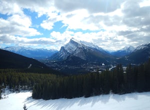
3.5The "Green Spot" is a beautiful grassy slope that opens up to sweeping views of downtown Banff and the surrounding area. It's a great spot for photography, especially capturing the peak of Mt. Rundle. There's also a set of chairs conveniently placed on the slope so you can kick back and enjoy t...Read more -
Banff, Alberta
Hike to the Hoodoos, Banff
5.03 mi / 295.3 ft gainThe beginning of this hike is easily accessed from the town center of Banff by the Bow river. Perfect for those without a car! Follow the trail on the side closest to town as it leads up the Bow River and into the forest following the signs for Hoodoos Loop.The hike is 4.8km one way, leading arou...Read more -
Banff, Alberta
Dawn to Dusk in Banff National Park
5.06.8 miThis is a micro adventure in one of the world’s most desired National Parks. The common excuse for those who tend to skip the great outdoors is lack of time. This one day adventure is an example that you can cram a lot into a day! Dawn: Sunrise hike up to South Ridge in Banff. Start at the famous...Read more -
Improvement District No. 9, Alberta
Hike to the Ink Pots via Johnston Canyon
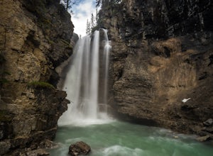
3.87.5 mi / 1050 ft gainThe hike through Johnston Canyon to its Upper and Lower falls is one of the most popular hikes to do in Banff - mostly due the little effort required for the great reward.To start, take the Bow Valley Parkway (Highway 1A) - the parking lot and trailhead are clearly marked by a Johnston Canyon sig...Read more -
Improvement District No. 9, Alberta
Hike Johnston Canyon
5.01.6 mi / 393.7 ft gainGetting There: The Canyon is very well marked, but here are directions anyway if you're coming from Banff: Head West on the Trans-Canada Highway for about 5 km or so. Take the Bow Valley Parkway exit, and continue West for another 18km - you'll then see signs to your right for Johnston Canyon. Th...Read more -
Improvement District No. 9, Alberta
Explore Lake Minnewanka
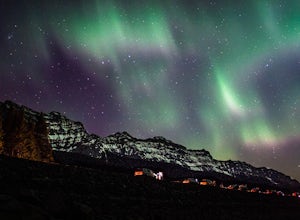
4.2Head up to Lake Minnewanka on a high alert night to get the perfect view of the Canadian Northern Lights. You can go online to get updates on the best times to go and where they will be the brightest. While the dam at the lake may be overrun with people, explore around and you can find a nice emp...Read more -
Improvement District No. 9, Alberta
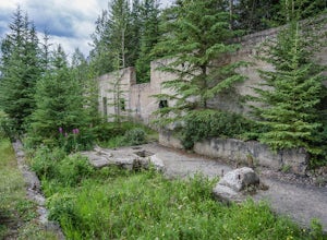
Explore Bankhead Ghost Town
5.00.81 mi / 37 ft gainBankhead is a ghost town which flanks Cascade Mountain and lies just south of Lake Minnewanka in Banff National Park. The main portion of the ghost town is located in Lower Bankhead, which can be reach by traveling North on Range Rd 1158 (closed Nov - Apr), following the signs to Lake Minnewanka....Read more -
Improvement District No. 9, Alberta
Hike to the Hermit of Inglismaldie
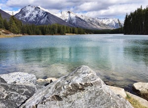
4.02 mi / 34 ft gainAs you drive towards Johnson Lake, the road will end at a parking lot where you should park. There are restrooms and picnic tables located in this same area. Due to the low elevation, the trail around Johnson Lake is a gentle walk, but trail conditions should always be checked especially during ...Read more

