Alberta
Looking for the best photography in Alberta? We've got you covered with the top trails, trips, hiking, backpacking, camping and more around Alberta. The detailed guides, photos, and reviews are all submitted by the Outbound community.
Top Photography Spots in and near Alberta
-
Jasper, Alberta
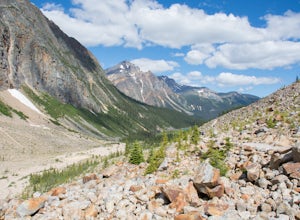
Hike to Edith Cavell Outlook
1.1 mi / 229.7 ft gainDouble check that Edith Cavell is open, it is usually open from mid-June, to late September or mid October depending on the amount of snow and time of snowfall. After following Glacier Rd. for 14km you will reach the parking lot, with four bathrooms (no running water). If you have a long trailer ...Read more -
Turner Valley, Alberta
Mist Mountain Scramble
4.5This is a pretty big objective, but doesn't feature any technical climbing, so anyone who keeps a clear head and can put one foot in front of the other can do it.Mist Mountain is located in Highwood Pass - whose highway is only open between June and December, so scheduling Mist Mountain as a big ...Read more -
Waterton, Alberta
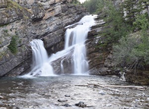
Explore Cameron Falls
Located on the west side of Waterton townsite in Waterton Lakes National Park is the iconic waterfall Cameron Falls. Probably one of the most photographed waterfalls in Waterton due to its accessibility The waterfall is practically right off of the road/bridge with easy parking right next to it. ...Read more -
Turner Valley, Alberta
Hike Porcupine Ridge
5.9 mi / 2231 ft gainThis trail was really easy to find and follow, unfortunately that means the description will be short.Park your car at Porcupine Creek on Highway 40 and take off to the southeast! The path follows the creek and requires a couple of creek crossings on makeshift bridges, but once the creek forks yo...Read more -
Kananaskis, Alberta
Raft the Kananaskis River
4.7The river is perfect for first time rafters and families, but the Kananaskis River also provides enough thrills for even a seasoned whitewater enthusiast. You will spend approximately 2 hours paddling, surfing and, if you feel brave enough, swimming in this glacial fed river! The section of rive...Read more -
Improvement District No. 9, Alberta
Hike to the Summit of Parker Ridge
5.05.5 mi / 1000 ft gainWhile the drive from Banff to Jasper on the Icefields Parkway is astoundingly beautiful, it's long enough to make even the most seasoned roadwarrior crave the chance to stretch their legs. At almost the exact halfway point on the lengthy drive lies Parker Ridge, a short but fairly steep hike rig...Read more -
Eldon, Alberta
View the Castle Mountain Lookout
Castle mountain, so named for its fortress-like shape, is a quick hop away from the town of Banff. If you don't have time to hike to Rockbound Lake (at the base of Castle), head to the viewpoint just off of Highway 91 and snap some pictures of this epic mountain. Drive north for about 10 minutes...Read more -
Kananaskis, Alberta
Scramble the Fortress
Have you ever done a hike where you just don't want the day to end? Scramble the Fortress and you'll know the feeling. The thing that drew me to the Fortress was its summit elevation of 3000 masl, as well as its blocky, fortress-like profile when viewed from the north. It's so much more than that...Read more -
Yellowhead County, Alberta
Cardinal Divide Ridge
4.98 mi / 607 ft gainWhitehorse is located in the northern front ranges of the Rocky Mountains. It shares a portion of its west boundary with Jasper National Park and its east boundary with a coal mine. The majority of the park is located above tree line with extensive alpine meadows and subalpine slopes. The view o...Read more -
Bragg Creek, Alberta
Hike Iyarhe Ipan
3.02.5 mi / 1476.4 ft gainIyarhe Ipan means "mountain point" in Stoney, and while it's far from the highest peak you'll ever climb, it certainly is worth it. Iyarhe Ipan was the fix for the scrambling itch I've had all winter.Before Highway 66 opens in the summer, you'll have to park your car at Elbow Falls parking lot an...Read more -
Pincher Creek No. 9, Alberta
Scramble Table Mountain near Pincher Creek
6.2 mi / 2296.6 ft gainThe trail starts at Beaver Mines Lake Campground.From the town of Beaver Mines, take route 774 South to the well marked Beaver Lakes campground turn off. Drive to the end of the camp where you will see a trail head sign board. The trail starts beside the parking sign (A second trail at the end of...Read more -
Greenview No. 16, Alberta
Camping at Two Lakes
Two Lakes Provincial Park, which is located 142 km south of Grande Prairie, is nestled within the foothills of northwestern Alberta. This remote scenic park includes two small lakes surrounded by forested hills. It is a great place to enjoy nature while camping, canoeing, hiking and wildlife view...Read more -
Clearwater County, Alberta
Hike Maze Peak
4.05.3 mi / 2624.7 ft gainThere's not much of a trailhead for Maze Peak - in fact there isn't a trailhead at all. Bring up the start location from this post and pull over on the side of the dirt road once you get to it! The hardest part about this trail is just kind of finding it, really. The good news is that you're goin...Read more -
Improvement District No. 9, Alberta
Scramble the Ten Peaks via the Perren Route
A true adventure with lots of route finding, glacier travel, loose rock and high altitude views. This is not for the faint hearted or first timers.From the Moraine Lake parking lot walk down the east side of the lake along the well maintained trail. Towards the end of the lake you will cross the ...Read more -
Canmore, Alberta
Trail Run on the Wind Ridge-Bow Valley
8.4 miWind Ridge is a 7,217 ft / 2,200 m mountain peak near Canmore, Alberta, Canada, with spectacular views into the Bow Valley. The trail is primarily used for hiking and is accessible from May until November.Take the Spray Lakes Road from the town of Canmore for 22km. The trail head is just below th...Read more -
Greenview No. 16, Alberta
Hike to the Cutbank Twin Falls
4.33.1 mi / -40 ft gainDirections: From Grande Prairie, drive about 50 minutes south on Highway 40. There is a ditch and an industrial road just off the side of the Highway, about 2 kilometers after the bridge. The trail is right off of the Highway, accessible by the ditch. Right before the bridge, that is crossing the...Read more

