
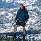
Josiah RoeExplorer
The world is big and I want to have a good look at it before it gets dark. - John Muir

Tank Hill
San Francisco, California
4.3
0.14 mi
/ 49 ft gain
Looking for a cool, under-the-radar spot that’s perfect for picnics, chilling out, and chasing the sunset? Look no further than Tank Hill. This little gem of a mini-park is 650 feet high and tucked away in Cole Valley. It’s so small that many maps of San Francisco don’t even include it.
To get there, drive to Belgrave Avenue and park on the street. Walk to the eastern end of Belgrave and you...

Hawk Hill
Sausalito, California
5.0
0.76 mi
/ 144 ft gain
If you're leaving from SF, head over the bridge and exit onto Alexander Ave. Make the immediate left under the overpass and you'll be on the road to Hawk Hill. There's a parking area just below the gate leading up to Hawk Hill. From the parking lot you can walk west about ten yards along the outside of the guard rail to take a well-worn use trail out to a spur overlooking Point Diablo. The view...

Slacker Hill
Sausalito, California
5.0
1.02 mi
/ 344 ft gain
Although the Headlands can be crowded, particularly at the parking-lot chaos of the Vista Point and pull-offs along Conzelman Road, the three routes leading to the summit of Slacker Hill remain relatively quiet, even during busy weekends. Each can be tied into larger loops throughout the Headlands (like the Ninja Loop), and the Slacker Hill detour makes for a great addition to any long run or h...

Coast Campground via Laguna Trailhead
Point Reyes Station, California
4.3
4.02 mi
/ 633 ft gain
This campground is the closest you can get to staying overnight on Pt. Reyes coastline if you're backpacking in. Once you get there, enjoy the view!
The easiest way to get to the camp is from the slightly uphill hike along the Laguna Trail and the Firelane Trail. The trailhead for the Laguna Trail is just past the hostel.
Keep in mind that the Coast Trail does have issues during the rainy mon...

Surf Under The Golden Gate at Fort Point
San Francisco, California
4.2
This has to one of the coolest spots to surf in the world. The break itself is a left point that requires a healthy swell to wrap into the bay, and only gets good on occasion. But when it's good, it can be an experience you'll never forget.It's important to note, that when it's good, this is not a wave for beginners. There is a local crew that has this spot on lock and they do a great job of re...

Snorkle Port Royal Gorge
José Santos Guardiola, HondurasIn the 17th century Port Royal on the far eastern end of Roatan was home to over 2000 pirates, 500 homes, and untold barrels of rum (and treasure). All that remains now is some rubble and ruins on Fort Morgan Cay, and a idyllic series of cays and coves surrounded by beautiful protected reefs and wrecks perfect for diving, snorkeling, and exploring.
Getting there is the trickiest part as there i...

Mountain Bike the Picnic Loop
Silver City, New Mexico
2 mi
/ 350 ft gain
Called the "Berg Trail" by Silver City locals in honor of Gary Berg who pioneered the extensive trail system around Gomez Peak, the Picnic Loop beginning at the Little Walnut Creek picnic area is a great way to be introduced to the incredible mountain biking trails to be found in the area.
Beginning at the picnic area, you can follow the trail in either a clockwise or counter-clockwise manner, ...

Dive Bear's Den
Sandy Bay, HondurasLocated on the Meso-American reef in the Roatan Marine Park, Bears Den begins with a 120 foot long “chimney chute” swim-through 15 meters below the surface, leading to an opening that gives way to a honeycombed coral wall. At the top of the wall is the entrance to Bear's Den, a gorgeous, enormous cavern 10 meters below.At the entrance, Spotted Drum, small Lettuce Leaf Sea Slugs and other types ...

Kiteboard Surfer's Point
Ventura, CaliforniaSurfer's Point aka Ventura Point is a well-known kite boarding/surfing (and surfing) spot due to its (when conditions are right) great wave quality, favorable wind direction (sideshore with occasional side-off), friendly locals, rider capacity, and a nearby point break with. When conditions are excellent, most often in the late afternoon, there are a lot of excellent waves.
The best wind direct...

Black Sands Beach on the Lost Coast
Whitethorn, California
5.0
0.5 mi
Black Sands Beach and all of the Lost Coast is almost indescribable in its ruggedness and beauty. Black Sands Beach sits along the southern portion of of the famous Lost Coast Trail, and is accessible by one of the two roads that go across the King Range to the ocean. From 101 in Garberville, head into Redway and then take the Shelter Cove Road. Follow the signs to Black Sands Beach.
The other...

Skimboard Table Rock Beach
Laguna Beach, CaliforniaLaguna Beach is both the birthplace *and* and the capital of skimboarding, and for good reason: it boasts an impressive array of beaches where (if you know where to look) you can find one where the conditions are right for one of the most difficult but rewarding of water sports.
Table Rock is one such beach, with the narrow channel between Table Rock and the rocky reef to the south often creati...

Fly Fish the Truckee River
Verdi, NevadaAt just 121 miles long from Lake Tahoe to Pyramid Lake, the Truckee River continues to produce the largest trout in the Lower 48. Fly fisherman commonly divide the river into two reaches – East & West. And just outside of Reno in the small town of Verdi, the Bridge Street bridge is an excellent access point for fishing on the river. Rainbow, cuttroat, brown, and whitefish are the most commo...

Fly Fish Money Flats
Sandy Bay, HondurasThe unique nature of the proximity of the reef to the shore of Roatan makes for some of the finest tropical fly fishing to be found in the Caribbean, particularly along the northwest shore at Sandy Bay aka the "Money Flats".
These narrow turtle grass flats, averaging 1' - 8' in depth, allow for permit, bonefish, and barracuda to come up off of the reef to hunt. Like all fly fishing it is a good...

Bouldering at Lamb's Rock, Sunset Boulders
Jenner, California
5.0
Lamb Boulder, located within the "Sunset Boulders" collection, contains four fun and challenging V2 - V6 bouldering routes. They are:
Calambity: V6Rock Scar: V3+Skullcracker: V2 RThe Specialist: V4
Lamb Boulder is located directly across from the Sunset Boulder itself and its trad routes. To get there take the Pacific Coast Highway / Highway 1 to the Goat Rock Road turnoff. There are three obvi...

Boreas Pass Road
Breckenridge, Colorado
5.0
9 mi
/ 1500 ft gain
Boreas pass is a high mountain pass in the Rocky Mountains that sits on the Continental Divide at 11,481'. Forest Service Road 33 goes over the pass and has numerous campsites all along its length, with several near the summit that feature breathtaking views of the Tenmile Range and the Breckenridge Valley.
To get there from the town of Breckenridge, go south out of town on Main Street and tak...

Port Orford Heads Trail
Port Orford, Oregon
3.0
1.25 mi
/ 236 ft gain
The Port Orford Heads State Park comprises a drastically pronounced peninsula jutting out into the Pacific Ocean from the southern Oregon coast, providing breathtaking views both north to the Cape Blanco Lighthouse and south to Humbug Mountain and beyond.
The Port Orford Heads Trail is the main loop trail arounds the Park, comprised of the Headlands, Nellies Cove, and Tower trails.
To get the...

Seven Pools Loop & Vista Canyon
Auburn, California
5.0
4.9 mi
/ 761 ft gain
Hidden Falls Regional Park is tucked way in the foothills of the Sierra Nevada, about an hour from Sacramento and a 20 minute drive off Interstate 80 and nearby the town of Auburn.
Most visitors simply make a be-line for Hidden Falls and miss one of the more breathtaking trail loops that the park has to offer, with views over the Seven Pools of Coon Creek and the waterfalls fo Deadman Creek.
...

Kayak the Oceanside Harbor
Oceanside, CaliforniaSea kayaking from the Oceanside Harbor public kayak launch is one of the best ways to experience the Oceanside coast and the Pacific Ocean.
There is ample parking along North Harbor Drive with the public kayak launch well-marked on the street.
You can paddle around the harbor or you can go out past the jetties to take in the entire coastline. There are some excellent fishing spots and local gui...

Bike or Skate the Strand
Oceanside, California
4.0
1 mi
/ 0 ft gain
Oceanside's iconic Strand is a 1 mile long ocean-front road that is perfect for cycling, walking, and running. At various points it is one way or pedestrian only, and is a must-do for any visitors to Oceanside.From the north The Strand begins at Breakwater Way and heads south underneath The Oceanside Pier where it becomes pedestrian only. At Lot 30 (excellent parking) it becomes mixed-use again...

Trojan Point
Mill Valley, California
4.7
0.28 mi
/ 30 ft gain
The endlessly scenic Trojan Point can be reached by taking the Panoramic Highway to Pantoll road from Stinson Beach to the west, or Mill Valley / Highway 1 to the east. It can also be reached by taking West Ridgecrest Boulevard from the north from the Fairfax-Bolinas road.
Park at the large parking lot just off Pantoll road but below Ridgecrest Blvd. and the Rock Springs Parking lot. Numerous...

Hike to the Jumping Rock on the Bear River
Colfax, California
2 mi
/ 150 ft gain
Though lesser known than its neighbors the Yuba and the American, the Bear River still features fantastic hiking, swimming, river-raft, tubing, and rock-jumping but without the crowds.A local favorite spot, the "Jumping Rock" near the Dog Bar Crossing, provides an excellent hike with several swimming holes along the way. To get there you can either take Dog Bar Road from Grass Valley if you're ...

Stand Up Paddle Board at Lake Nacimiento
Paso Robles, CaliforniaLake Nacimiento near Paso Robles, CA is a gorgeous reservoir used for kayaking, paddle boarding, and all manner of water sports.
To get there, from Highway 101 take the 24th street exit in Paso Robles west till it turns into Lake Nacimiento Drive. Lake Nacimiento Drive will eventually turn into Godfrey Road and then back into Nacimiento Drive.
Just before the road crosses the damn, go left on ...

Drive Black Bear Pass & the Ingram Basin
Telluride, Colorado
5.0
12 mi
/ 3000 ft gain
Black Bear Pass (el. 12,840’), officially known as Forest Service Road 648, is an infamous 4WD road that runs between U.S. Highway 550 (between Silverton & Ouray) and Telluride, CO. From the pass downhill through the Ingram Basin to Telluride, the road is one-way and features switchbacks and the notorious “Steps” with several hundred meters of drop-off on either side. If driving, you *must*...

Dive East Fish Camp
Ventura, CaliforniaThe numerous kelp forests, sea caves, and coves of the Channel Island National Park, coupled with its unbelievable sealife makes for some of the best diving in the world.
East Fish Camp off Anacapa Island is an excellent introduction to diving on the Channel Islands, with an average depth of 35' and a great array of wildlife and underwater nooks and crannies to explore.
Like any coldwater, Cal...
Discover
Community
Mobile Apps

© 2026 The Outbound Collective - Terms of Use - Privacy Policy