Washougal, Washington
Top Spots in and near Washougal
-
Mount Hood, Oregon
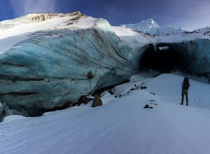
Hike to Sandy Glacier Caves
4.512.5 mi / 2800 ft gainThe hike to the caves begins at Top Spur Trailhead. The hike to McNeil Point is 5.4 miles one way, and 2200 feet of elevation gain. The trail starts in the forest, but will eventually open up to views of Mt Hood, as well as St. Helens, Adams and Rainier on a clear day.There is a shortcut up to Mc...Read more -
Mount Hood, Oregon
Timberline Loop Trail via the Top Spur Trail
4.02.26 mi / 627 ft gainStarting at the parking area, cross the dirt road to start hiking up from the Top Spur Trailhead. In 0.4 miles you will reach the Pacific Crest Trail intersection, take a right onto the Pacific Crest Trail. In a couple hundred feet you will reach a larger intersection of a bunch of different trai...Read more -
Stevenson, Washington
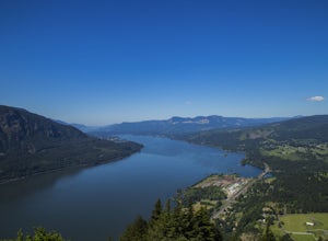
Wind Mountain
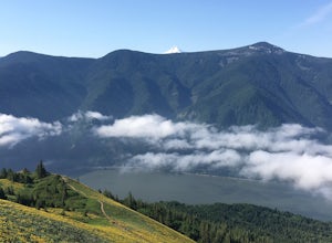
5.02.5 mi / 1037 ft gainOnce you reach the parking lot, walk down the hill and find the trail head, which is easily seen as it is marked. Begin your trek up the trail. The way up is pretty much all uphill, and is a great workout for the legs. You will walk through forests and over many rocks on the way up. As soon as y...Read more -
Ariel, Washington
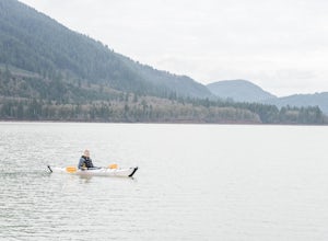
Kayak at Yale Lake
5.0Just 55 miles northeast of Portland lies a body of water so pure you have to see it to believe it...that's right, we're talking about Yale Lake. One of three lakes beneath Washington's ever rumbling Mount St Helens, Yale offers the outdoor lover just about everything they could ask for: calm wat...Read more -
Carson, Washington
Panther Creek Falls
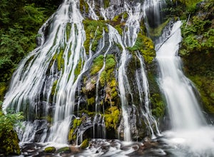
4.60.64 mi / 180 ft gainThis hidden beauty is just north of Carson, Washington. Watch for Panther Creek campground signs and follow the twisting road about 7 miles to a rock quarry and park there. The trail begins just off the road about 50 yards back - keep an eye out for signs for the trailhead and listen for the fall...Read more -
Stevenson, Washington
Dog Mountain via Dog Mountain Trail
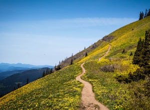
4.56.53 mi / 2858 ft gainThe Dog Mountain trailhead is located halfway between Stevenson and Bingen. Look for the big signed parking area just after milepost 53 (Eastbound). The parking lot fills up quickly, especially during peak wildflower season, so if you can go on a weekday that would be better. There are 3 trails ...Read more -
Stevenson, Washington
Dog Mountain: The Steeper Route
4.55.55 mi / 2858 ft gainIf you know the Columbia Gorge, you know Dog Mountain. It's the ever-rewarding, incredibly challenging, insanely popular, calf-burning 6.5-mile hike that attracts hundreds of people every weekend, especially during May and June when the wildflowers are in full bloom. If you're like me and you h...Read more -
Rhododendron, Oregon
Little Zig Zag Falls
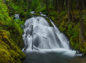
5.00.66 mi / 131 ft gainThe hike along Little Zig Zag River is definitely one of Oregon's hidden gems. Although the waterfall isn't as highly rated in comparison to other impressive falls like Multnomah Falls, Abiqua Falls, or Bridal Viel Falls, it is still quite the sight to see, and most definitely worth the visit. T...Read more -
Rhododendron, Oregon
Devil's Peak Lookout
3.02.62 mi / 600 ft gainThe Trail: This hike is one of the 2 routes that lead to the lookout, and the shorter of the two. It requires more driving to get to the trailhead than the other, but less walking, so if that sounds appealing to you, you have come to the right place! First, you'll be greeted by a dense forest w...Read more -
Cascade Locks, Oregon
Mount Defiance
3.712.55 mi / 5167 ft gainThis hike starts at the Starvation Creek Rest Area. After parking, head west back along the shoulder of the freeway, where you’ll see a wooden sign stating “Mt. Defiance Trail.” Continue heading west along the abandoned Columbia River Highway. Keep going west as you pass the junction with the Sta...Read more -
Cascade Locks, Oregon
Lower Starvation Ridge Loop
3.72.69 mi / 1001 ft gainStarvation Creek Falls is an impressive 190 ft. waterfall just a few feet from the parking lot. If you don't know it's there, you'll miss it. Keep walking past the restrooms, away from the trail head to see this beautiful two-tiered waterfall. There are a couple of picnic tables near the creek to...Read more -
Cascade Locks, Oregon
Starvation Creek Falls
3.5The Starvation Creek Falls drops 141ft down into a naturally formed bowl, cascading past a wooded picnic area and onto the Columbia River. The falls are one of the easiest falls to access in the Columbia River Gorge along with Multnomah Falls, but are far less Crowded. The short 300ft walk from t...Read more -
Cascade Locks, Oregon
Warren and Lancaster Falls
4.51.89 mi / 571 ft gainThe hike along Mt. Defiance Trail to Warren and Lancaster Falls is great if you want to get away from some of the more crowded destinations in the gorge, or just want to catch some shade during the summer. The trail is fairly easygoing, though the last 1/4th of a mile to Lancaster Falls is a bit ...Read more -
Government Camp, Oregon
Tom Dick and Harry Mountain
5.08.28 mi / 1726 ft gainLooking to score those iconic photos of Mt. Hood? Climb the well-graded trail to Tom Dick and Harry Mountain, one of the most accessible summit hikes to Portlanders, and see where they were all taken. Starting from the busy Mirror Lake Trailhead, climb roughly 900 feet and 1.5 miles to Mirror La...Read more -
Government Camp, Oregon
Mirror Lake Trail
4.54.09 mi / 810 ft gainI was out doing the Ramona Falls hike, and I decided that I needed to find a lake that provided me with a great view of Mt Hood. My first stop was Trillium Lake, but with that being a “drive up” lake, there were tons of people. Tons of people only means one thing…turbulent waters! As I was dr...Read more -
Mount Hood, Oregon
Kayak Laurance Lake
5.0This lake is found about 25 miles south of Hood River, Or. $5 for day use and now other passes are accepted, just keep that in mind. There are camping sites all over the lake as well, so if you are thinking of making a weekend out of it. It wasn't very crowded on a weekend during the summer so y...Read more

