Verlot, Washington
Looking for the best hiking in Verlot? We've got you covered with the top trails, trips, hiking, backpacking, camping and more around Verlot. The detailed guides, photos, and reviews are all submitted by the Outbound community.
Top Hiking Spots in and near Verlot
-
North Bend, Washington
Drive Along the Middle Fork Snoqualmie River
5.0Some days you don't need to tackle a grueling summit or long mileage loop, just getting outside the city is enough. Driving forest roads is always an adventure and pays its dividend in seclusion, viewpoints, and peacefulness. The Middle Fork Snoqualmie (FR56) offers a photo enthusiast numerous pi...Read more -
North Bend, Washington
Mailbox Peak New Trail
4.210.53 mi / 4127 ft gain*Disclaimer this article is in regards to the newly built trail.* For the old trail, head to Hike Mailbox Peak. Just off of exit 34, Mailbox Peak offers a birds-eye view of the surrounding area. This hike begins at a mere 800 ft. above sea level and by the time you are done you are nearly touch...Read more -
North Bend, Washington
Mailbox Peak Old Trail
4.44.96 mi / 3898 ft gainNote this adventure covers the old route. For the updated route, check out Hike Mailbox Peak New Trail. Take exit 34 from I-90. Head north on 468th Ave SE until the intersection with the SE Middle Fork Road. Turn right onto the Middle Fork Road. Follow SE Middle Fork Road 2.2 miles to the stop ...Read more -
Leavenworth, Washington
Hike to the Summit of Rock Mountain, WA
5.011 mi / 4175 ft gainThe trail starts out poorly, following a jeep road under high-tension wires. Shortly, though, the trail begins to switchback up the south face of Rock Mountain and the views, as well as the wildflowers, are remarkable.After switchbacking up the mountain, follow a ridge-line towards the upper basi...Read more -
Renton, Washington
Far County Falls via Licorice Fern Trail
4.24.25 mi / 801 ft gainFrom Seattle, take the I-90 E to exit 15. Make a right on 17th Ave. This street will later become Renton/Issaquah Rd. Drive about four miles then turn right on to May Valley Rd. Make a sharp right onto SE 112th St. This street will soon turn into 169th Ave SE as it turns left. The trailhead is ri...Read more -
Leavenworth, Washington
Backpack to Ice Lakes Basin
20 mi / 7600 ft gainBegin your adventure at the Phelps Creek Trailhead, roughly a 4 hour drive from Seattle. Make sure your car has good clearance and traction because the last section of the forest service road gets a little rough. Only a few minutes after starting down the trail, you will reach a split that head...Read more -
Leavenworth, Washington
Hiking the Lyman Lakes
5.021 mi / 2775 ft gainStart out on the Phelps Creek Trail and hike in 6.5 miles to reach the head of Spider Meadows. Continue on up the trail to the the base of the Spider Snowfield around 6200 feet for even better views of the entire Phelps Basin. Follow the trail up the snowfield for .5 miles to the top of Spider Ga...Read more -
Leavenworth, Washington
Carne Mountain
7.4 mi / 3599 ft gainDrive USFS Road 62 for 23 miles from Lake Wenatchee (turn left at Cole's Corner off of Highway 2 towards Lake Wenatchee). Turn right on USFS Road 6211 for ~2.5 miles to the end at the Phelps Creek Trailhead. Begin to hike the Phelps Creek Trail but in 1/4-1/2 a mile, take a right on the Carne Mo...Read more -
Leavenworth, Washington
Spider Gap to Buck Creek Pass
5.034.4 mi / 8317 ft gainBackpacking the Spider Gap to Buck Creek Pass Loop in the Glacier Peak Wilderness is no easy task, but yields some of the most spectacular views found in Washington. Plan for at least four days in order to stay fresh and to allow for extra time to soak in the Cascadian beauty that assaults your ...Read more -
Leavenworth, Washington
Spider Meadow Trail
14.13 mi / 2923 ft gainSpider Meadow Trail is an out-and-back trail where you may see local wildlife located near Stehekin, Washington.Read more -
Coupeville, Washington
Hike Ebey's Landing
4.5Just walk straight past the restroom to find the start of the trail route. The Bluff trail heads up a set of stairs to the top of the hillside on the right. After climbing the stairs, you come right up on farmland (Ebey's Prairie), with a grassy two-track trail leading up toward the top of the bl...Read more -
Marblemount, Washington
Winter ascent of Trappers Peak
9.78 mi / 3448 ft gainNorth Cascade National Park is home to some of the most rugged and remote mountains in the lower 48 states. Because of this, the area is rarely seen up close and personal in the winter, but there are a few spots where you can see these wild mountains that will defy all imagination. In terms of lo...Read more -
Marblemount, Washington
Thornton Lakes & Trappers Peak
3.710.57 mi / 3885 ft gainTo get to your campground or to Trappers Peak, hike roughly five miles along the trail to ridge, where the trail divides. If you head left you'll go down into lake basis where you can drop your gear. Come back to the divide and head right, which will lead you up to trappers peak. Something to ke...Read more -
North Bend, Washington
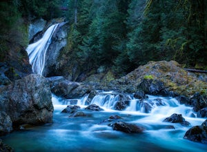
Twin Falls
3.32.51 mi / 778 ft gainFor a portion of this 3-mile hike, you'll trek next to the South Fork Snoqualmie River, so take in the peaceful sound of the river running. Along the trail runs a river, where massive boulders create wading pools of icy water for warm summer days. At 1.5 miles, you'll reach a viewpoint bridge, wh...Read more -
North Bend, Washington
Hike Mount Washington
4.32.89 mi / 3058 ft gainYou start out at an elevation of about 1200 feet and you gradually make your way up to the top at 4450 feet. You are hiking through forest land the whole time with peaks of a beautiful view to the north every so often. Along the way there are many rock walls which you can climb at, however on our...Read more -
Port Townsend, Washington
Hike to Point Wilson
5.02.5 mi / 0 ft gainThis trail offers amazing views of Mt. Baker, Vancouver Island, the San Juan Islands, and the Cascade Mountains. The Point Wilson trail is located in Fort Worden State Park on the Olympic Peninsula, along the Strait of Juan De Fuca. The trail is 2.5 miles round trip, and is accessible regardless ...Read more

